
Tropical Storm Erin formed Monday morning with sustained winds up to 45 mph in the latest advisory.
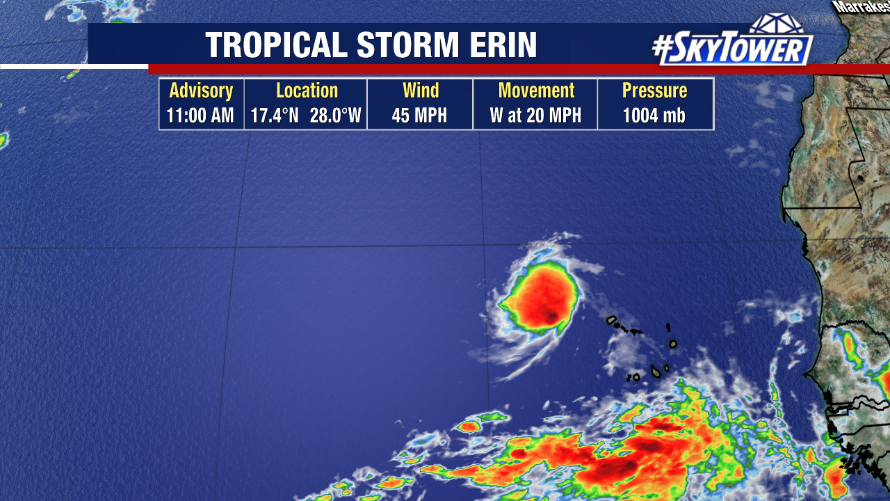
Previously named Invest 97L, thunderstorms west of the Cabo Verde Islands have continued to organize despite Saharan dust concentrated nearby this disturbance.
The first cone is out for Tropical Storm Erin and shows it steadily strengthening.
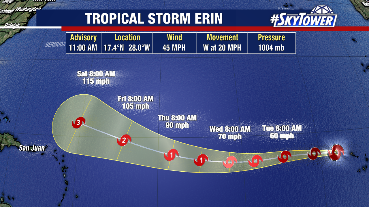
Erin is moving west at 20 mph and will continue on this track the next few days. There is more uncertainty at the end of this week into the weekend.
The upper level steering will eventually support a curve north as it rides around the ridge of high pressure. There will be a dip in the jet stream that will help to nudge it north.
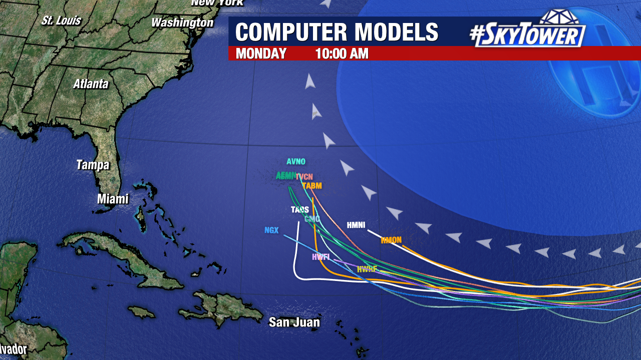
How far east of Florida and the Atlantic Coast will this happen? That is something we’re ironing out as we watch for this to form and see how model trends evolve.
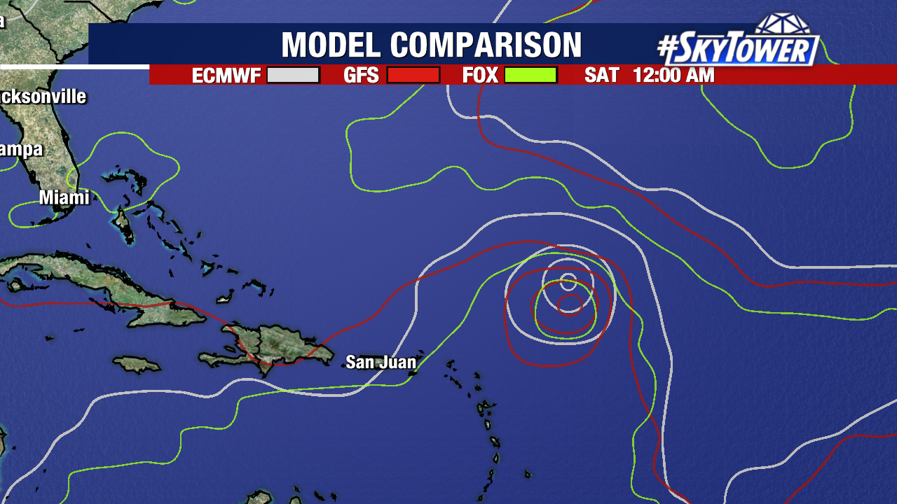
Check back for updates as we closely monitor model trends on Tropical Storm Erin.