
Tropical Depression 14 is getting organized in a hurry and the first track is out for this developing storm in the Gulf of Mexico.
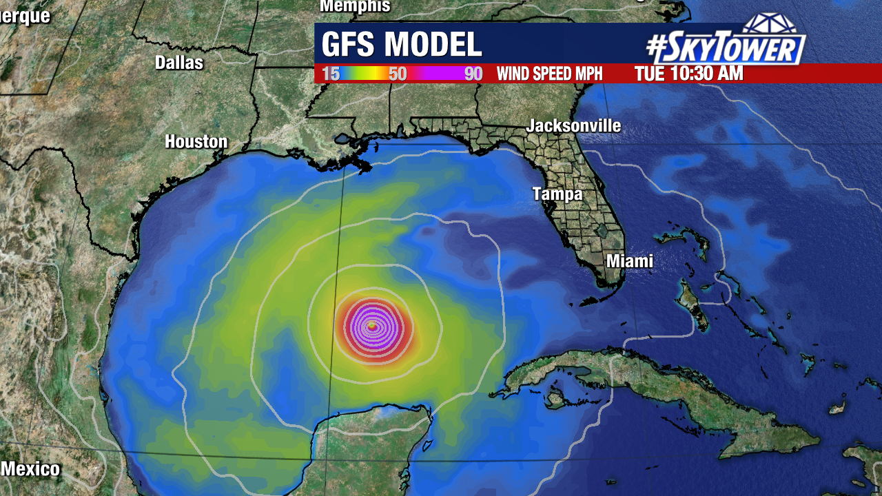
The initial forecast calls for this to become a Category 2 hurricane just ahead of landfall on Wednesday.
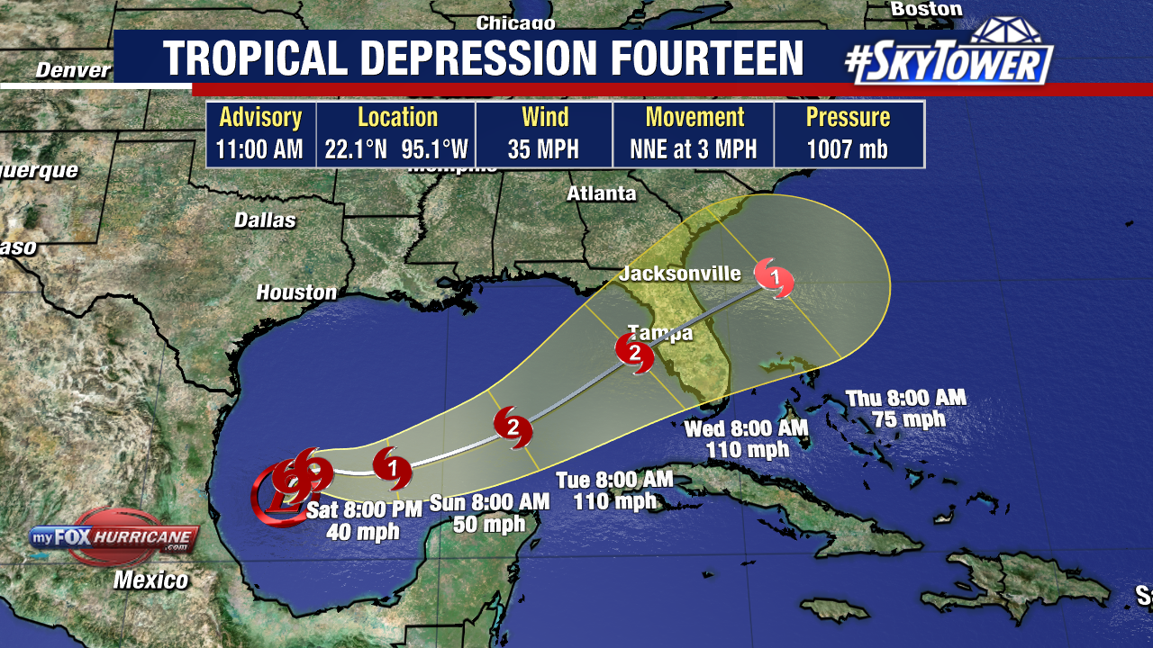
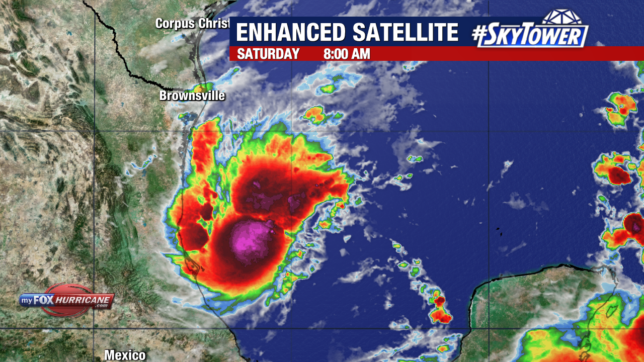
The area is already looking healthy Saturday morning with sustained winds of 35 mph and higher gusts.
Right now, the Gulf of Mexico is a very favorable environment for strengthening. As this area heads east, this is expected to become Tropical Storm Milton later today.
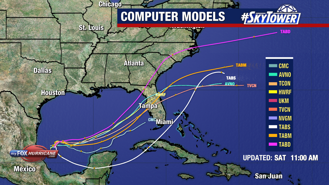
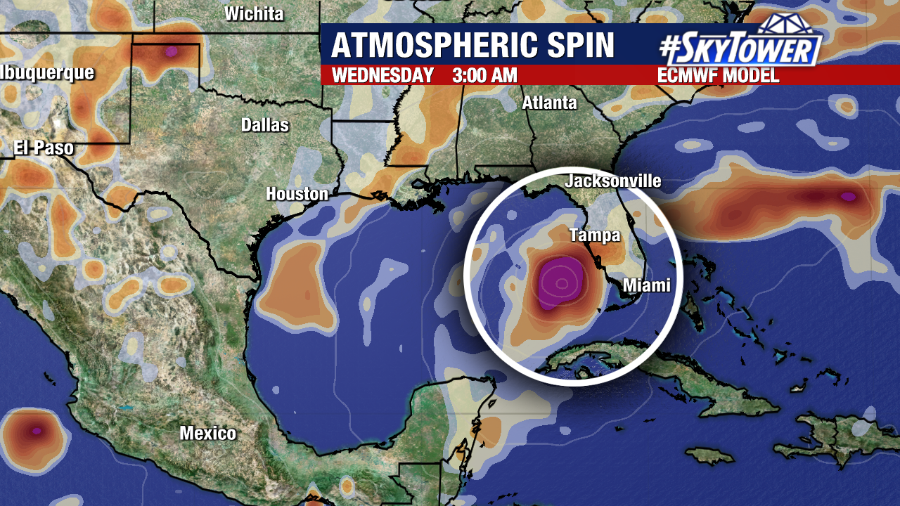
Here’s what model trends are showing. This area will generally travel east before curving more NE. All of Florida’s West Coast should be closely watching this storm.
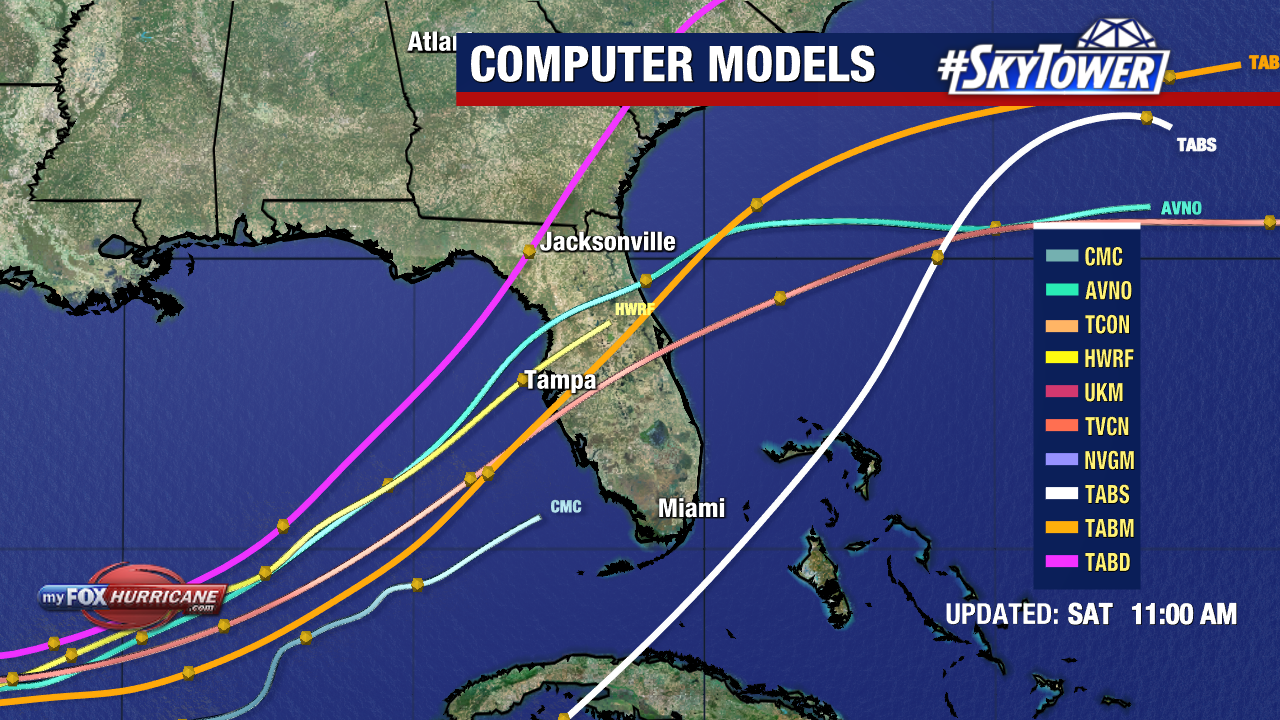
There is a spread in models from Florida’s Big Bend to south of the state, but most consensus tracks the area towards Tampa Bay.
Hurricane Hunters are set to start flying in Invest 92-L so we will learn more and likely see adjustments to the general track/strength of this storm.
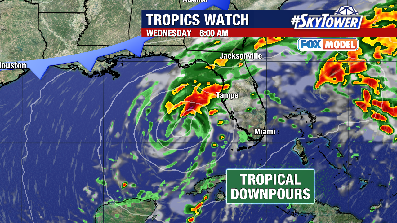
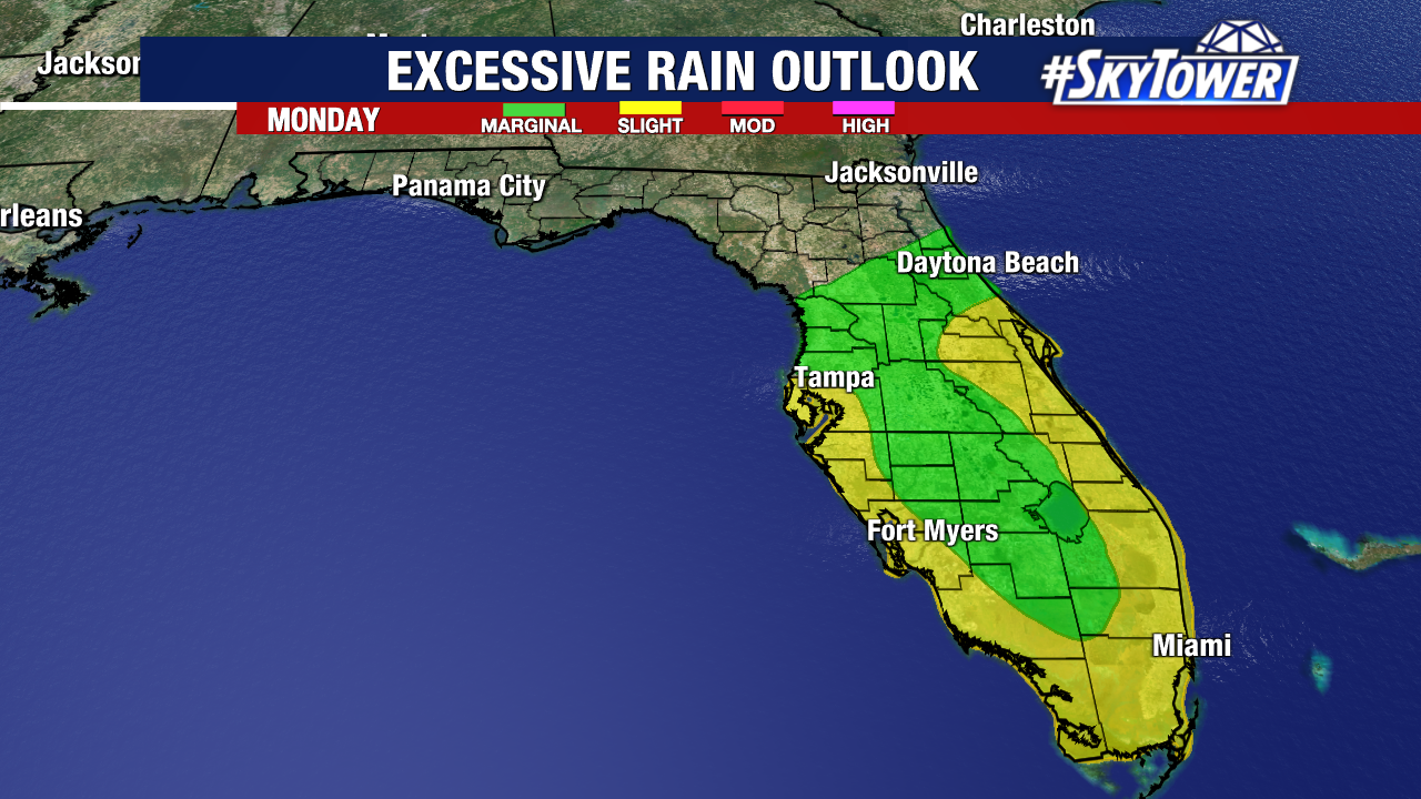
Rounds of heavy rain will start for Florida Sunday as the storm approaches from the west. Wednesday looks like the timeframe where landfall would occur, before the storm crosses the state and emerges into the Atlantic.
The exact track will determine storm surge impacts, strongest winds, and where heaviest rainfall will occur. We are certain of the heavy rain on the way for the state, with several inches of rainfall mainly Monday – Wednesday.
Models have been wavering between the strength so it’s too soon to say exactly what kind of winds we’ll get from this storm. Some models have it as a tropical storm, others are showing a Category 2 hurricane.
The point of landfall is crucial and we’ll be fine tuning that. South of the center is where the worst of the storm surge will occur, but heaviest rains likely occur north of the storm’s center.
The timing hasn’t changed. The worst of the weather will be on Wednesday and the storm will be done here by Wednesday night. More updated to come – stay tuned!