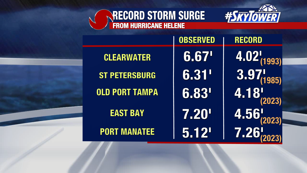
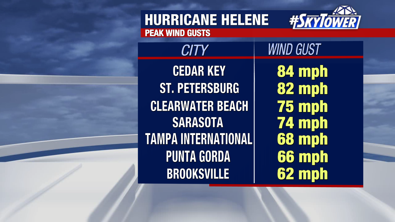
High water and historical storm surge has been recorded across Tampa Bay from Hurricane Helene passing about 100 miles off our coast.
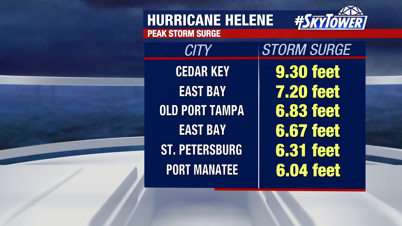
We talked about the storm surge being the biggest impact from this storm and that’s exactly what we’re seeing as preliminary numbers are coming in. For many Tampa Bay areas, these surge values set new records.
Helene made landfall near Perry, FL with 140 MPH winds as a powerful Category 4 hurricane. Landfall was just after 11:00 PM Thursday.
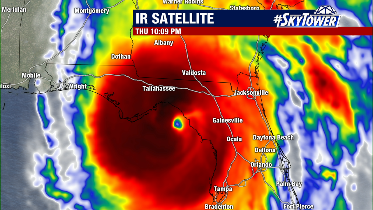
Helene had a massive wind field on approach to landfall, with tropical-storm-force winds extending 350 miles from the storm’s center. That is why impacts are far reaching, with power outages spanning the state.
Water levels are receding this morning but river levels are still at flood level for some spots, especially the Alafia River.
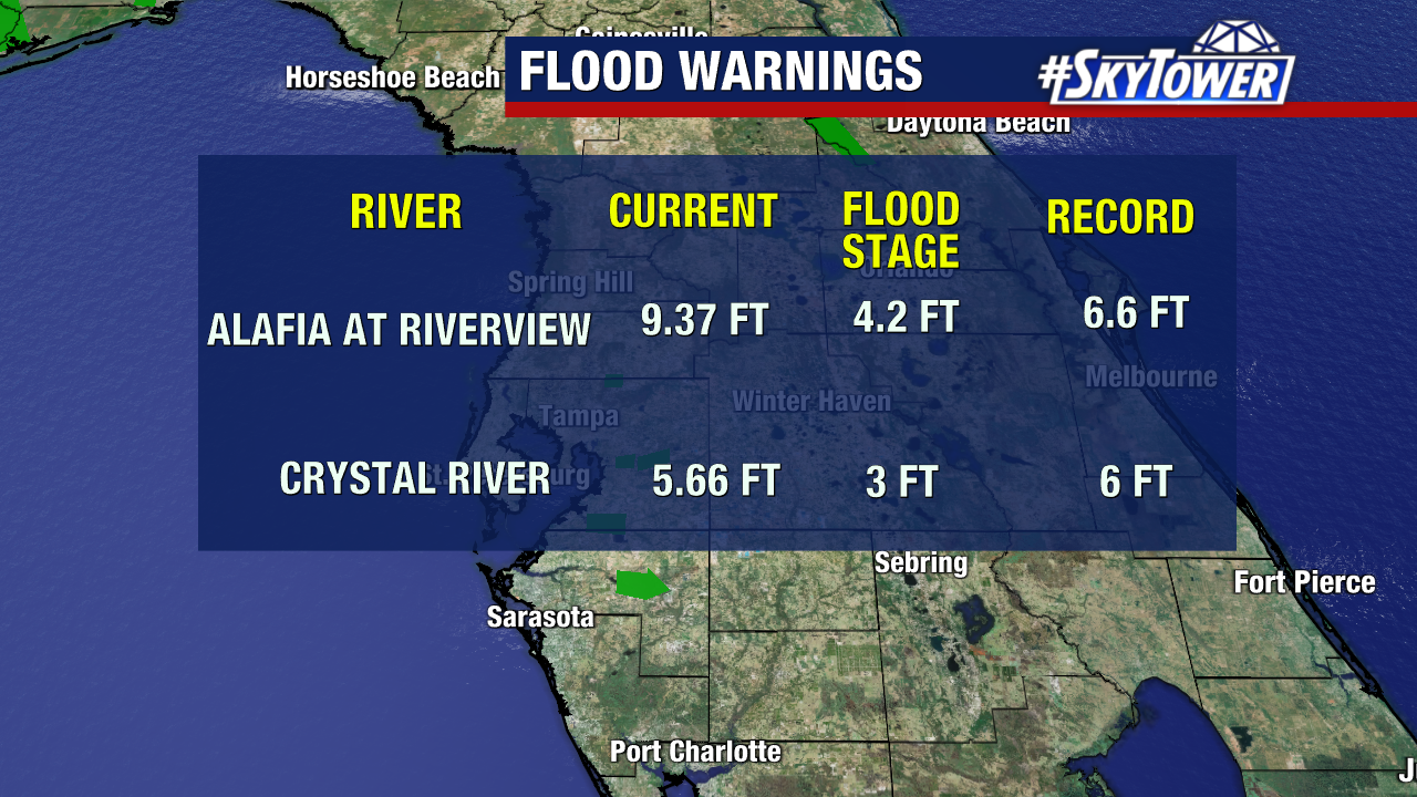
With the tide coming back in again later this morning – afternoon, there are still concerns about high water around the area.
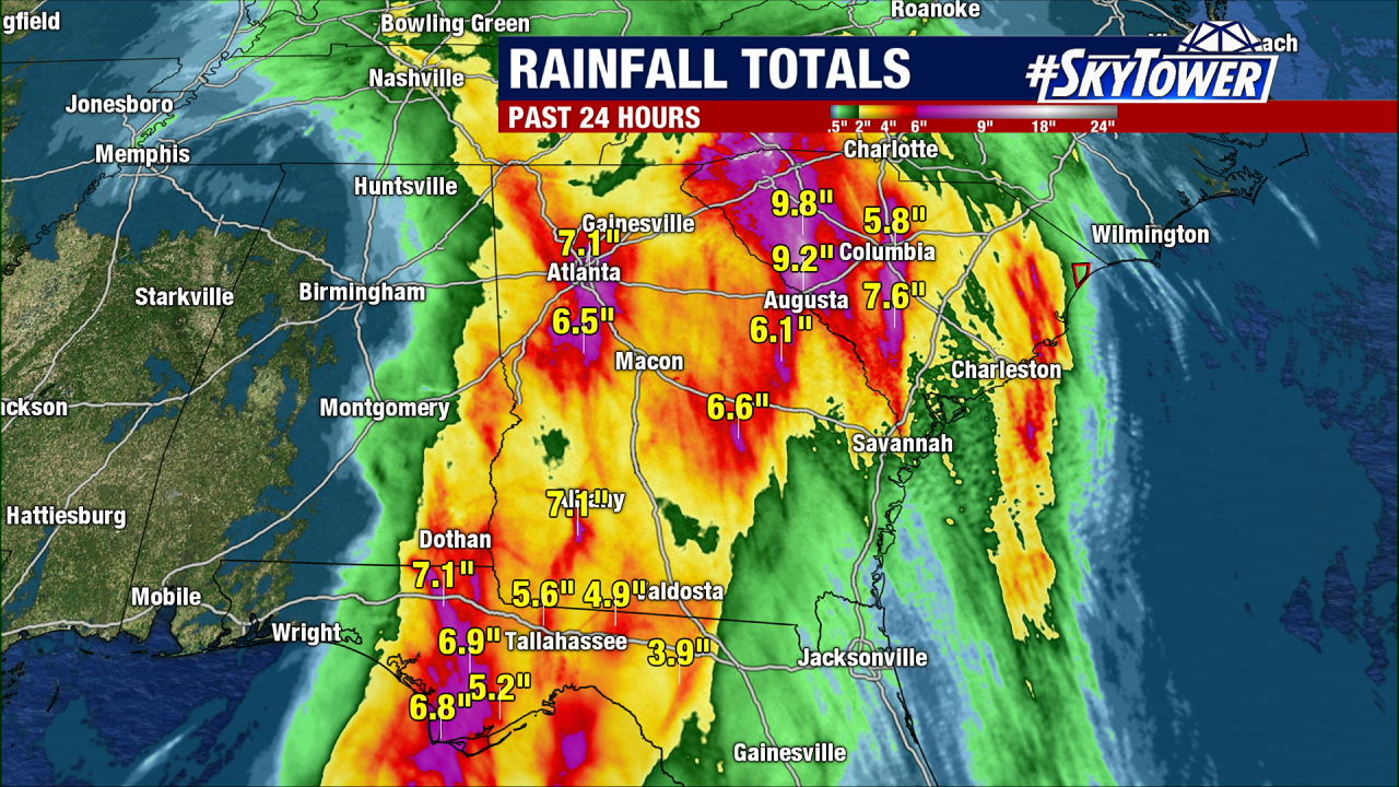
This was a fast storm, so rainfall was not nearly as big of a concern. Especially compared to Tropical Storm Debby earlier this season causing record flooding from slow-moving heavy rainbands. The Panhandle up into Georgia is where the heaviest rain fell from Helene.
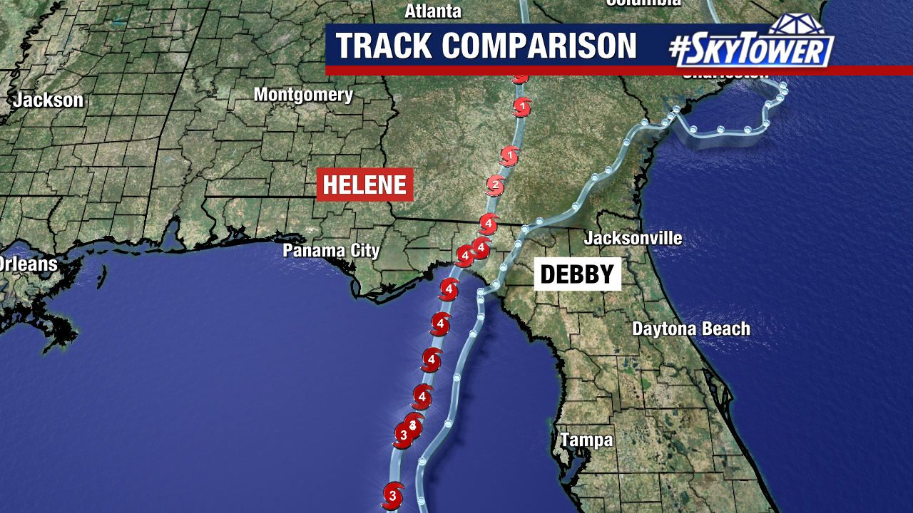
Helene is the 4th storm to make a Gulf landfall this hurricane season and the 2nd to hit Florida. Look at how close those two storms made landfall – both in Florida’s Big Bend but Helene was much stronger.