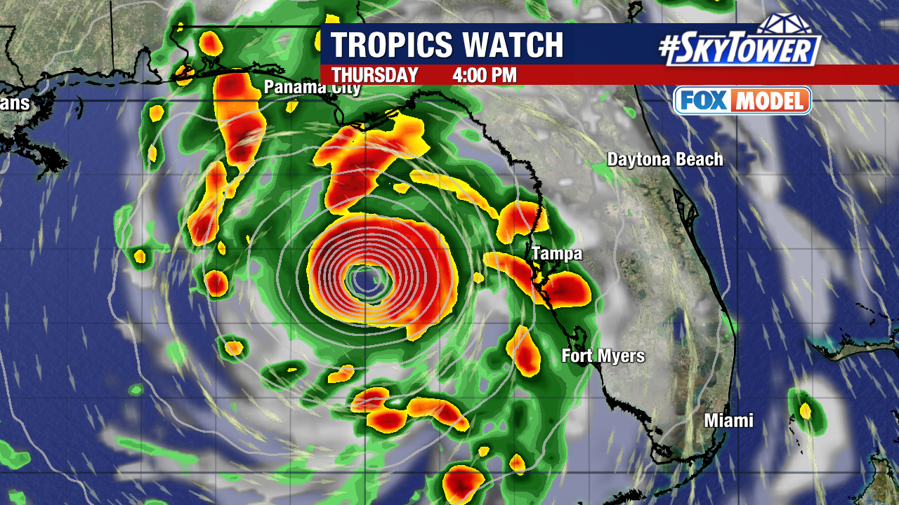
All eyes are on soon to be Hurricane Helene, which is expected to rapidly strengthen as it moves through the Gulf of Mexico.
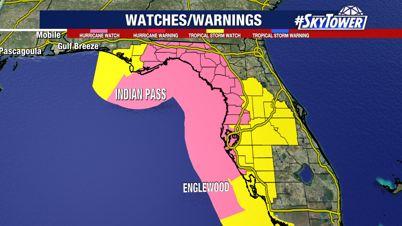
A Hurricane Watch is in effect from Englewood to Indian Pass, including most of the Big Bend. Areas in yellow are under a Tropical Storm Watch – areas in pink are under the Hurricane Watch.
This is not yet a named storm, but all the conditions are in place for this to become a major hurricane before it reaches the Gulf Coast on Thursday.
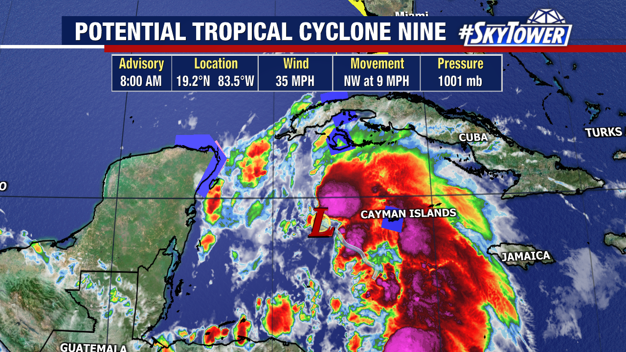
It is currently still Potential Tropical Cyclone Nine as this disturbed area spins in the northwestern Caribbean. Western Cuba will deal with heavy rain, flooding and mudslides Tuesday before this emerges into the Gulf.
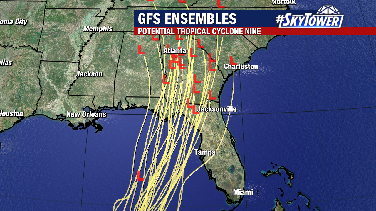
There is pretty good consensus among models on the expected track of this storm. Given the steering flow in place, this likely parallels Florida’s West Coast before curving more towards the Big Bend Region.
Despite where this makes landfall, this is a large storm and impacts will be felt across the West Coast. Heavy rain, flooding and storm surge are a big concern for the Gulf Coast and even inland.
The 8:00 AM advisory calls for Helene to reach Category 3 hurricane strength as it moves through the eastern Gulf. Waters are incredibly warm, so it’s not out of the question that this storm could be even stronger than a Cat 3.
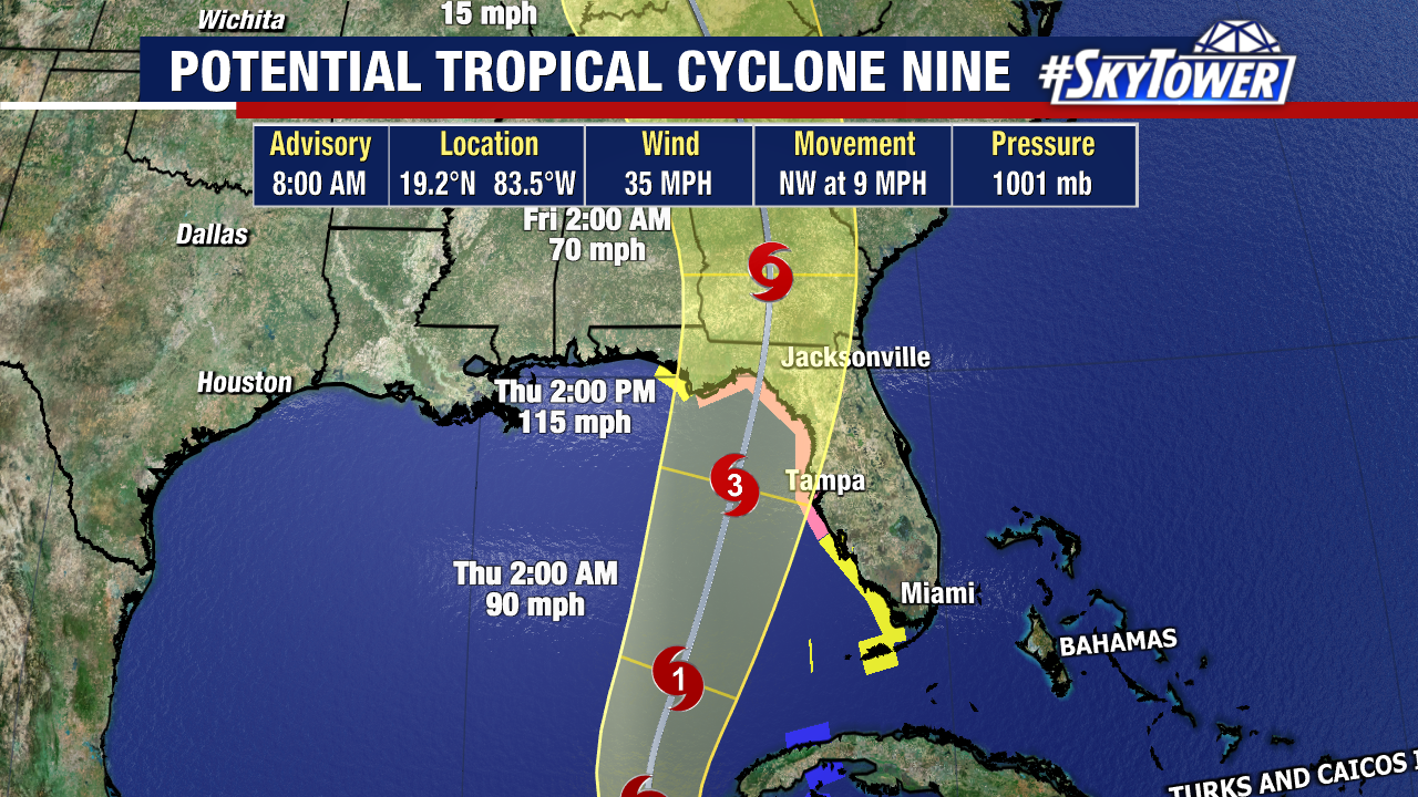
Small changes in the storm’s track will mean a big difference with a storm like this. The expected timeframe for landfall looks to be Thursday night.
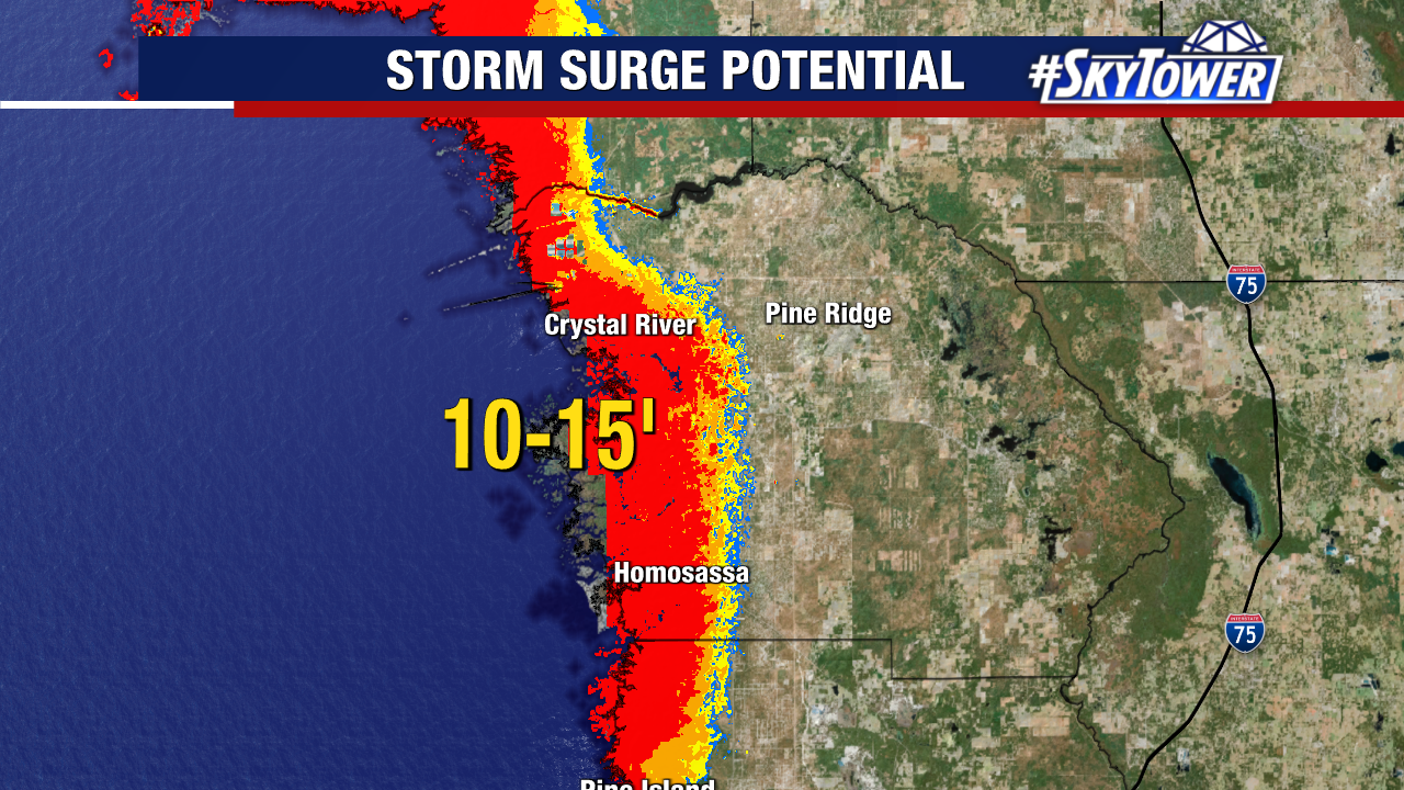
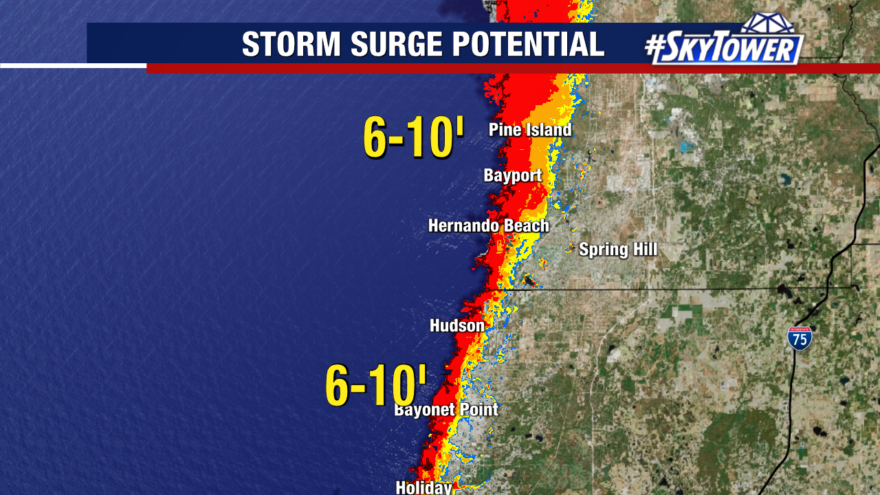
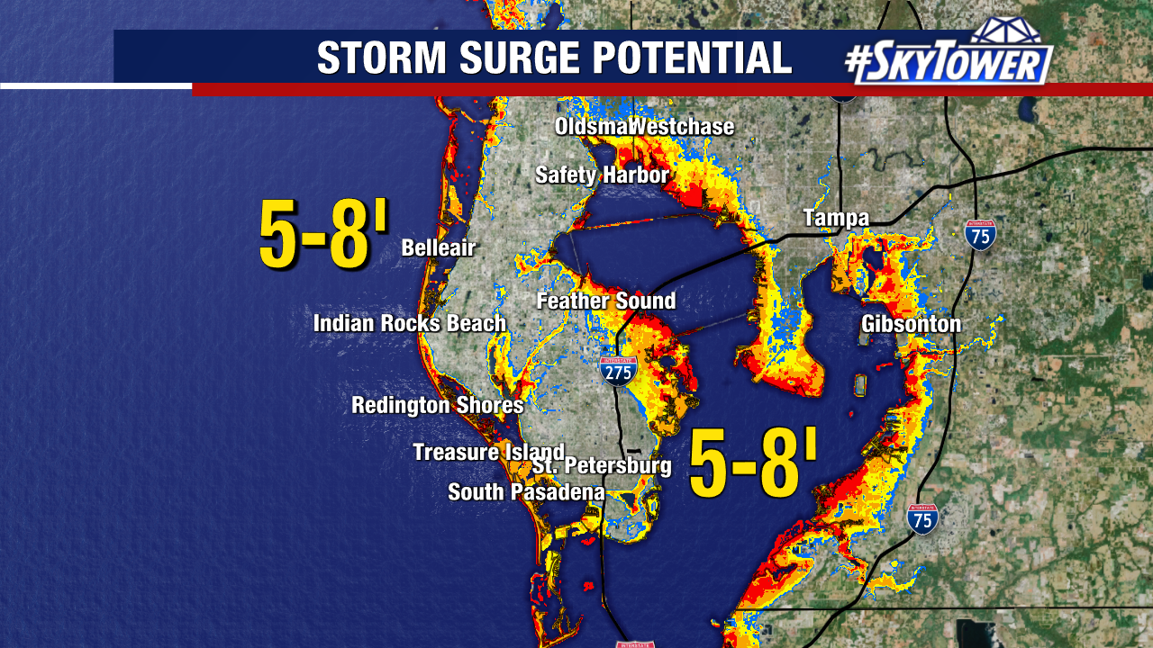
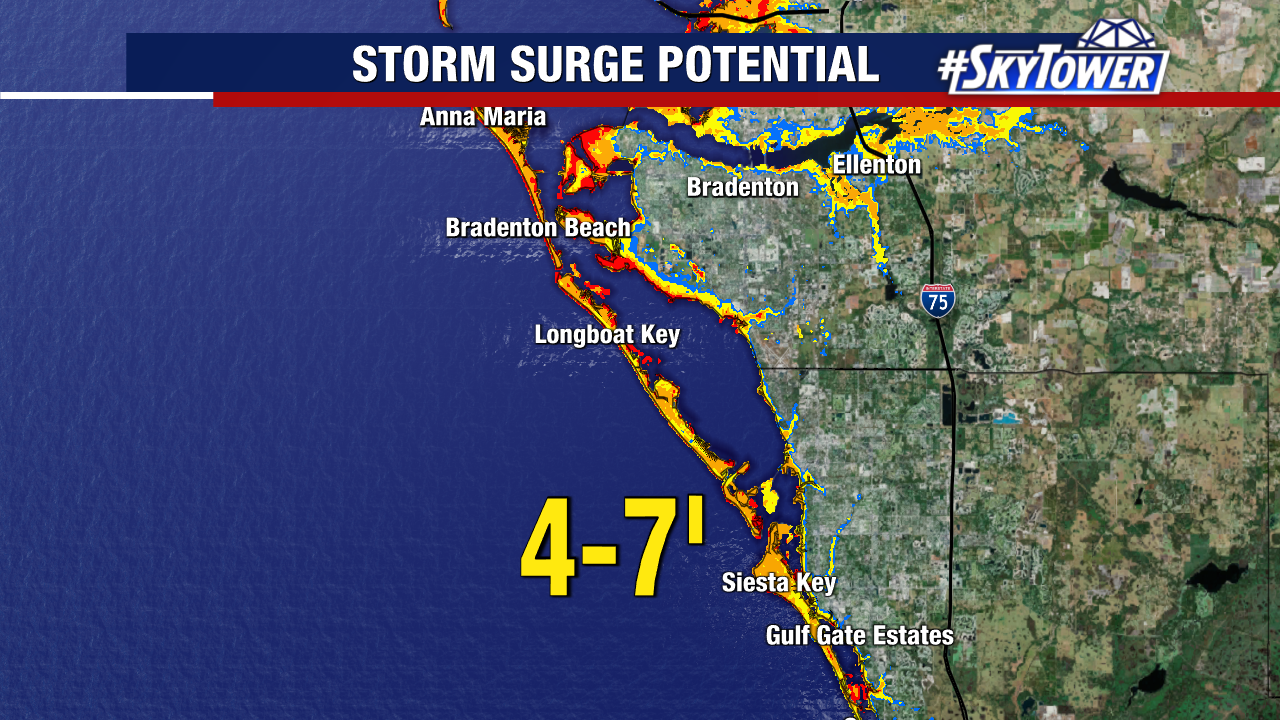
Storm surge is going to be a huge concern with Helene, with the worst of it forecast to hit the Nature Coast and Big Bend. Worst case scenario calls for up to 15 feet of surge.
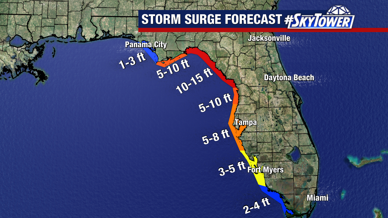
Here is a closer look at current storm surge forecasts: