
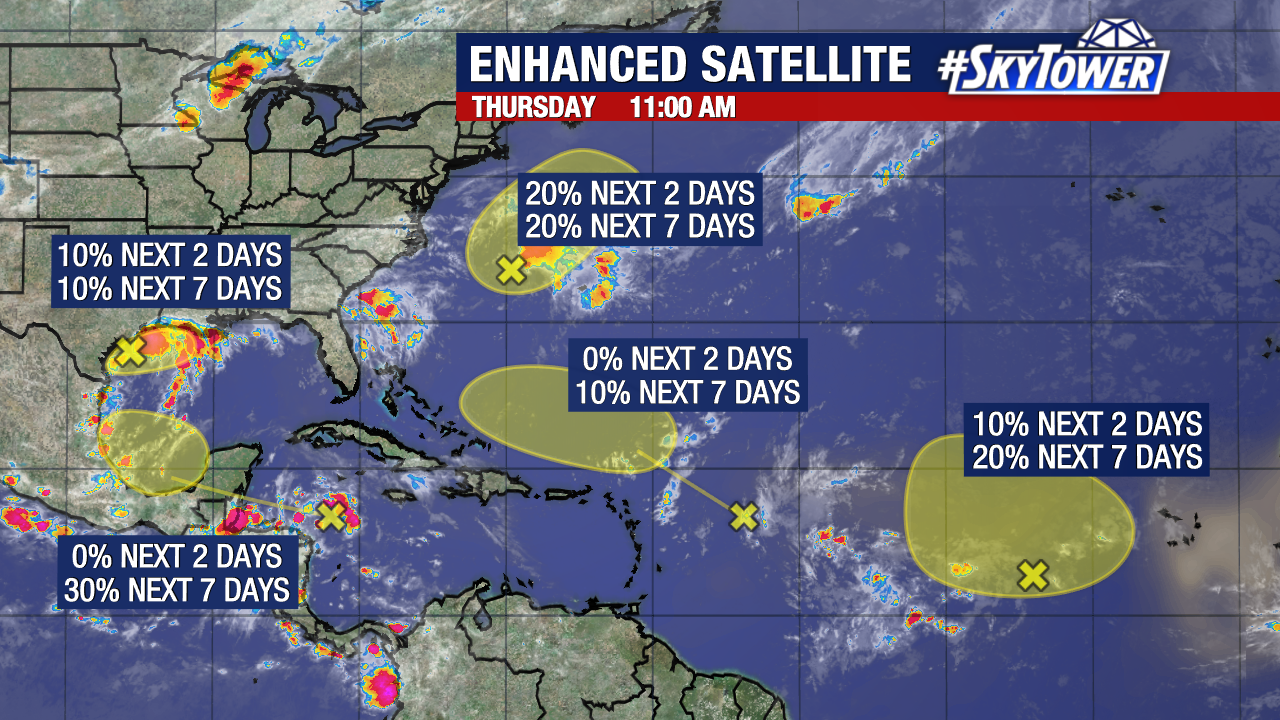
We are now keeping tabs on five unique areas of disturbed weather in the Atlantic for chances of development.
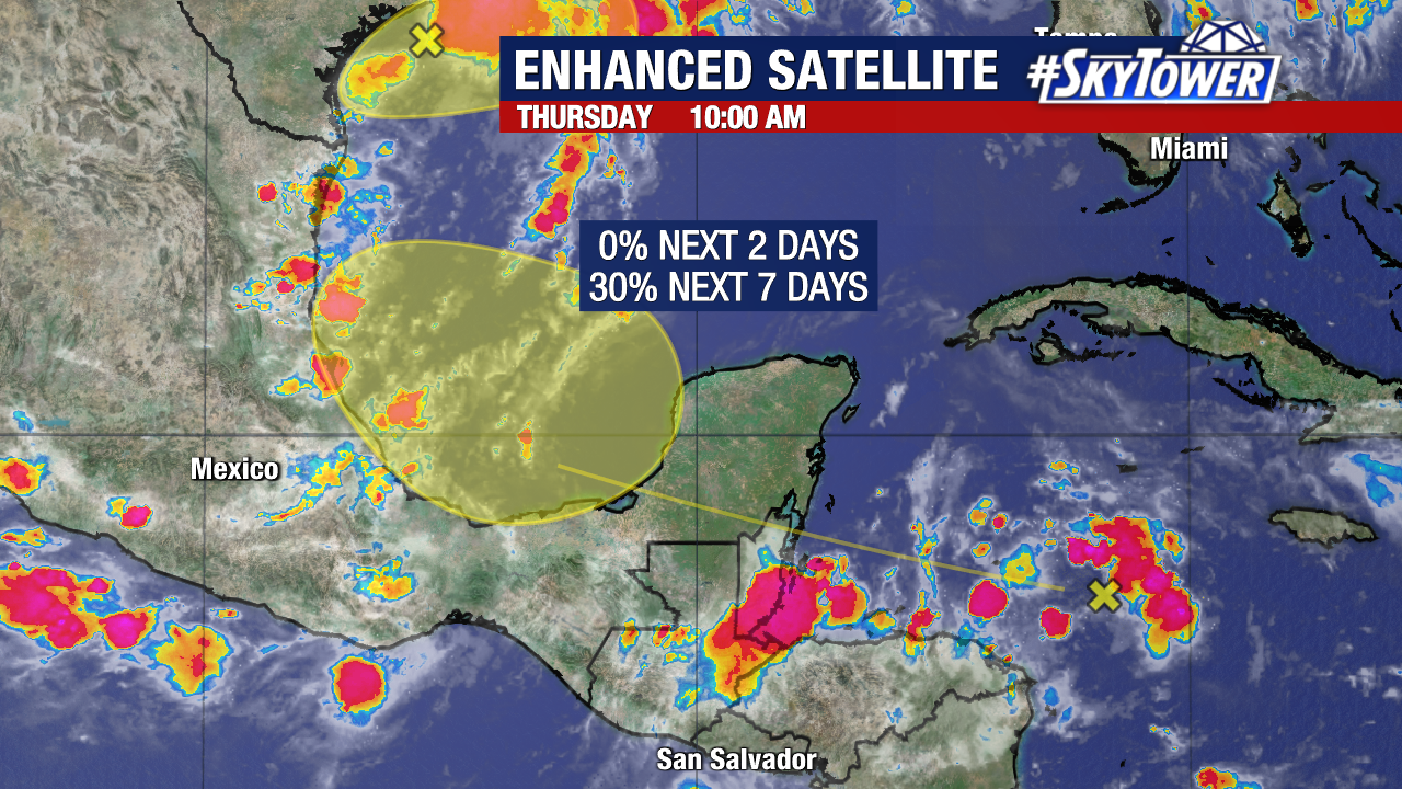
A tropical wave in the northwest Caribbean Sea will have a low (30%) chance of formation after it enters the Bay of Campeche over the weekend.
While this wave has struggled to organize over the past several days, it will have another chance over the warmer waters of the southern Gulf
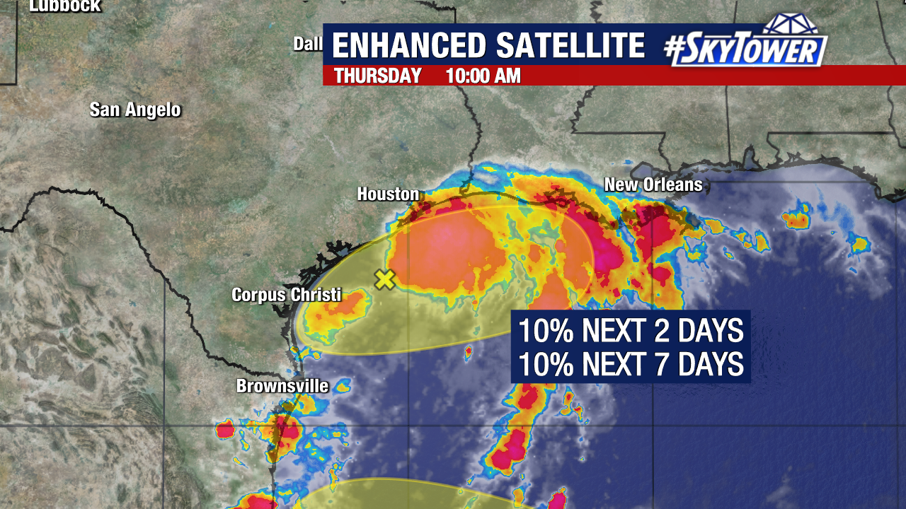
Meanwhile, we are again keeping tabs on a disturbance off the coast of Texas. Development is unlikely as increasing wind shear will create a hostile environment off the coastlines of Texas and Louisiana. It currently has a low (10%) chance of formation over the next week.
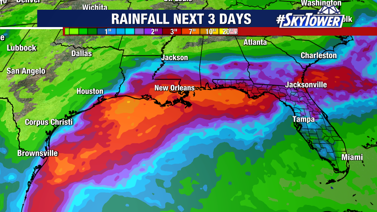
The disturbance will continue to be a prolific rainmaker for that region through the weekend.
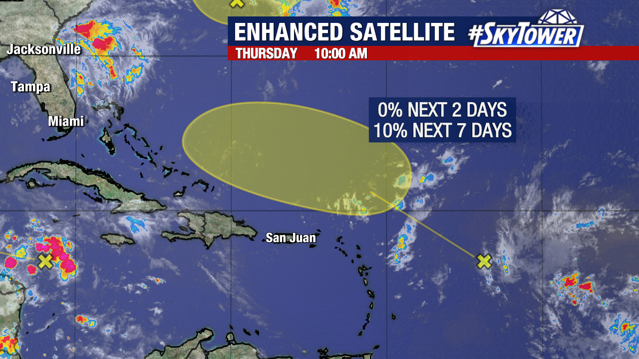
By early next week, there is now a low (10%) chance of formation for a tropical wave in the Central Tropical Atlantic. This is after passes north of the Greater/Lesser Antilles early next week.
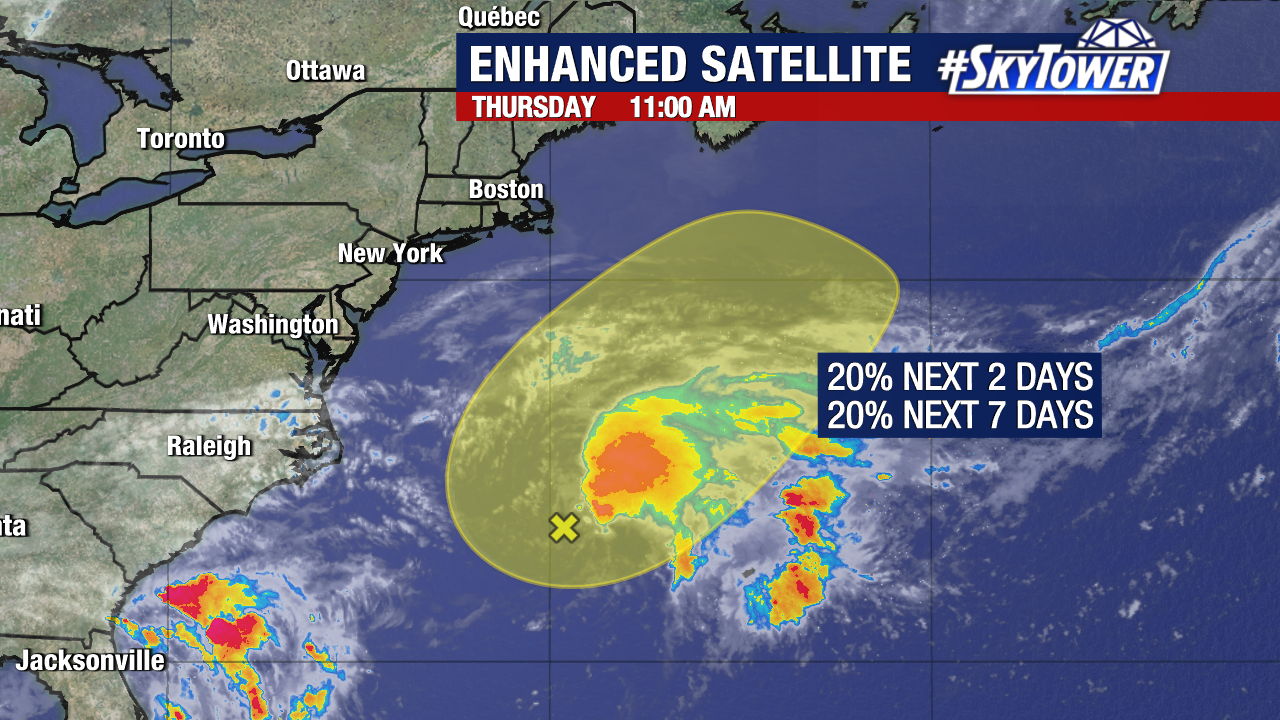
The National Hurricane Center is also watching an area of low pressure (Invest 99L) producing disorganized showers and storms a few hundred miles east of North Carolina. This could gain subtropical characteristics as it generally moves northeast over the next few days.
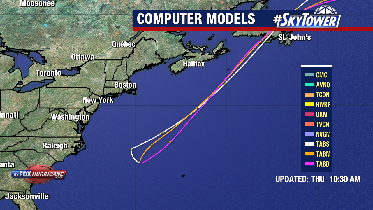
Weather forecast models keep the disturbance well off the coast of the United States. They eventually bring it into a less favorable environment for formation, over the cooler waters of the North Atlantic this weekend. It has a low (20%) chance of development over the next two days.
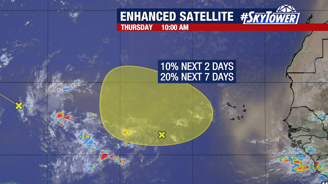
A broad area of low pressure over the eastern tropical Atlantic now has a low (20%) chance of forming within the next week. Regardless, it will likely track north/northwest and remain in the central Atlantic.