
The Atlantic Basin is showing signs of life after a busy start, followed by an eerily quiet stretch to end August.
There are two areas we’re watching, both jumping on our radar in the last 48 hours.
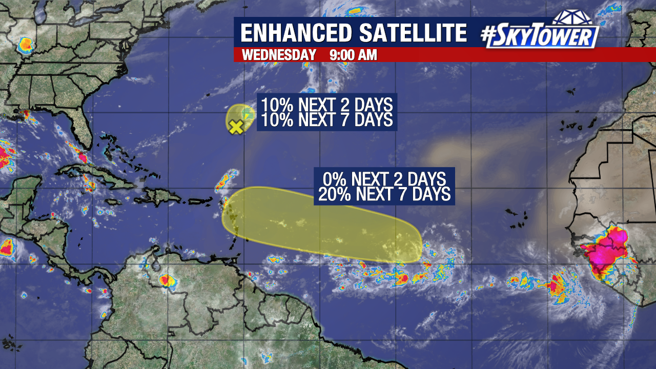
One is in the main development region between the coast of Africa and Lesser Antilles. This has a low chance to develop at the end of this week – only 20%.
This isn’t a typical wave coming off the coast of Africa, but rather a disorganized area of thunderstorms that will move into a more favorable environment for strengthening. This area will generally move west-northwest the next few days at around 10-15 mph.

At the end of this week or early next week is likely when we see any development. That’s why the odds of formation remain low in the next 7 days and only 0% over the next 2 days.

If the system organizes into a tropical storm, it will be named Francine.

The second spot flagged by the NHC is an area of low pressure spinning a few hundred miles SE of Bermuda. A combination of dry air and hostile upper winds will limit much strengthening.
There is a 10% chance of development over the next 2 days and the next 7 days. It will generally move north to northeast around 10 mph.
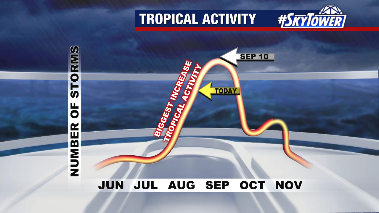
The official peak of hurricane season is September 10th.