Convection is becoming more organized around Tropical Storm Ernesto’s center and the storm is still on track to intensify into a hurricane in the coming days.
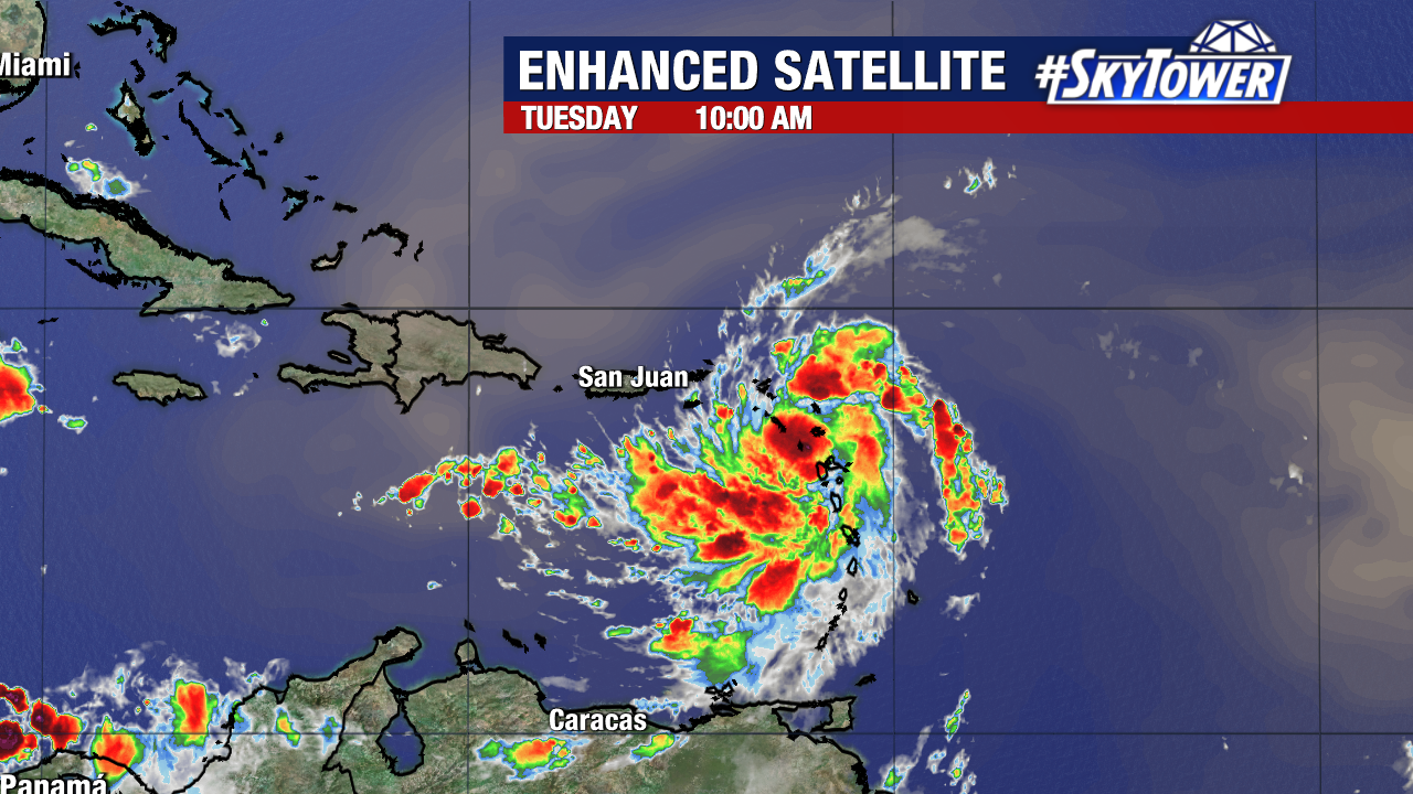
St. Barthelemy reported a wind gust of 56 mph and St. Martin reported a gust of 50 mph Tuesday morning as rainbands have started moving through the Leeward Islands.
Tropical-storm-force winds extend outward 70 miles from the center. Tropical storm conditions will continue through the day from Guadeloupe to Anguilla.
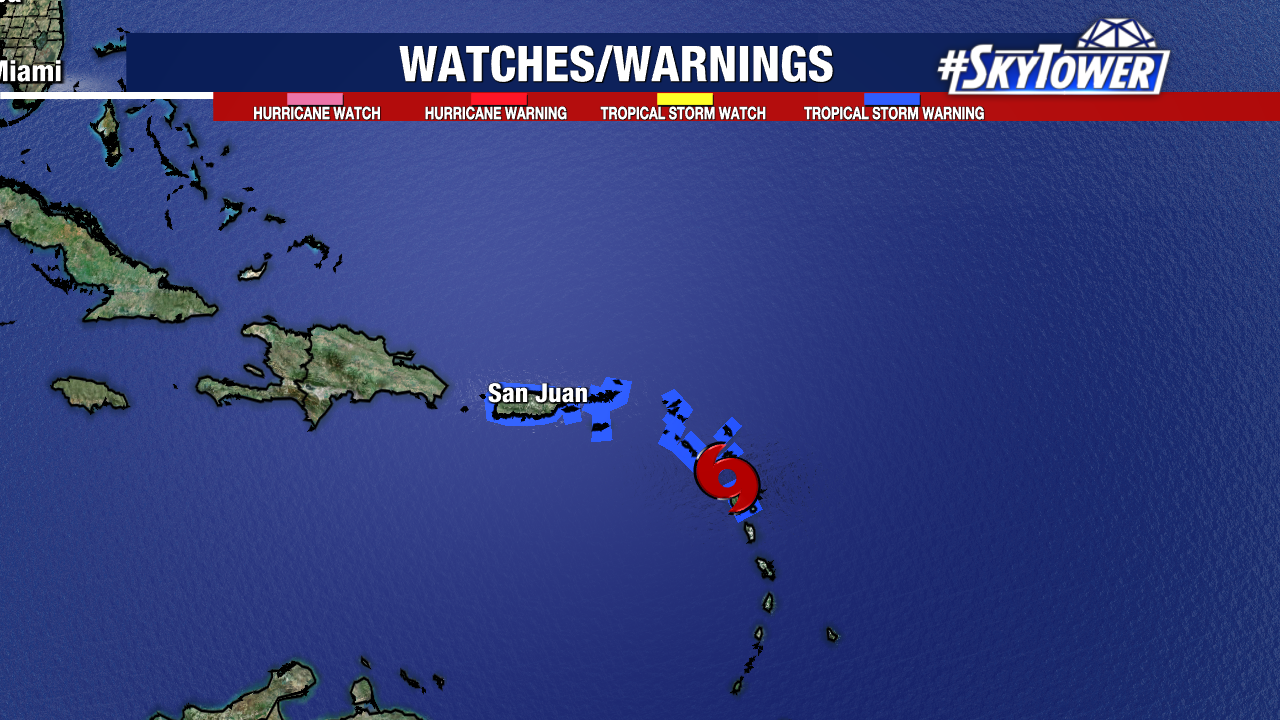
A Tropical Storm Warning is in effect for:
- St. Kitts, Nevis, Montserrat, Antigua, Barbuda, and Anguilla
- Guadeloupe
- St. Martin and St. Barthelemy
- Sint Maarten
- British Virgin Islands
- U.S. Virgin Islands
- Puerto Rico
- Vieques
- Culebra
Ernesto’s sustained winds are 50 mph as of the 11AM update as it moves west-northwest at about 18mph. Additional strengthening is not expected until the storm emerges into the Atlantic.
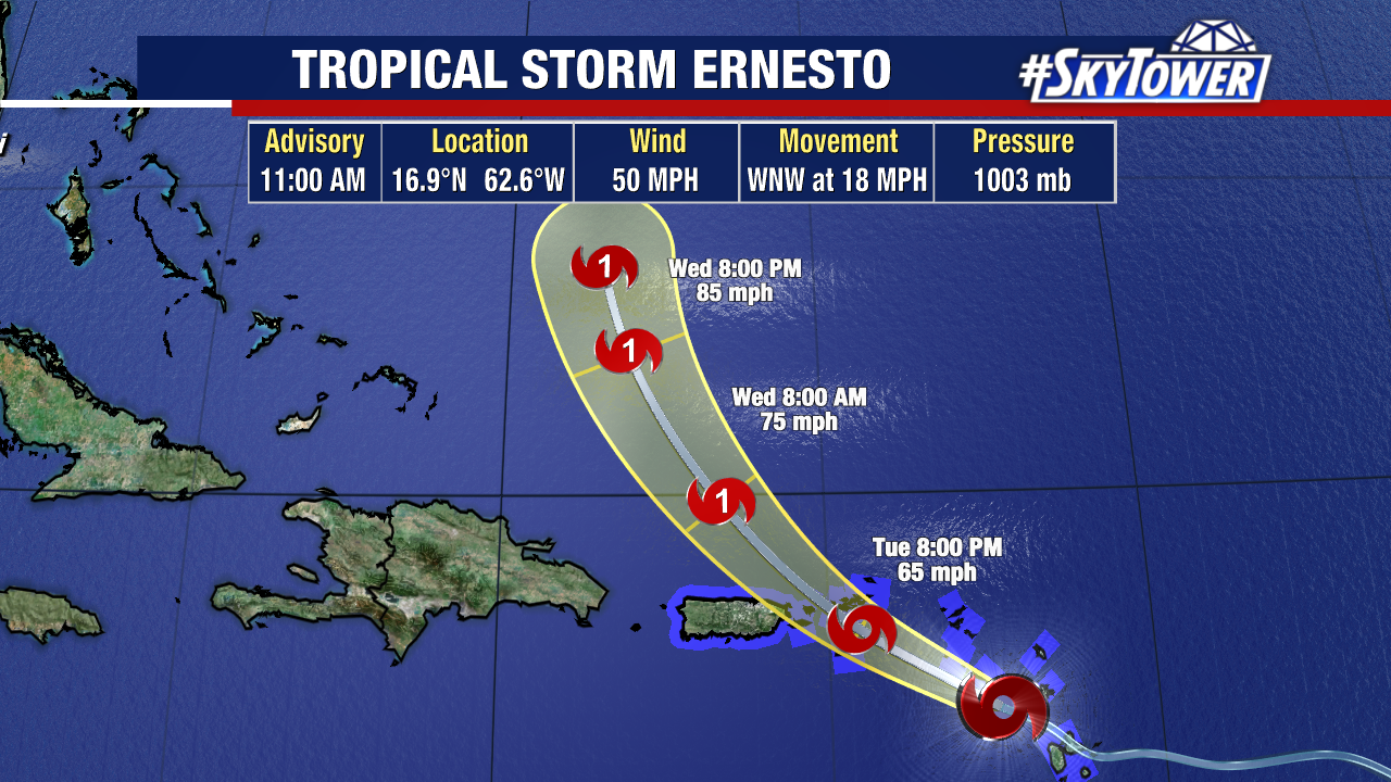
It is forecast to stay a tropical storm while moving through the U.S. and British Virgin Islands and Puerto Rico Tuesday evening.
After passing Puerto Rico and the Virgin Islands, Ernesto is forecast to turn northward over the western Atlantic.
The storm is expected to reach hurricane strength Thursday while moving over very warm Atlantic waters without much wind shear to encounter.
Ernesto could become a category 2 hurricane on approach to Bermuda later this week, which is something we’re closely watching.
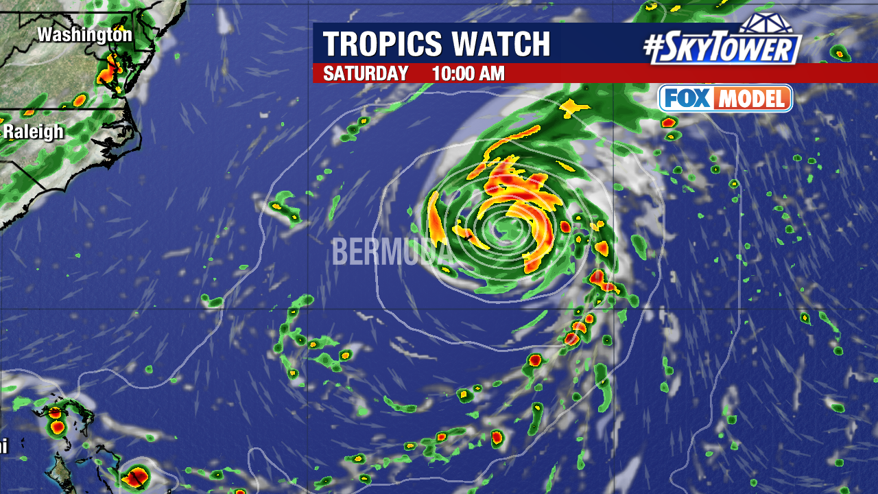
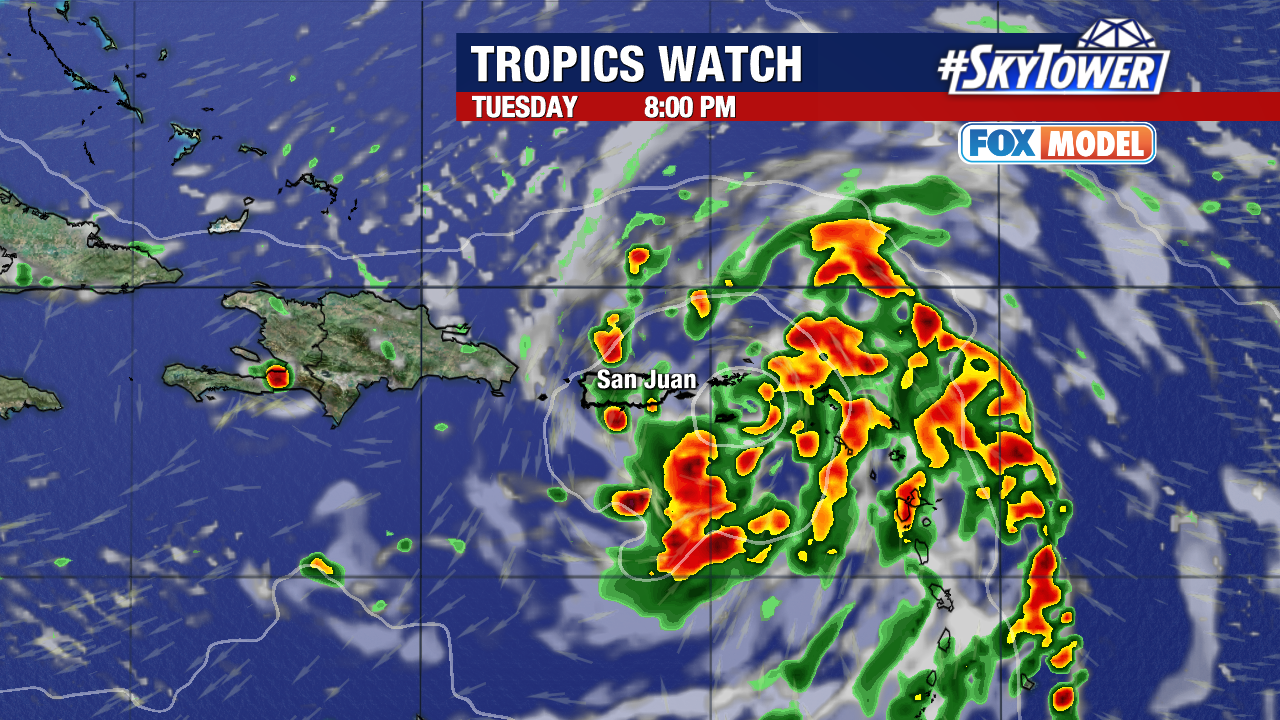
Tropical Storm Ernesto is expected to drop 4 – 6 inches of rainfall over portions of the Leeward and Virgin Islands Tuesday. Puerto Rico will get 3 – 6 inches of rainfall, with higher amounts of 10 inches.
Storm surge forecasts call for up to 3′ above normal tide for the east coast of Puerto Rico from San Juan to Guayama, including the islands of Culebra and Vieques and in the U.S. Virgin Islands. Along with St. Thomas, St. John, and St. Croix.
High surf will then start to spread up the east coast as Ernesto takes a sharp turn north, staying east of the Bahamas, and well east of the Lower 48.
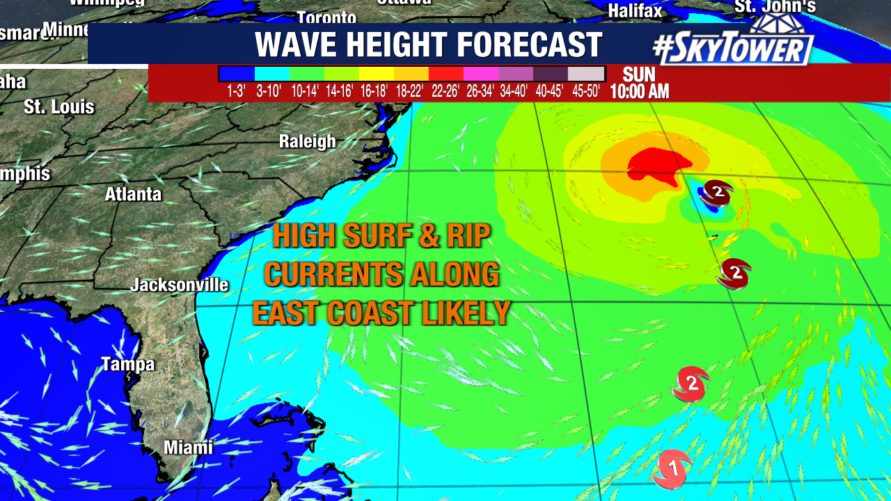
Once Ernesto gets out of the Caribbean, all things are favorable for fast strengthening. The forecast calls for this to reach category 2 hurricane strength before nearing Bermuda early Friday morning.
Where the storm’s center of circulation ends up will mean a big difference in impacts. Bermuda could take a direct hit or end up on the right side of Ernesto – both would be bad situations for the small island.
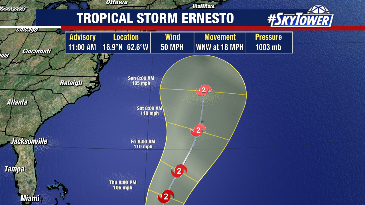
It’s too early to say for sure, and Bermuda is not included in any watches/warnings. Models are in pretty good agreement on the track and we’ll have a better idea how close it will end up getting to Bermuda in the next few days.
