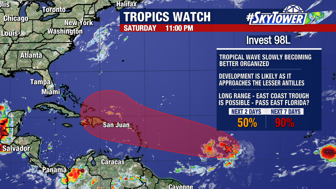
There is now a high (90%) chance of development over the next seven days for Invest 98L in the central Tropical Atlantic.
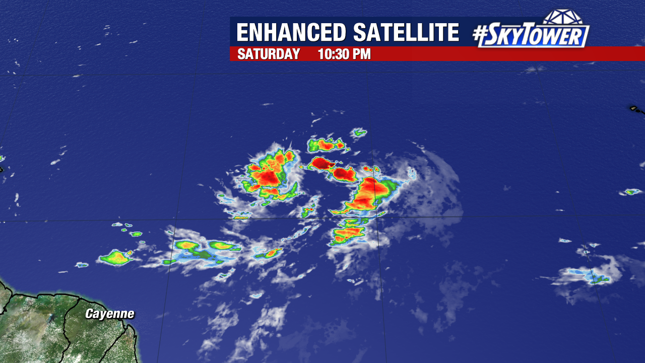
Satellite imagery has revealed that Invest 98L appears more organized and will have a great chance of formation over the next few days.
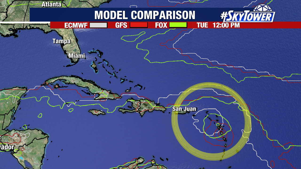
Weather models are highly confident that this system will reach or pass just north of the Lesser Antilles as we head into Tuesday and Wednesday of this upcoming week.
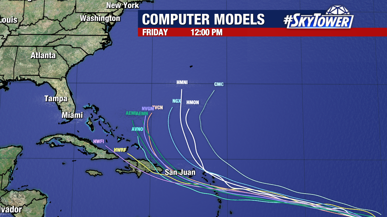
From here, the majority of our weather models (not all) show this storm strengthening and recurving to the north. This path would keep it east of the Contiguous United States. As we get more data and see how quickly it develops, we will continue to watch for any changes in this trend.
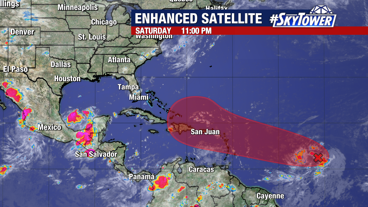
Invest 98L is currently over 2,700 miles away from our coastline, so we’ll have a long time to monitor it. The next name on our 2024 naming list is Ernesto.
