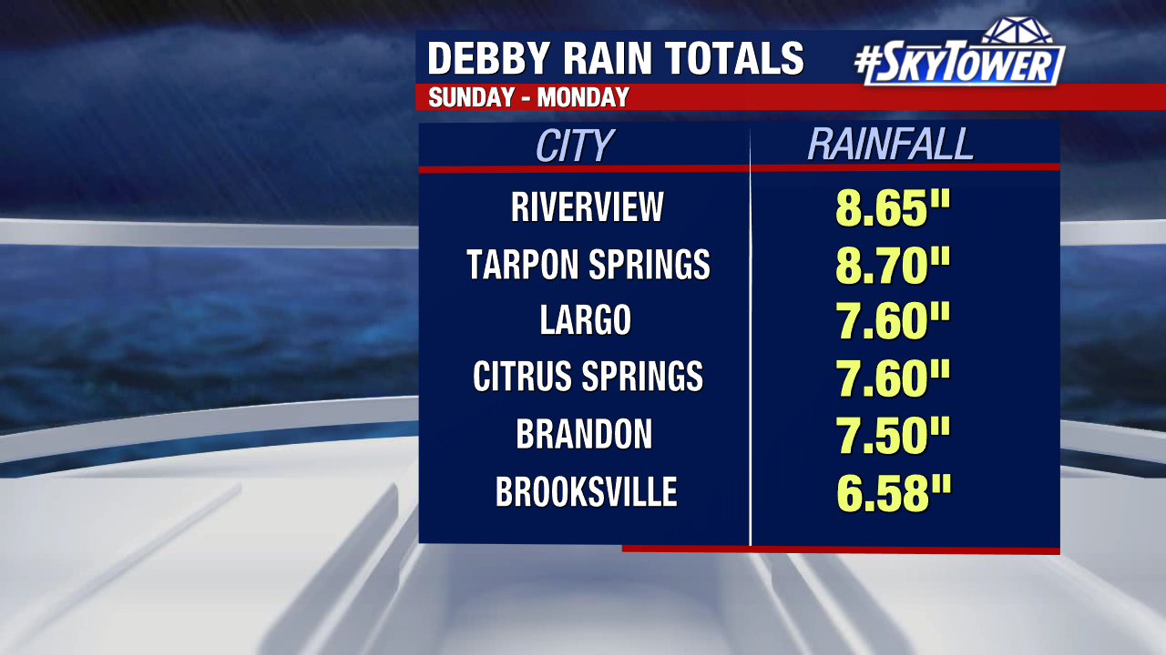
Debby was a proficient rain producer while the storm jogged parallel to Florida’s west coast before making landfall on the Big Bend.
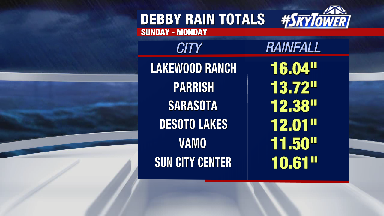
Southwest Florida and the Tampa Bay area got the dirty side as the storm’s outer rainbands swept across the state. Flooding was the biggest impact, but tropical-storm-force winds and dangerous storm surge also moved through.
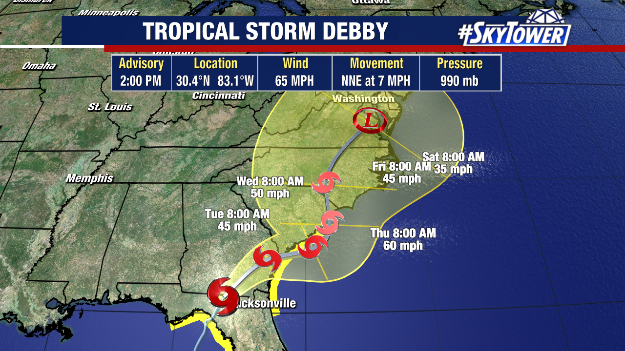
Since landfall Monday morning, Debby weakened back into a tropical storm. As of the 2:00 update, winds have weakened a bit more with sustained winds of 65 mph.
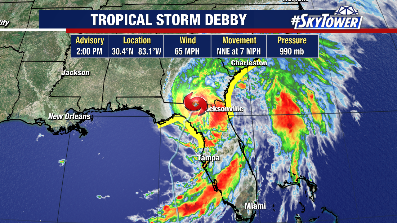
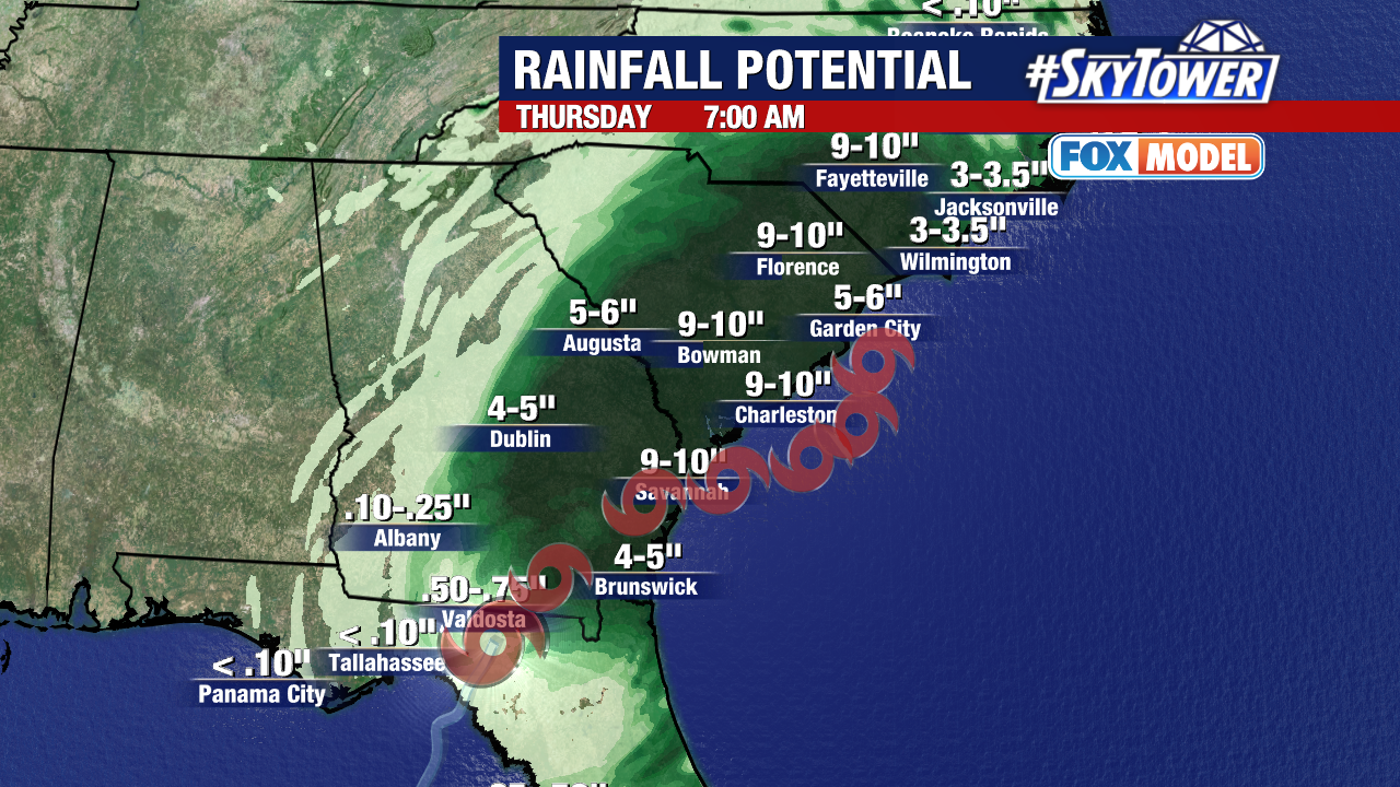
The other big thing to note in the latest advisory is how much the storm has slowed down. This is going to be a big rain maker as it head for the FL-GA line and the Carolinas.
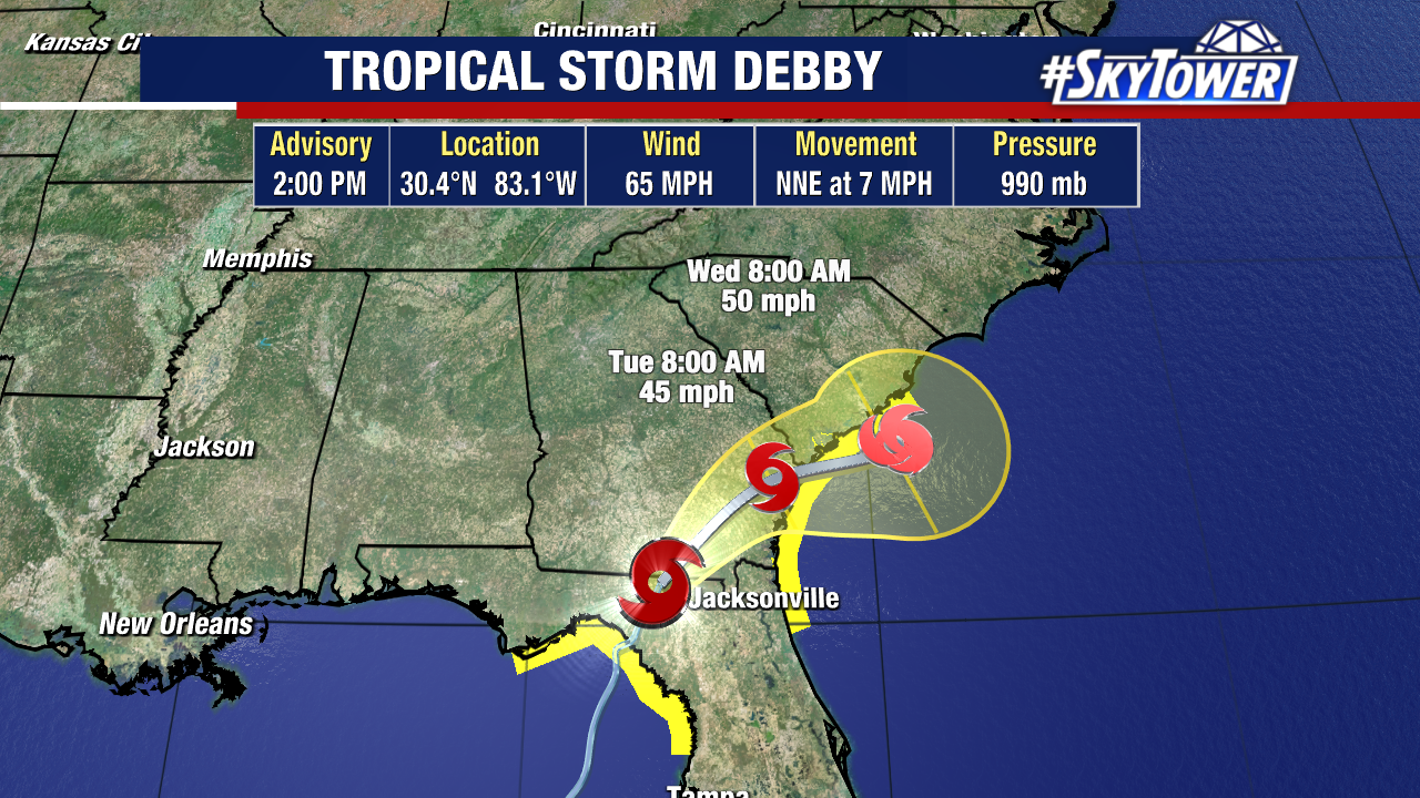
This is going to bring potentially historic heavy rainfall to these SE states as Debby is going to lose steering flow, causing it to stall out and spin over these area for days.
We will likely still be talking about Debby through the end of this week. Once the storm gets close and potentially spins over warm Gulf Stream waters, it will have additional fuel to sustain itself.
Debby is now forecast to track all the way up the Atlantic Coast into Saturday before weakening to a tropical depression.
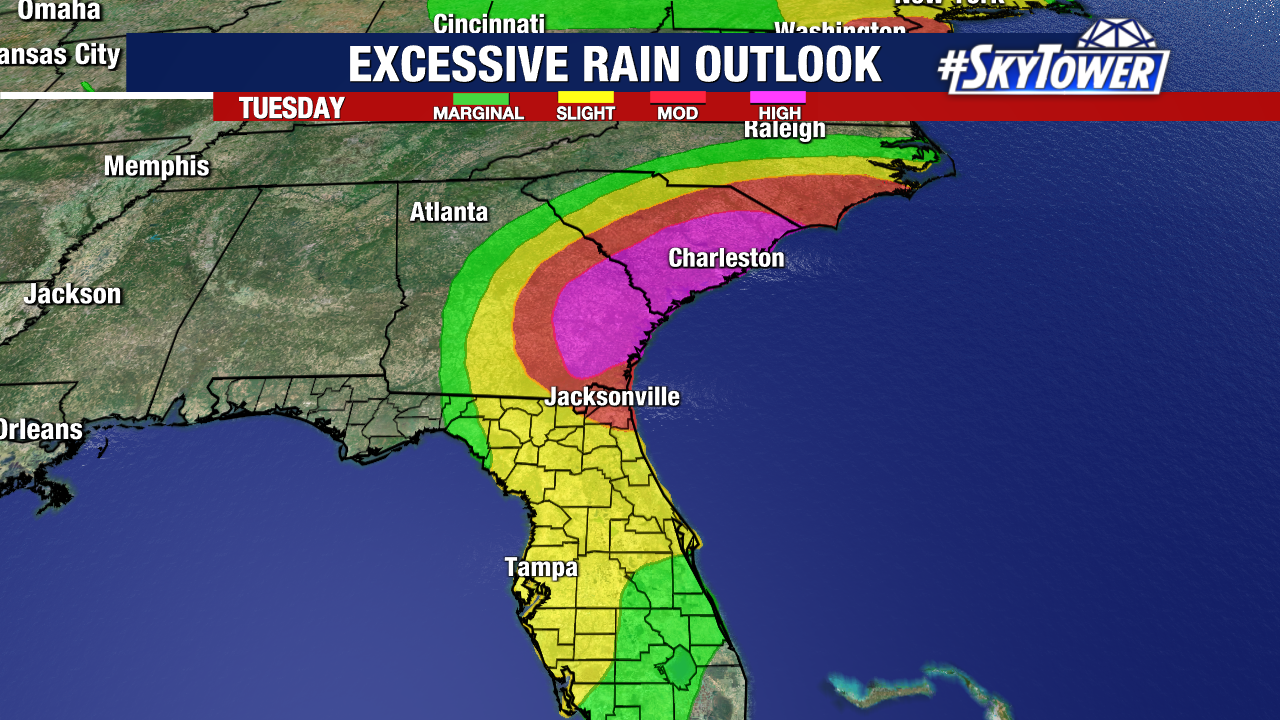
The excessive rain outlook for the Georgia and South Carolina coasts are at the highest level, the areas in pink, where up to 2 feet of rain could fall over several days.
Ernesto is the next name on the 2024 hurricane list. It may not be long before we’re tracking our next tropical wave. We’re already eying a potential area of interest in the Atlantic Basin.