We now have Tropical Depression Four off the southern coastline of Cuba.
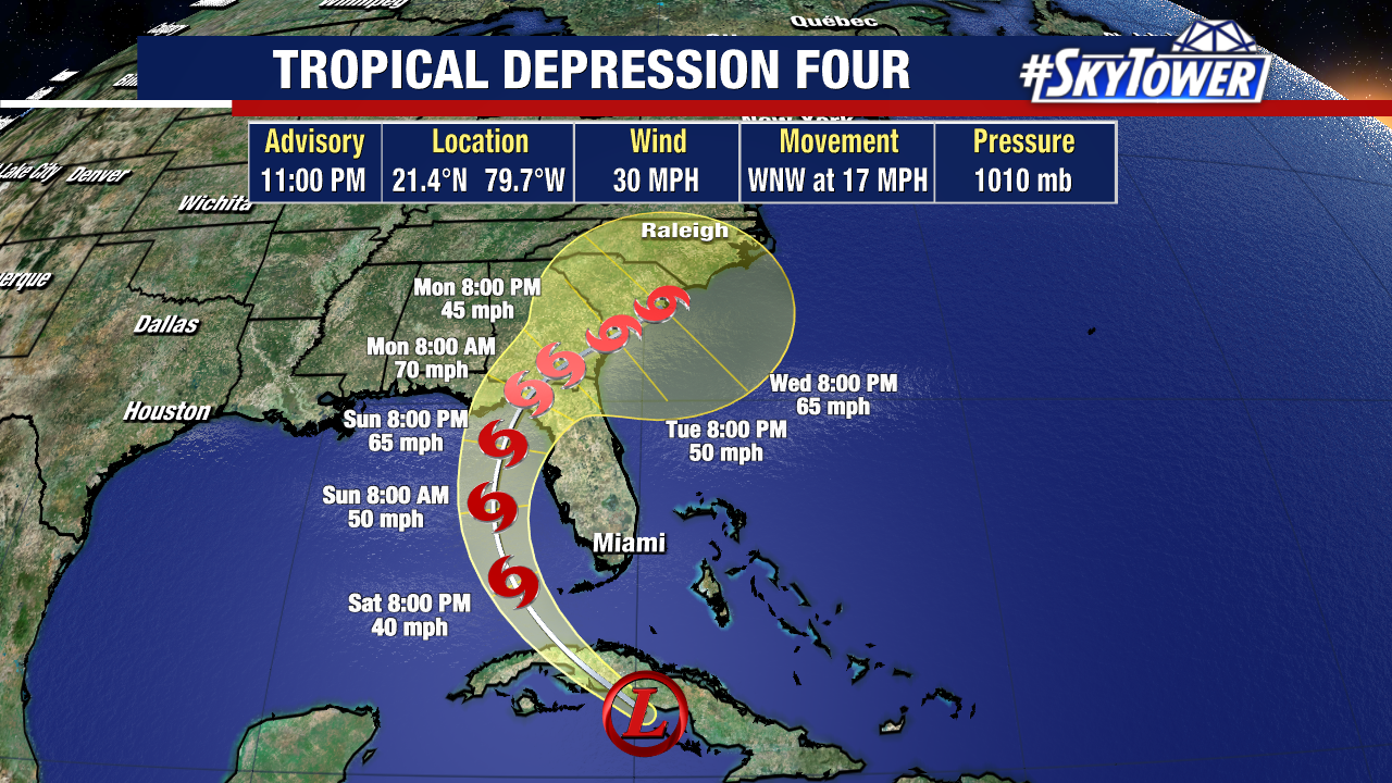
Tropical Depression Four is expected to pull north into the eastern Gulf of Mexico as it likely strengthens into a tropical storm this weekend. “Debby” would be the next name assigned to this system.
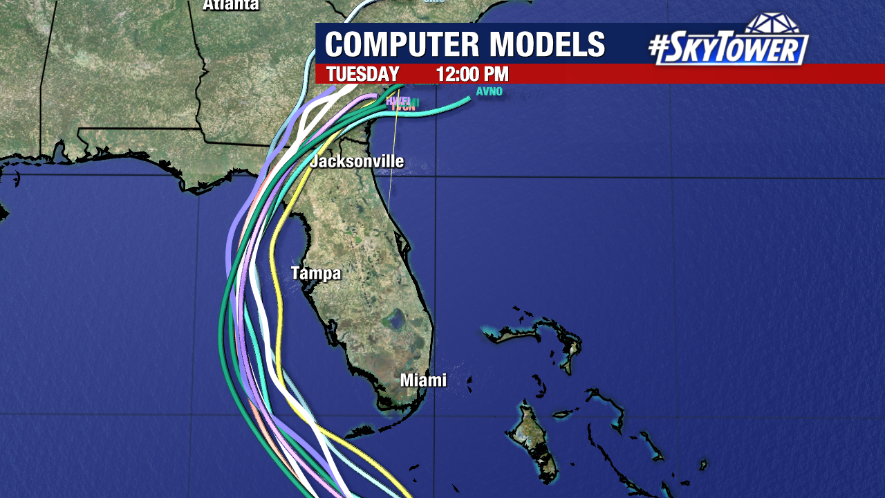
Our latest models have shifted slightly west to account for where the center of this tropical depression was located. This is also why the forecast cone has been nudged slightly west. Only time will tell if this trend holds. Regardless it is important to remember that impacts can extend far outside the cone.
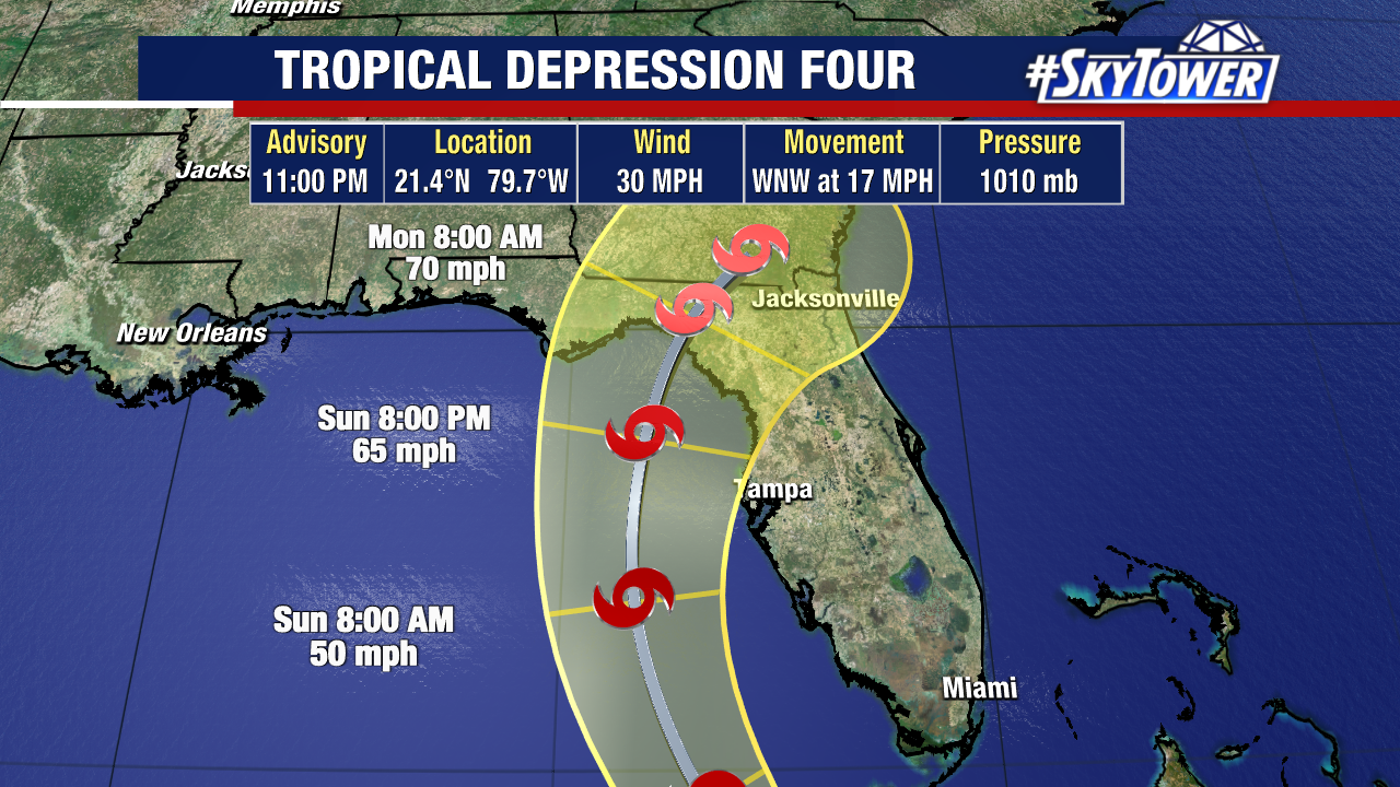
Tropical Storm watches remain in effect for central Florida with warnings in effect for southwest Florida. The strongest winds of this system would likely arrive on Sunday.
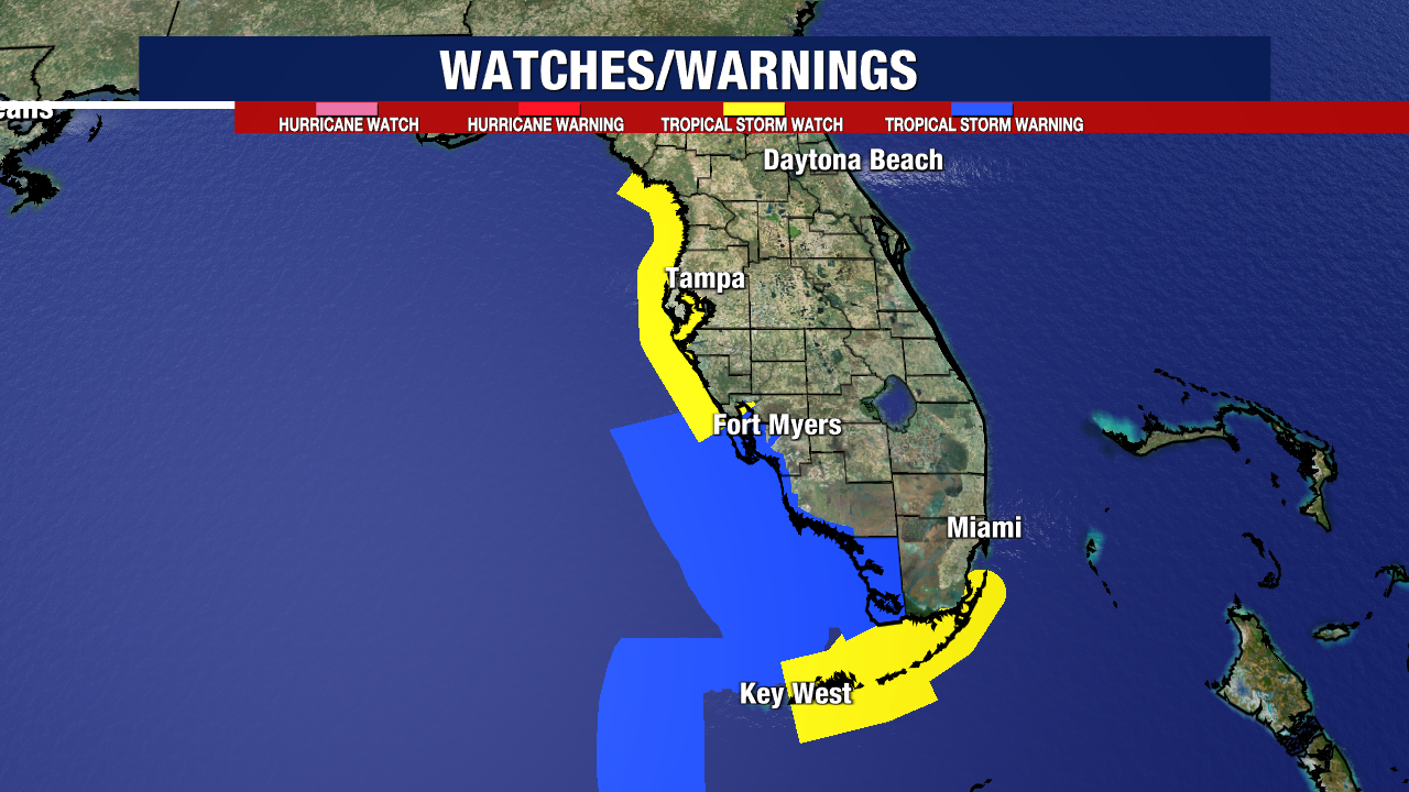
Additionally, storm surge watches remain in effect for most of Florida’s Gulf Coast.
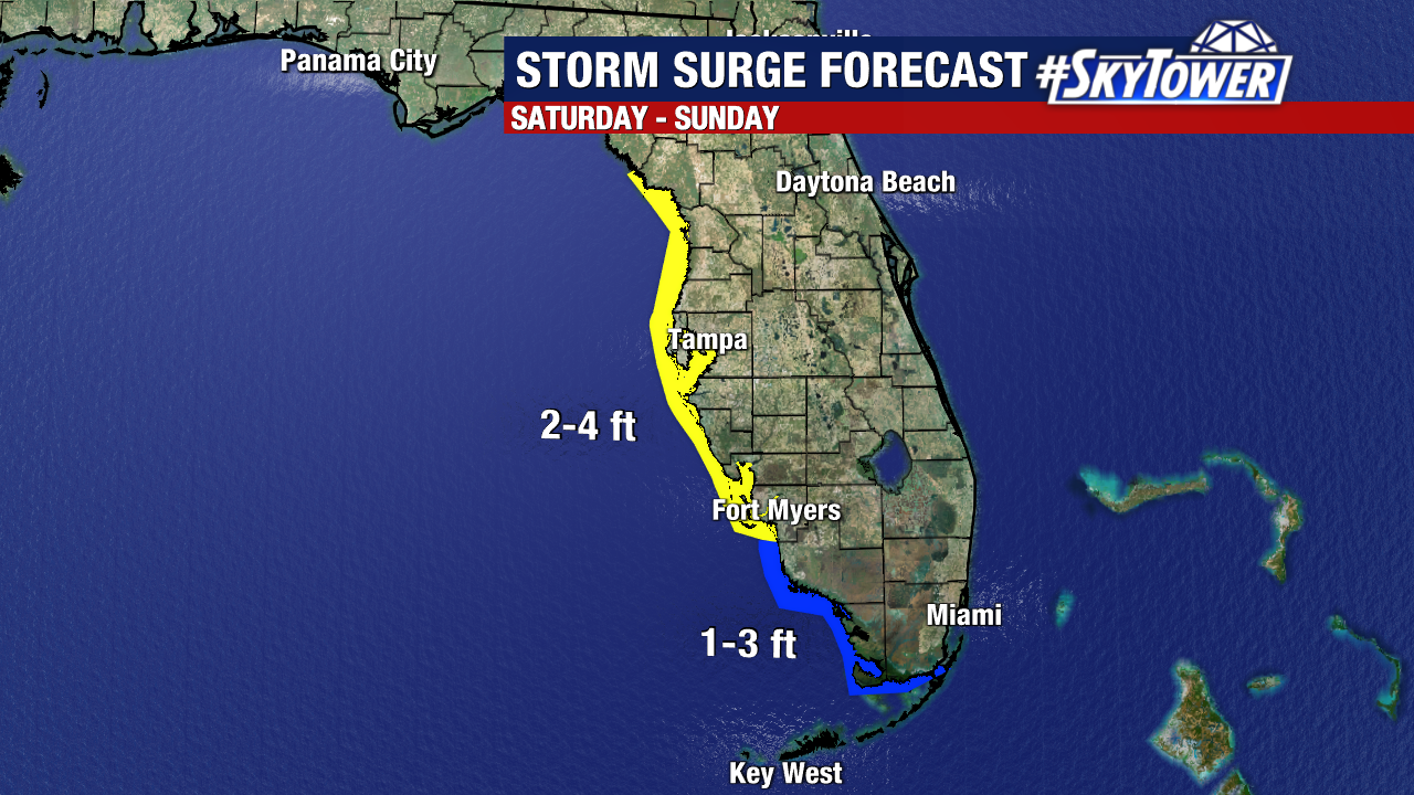
Depending on how close and strong this storm tracks, these forecasts will likely be heavily adjusted over the next few days.
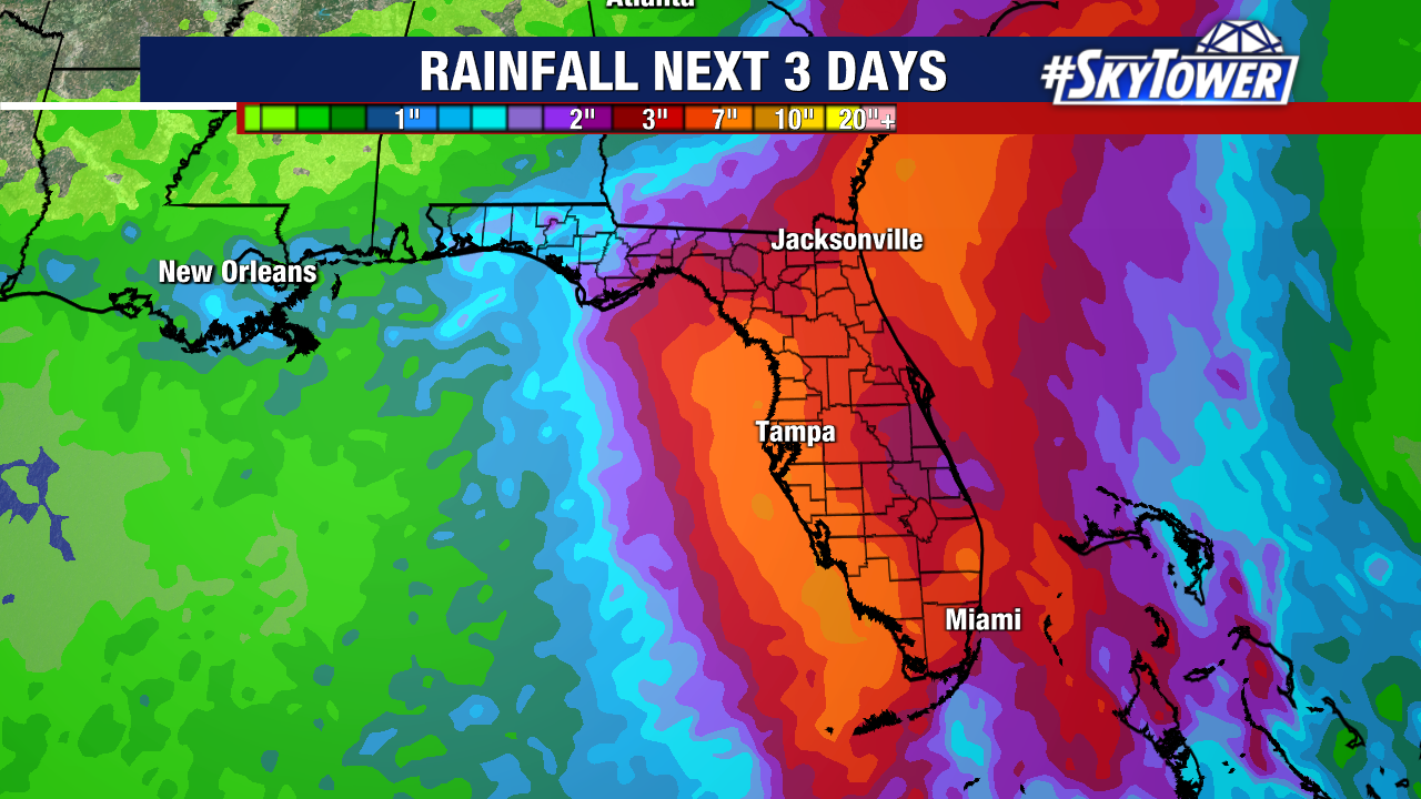
Heavy rain and flash flooding remain the primary hazards of this system. At the moment, Sunday appears to be the day where most of these rainfall totals build.
