
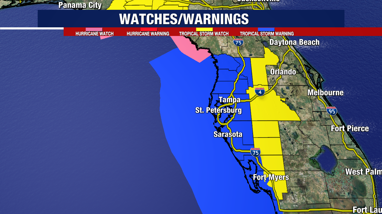
A slight change in the track has prompted more tropical watches/warnings. Hurricane Watch in effect for Florida’s Big Bend from the Aucilla River to Yankeetown, where hurricane-force winds are possible.
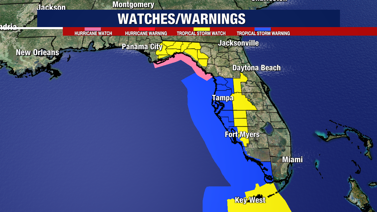
Tropical Storm Warning runs along most of the west coast, including Tampa Bay. Watches are in effect for inland areas highlighted in yellow.
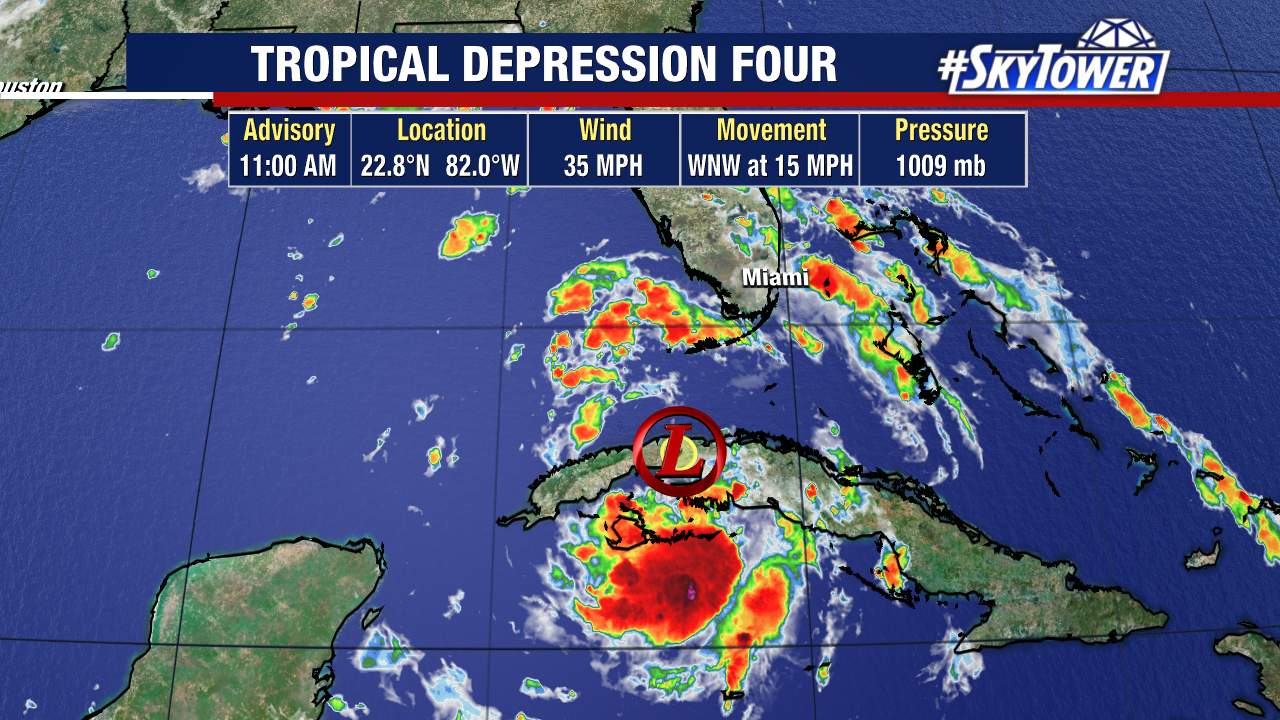
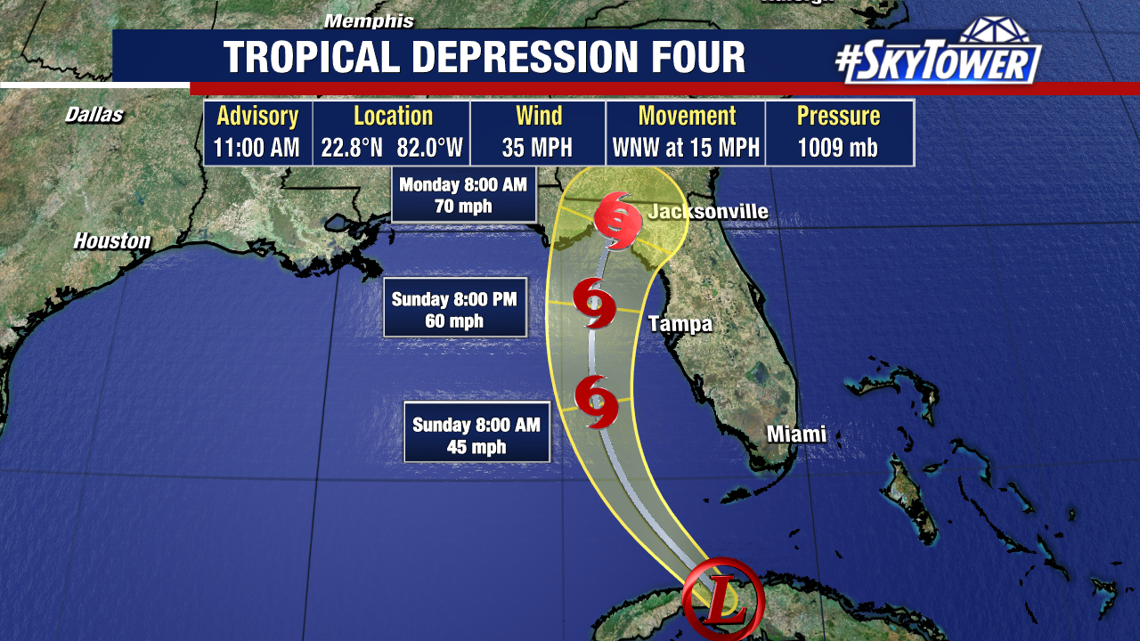
Tropical Depression Four still has sustained winds of 35mph while it spins over western Cuba, moving WNW at 15 mph.
Here’s the latest track for Tropical Depression Four:
The track has shifted west based on where the storm’s center of circulation is ending up on the southern edge of the island of Cuba. This will offer more time for this to strengthen over very warm Gulf waters.
Earlier interaction with land would cause the storm to weaken, but that looks less likely in the recent track. The west coast, and a large part of Florida, will get downpours, flooding and tropical-storm-force winds.
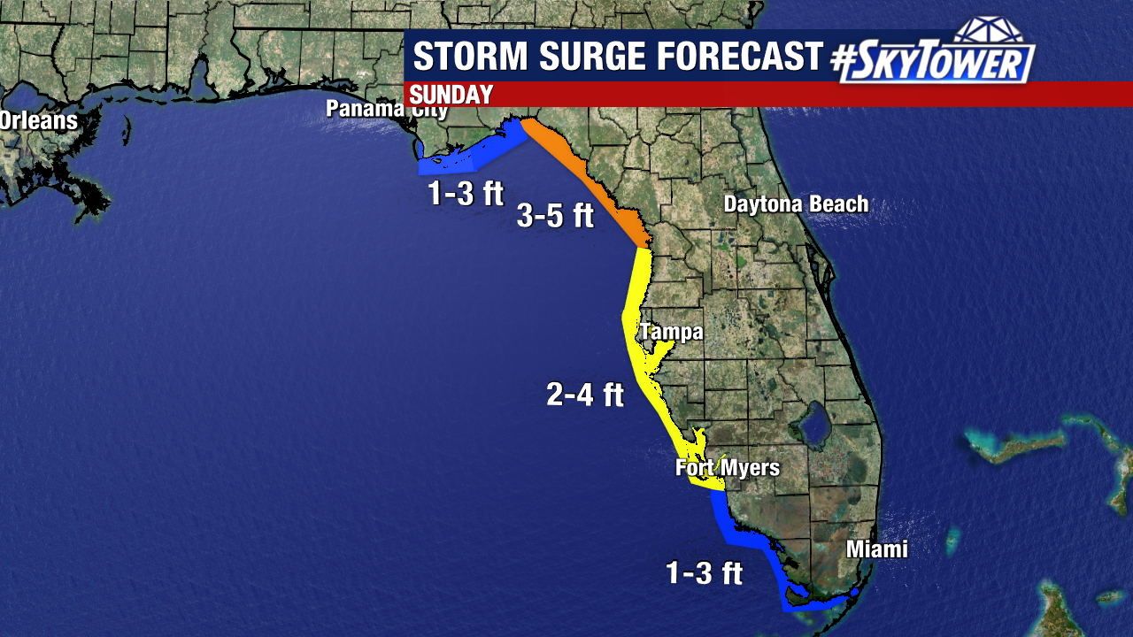
A Storm Surge Watch runs from Bonita Beach to the Aucilla River, including Tampa Bay and Charlotte Harbor. Here’s a look at the expected storm surge:
Tropical Depression Four is still forecast to become Tropical Storm Debby sometime on Saturday as it moves through the eastern Gulf of Mexico.
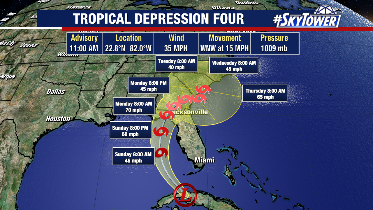
The storm will turn north and run parallel to the west coast of Florida Sunday, before turning NE and likely coming onshore over the eastern Big Bend.
Then the storm likely slows down early next week, possibly even stalling near the Carolinas. If it hugs the coast and feeds off warm Gulf Stream waters, this could cause quite a bit of trouble for the SE.
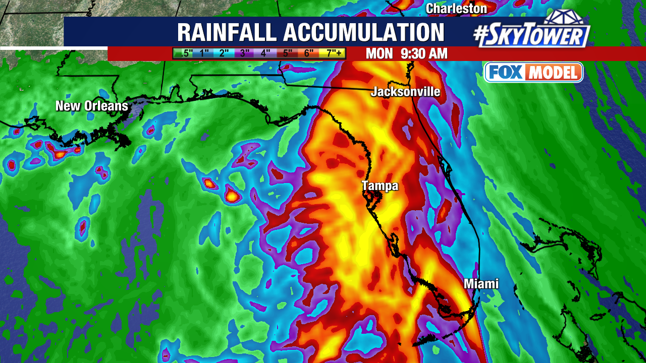
This is going to be a big rain maker, with 4-8″ of rainfall looking likely, and some spots even getting a foot of rain. Flooding, especially along the coast, will be one of the main concerns.
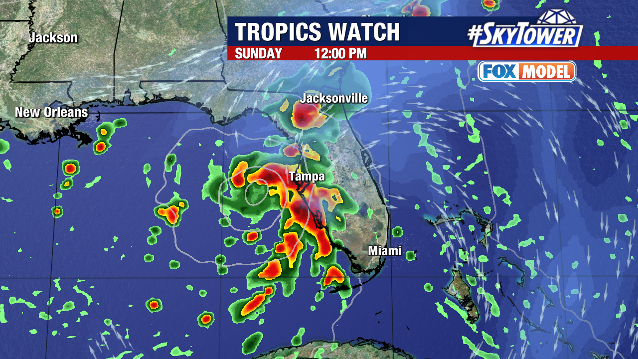
High tide Sunday afternoon could coincide with the brunt of this, ramping up storm surge impacts. We can’t rule out tornadoes spinning up as Tampa Bay and the west coast will get the dirty side of the storm.
Could this strengthen into a hurricane? It’s more likely with the latest track keeping it over the Gulf longer – but not certain. We can’t rule out rapid intensification over the incredibly warm waters.
At this point, forecasts don’t call for it to become a hurricane. We will be closely watching it. Make sure you have a way to get alerts! We’ll keep you updated.