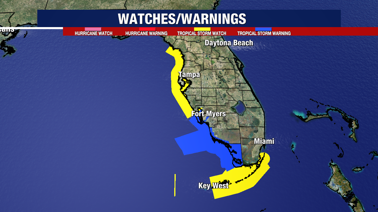
Tropical Storm conditions will spread into the state starting Saturday, worsening early Sunday morning.
Tropical Storm Watches/Warnings extend from the Big Bend down the Southwest Coast and into the Florida Keys.
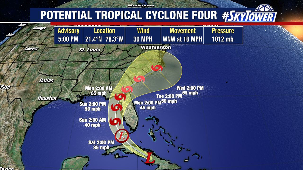
Potential Tropical Cyclone Four is currently over Cuba and will emerge somewhere near the Straits of Florida by early Saturday. Once this wave reaches the incredibly warm Gulf waters, it’s expected to intensify.
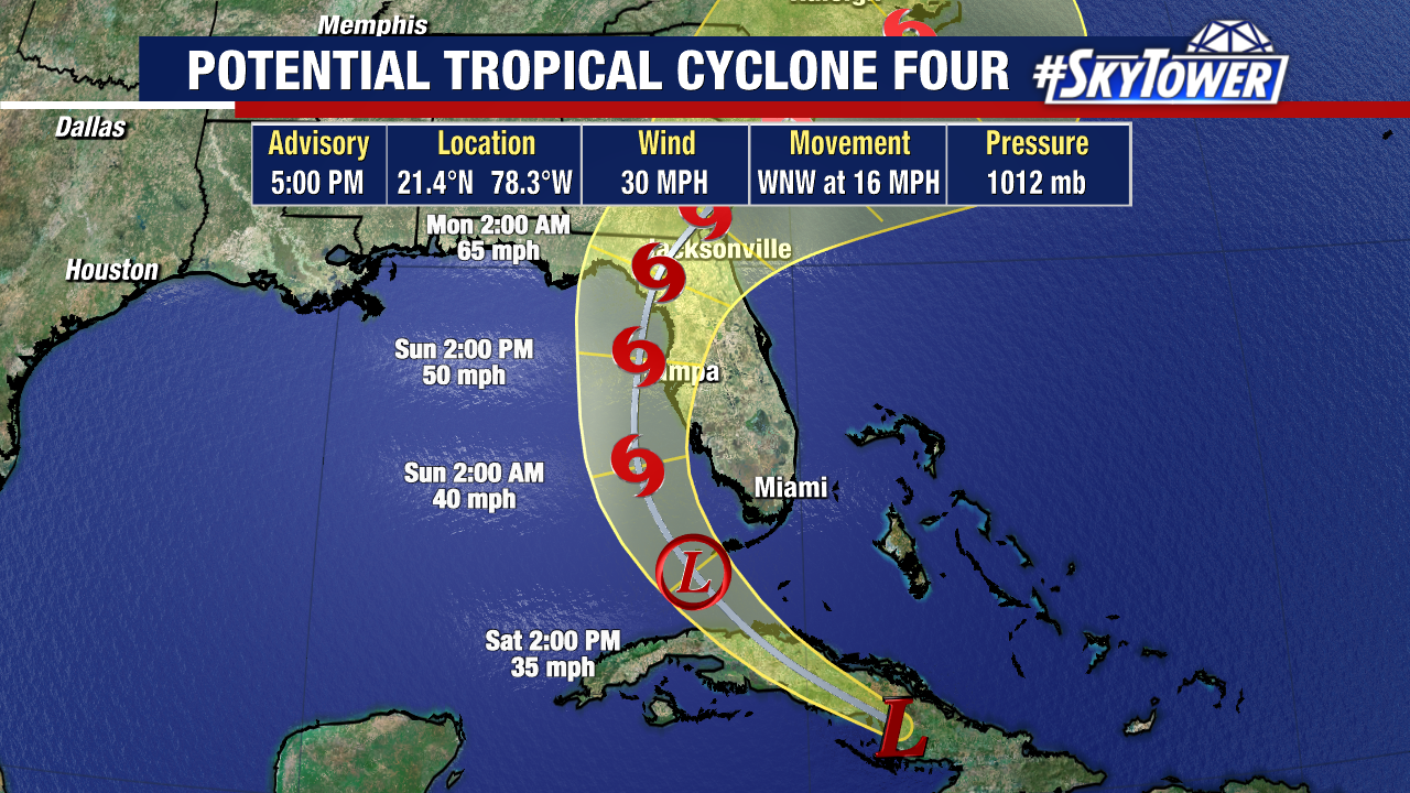
We’ll likely have the fourth named storm of the season on Saturday. It will be named Tropical Storm Debby once maximum sustained winds reach 39 mph.
The storm will continue moving northwest, then take a turn north and northeast Sunday into early next week. This could still maintain tropical storm strength as it crosses the state and moves up the Atlantic coastline.
Rain is going to be the biggest impact from this storm, with a general 4-6″ looking likely late Saturday through Sunday. A large portion of Florida is highlighted in a risk for excessive rain on Sunday, particularly central and southern FL.
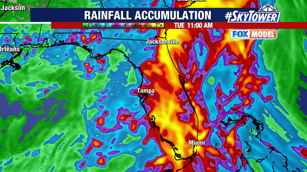
There heaviest rain could shift depending where exactly the storm comes onshore. Coastal flooding along the west coast will be a concern, along with the potential for inland flooding from a deluge of tropical rains Sunday.
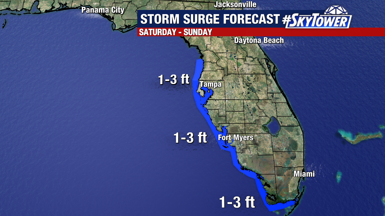
As for storm surge, here’s what we’re thinking. A general 1-3 feet of surge is possible from Aripeka to the southern coast of FL.
Tropical-storm-force will start in southern parts of the state Saturday, spreading north overnight as the storm moves up the west coast.
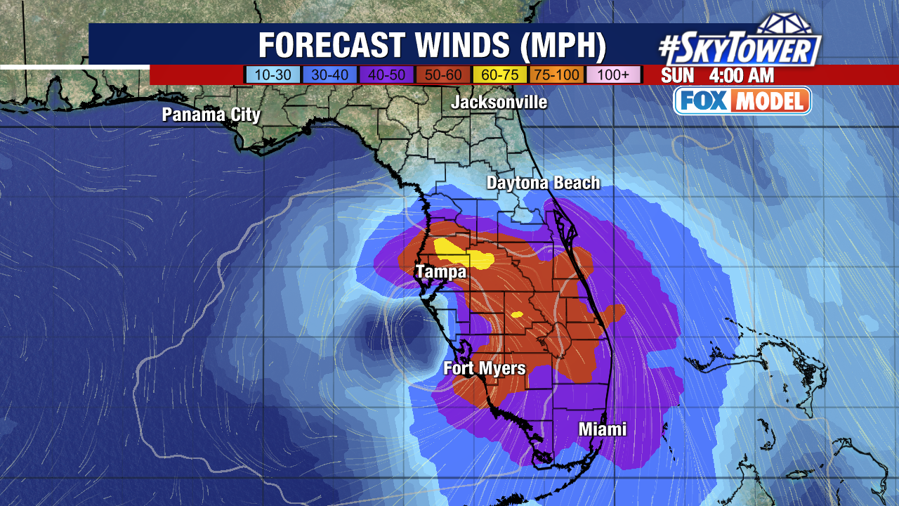
By early Sunday morning, the Bay Area will be dealing with gusts between 50-60 mph, with some higher gusts possible closer to the storm’s center. Winds will be howling for a good portion of Sunday as the storm moves northeast.
Keep in mind these: computer models can shift as the storm organizes more. The general consensus is it continues northwest, taking a curve NE to cross the state somewhere in central FL.
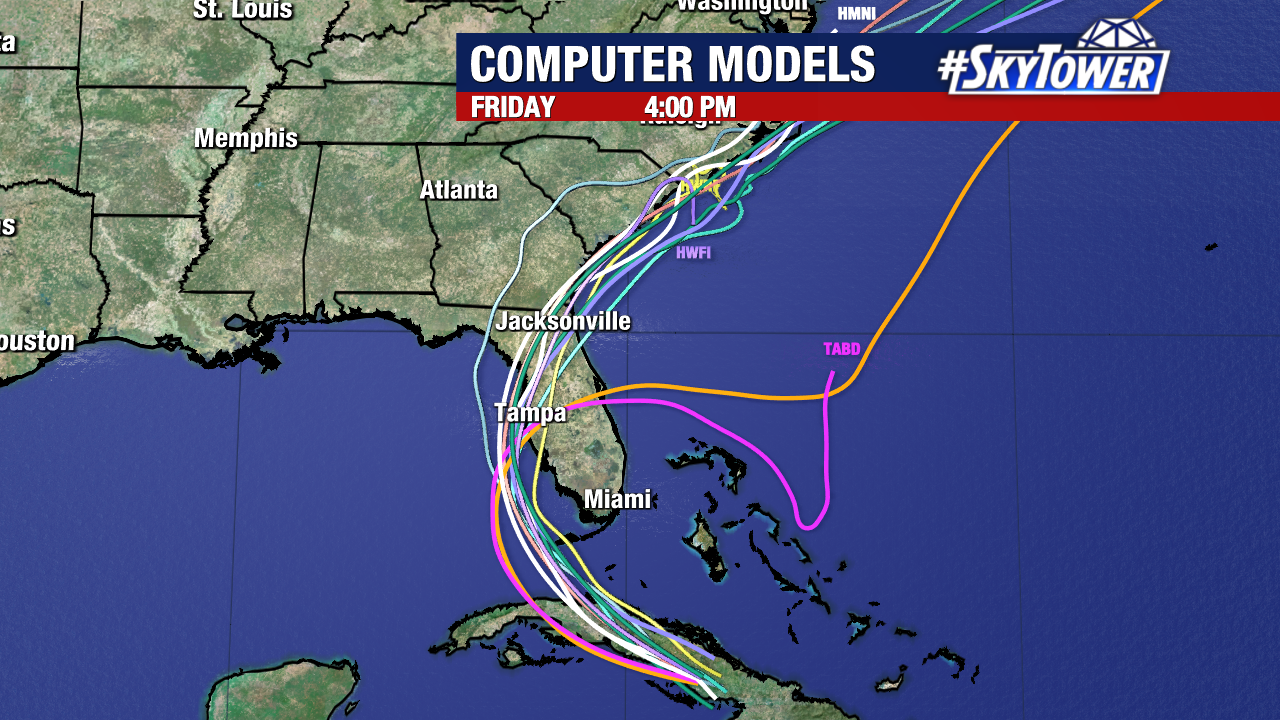
If it hugs the coast more and makes landfall closer to the Big Bend, this would offer more time so strengthen. At this point, a weaker tropical storm making a farther south landfall is most likely.
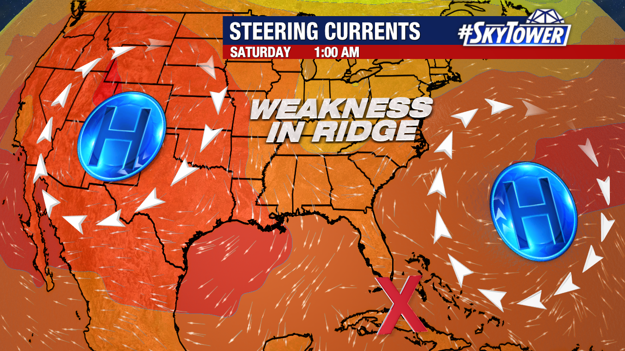
So what’s steering this storm? There are two main areas of high pressure guiding it. On Sunday, a trough dips into the northeast which allows for a weakness in the ridge. This will pull the storm north, before turning it NE.
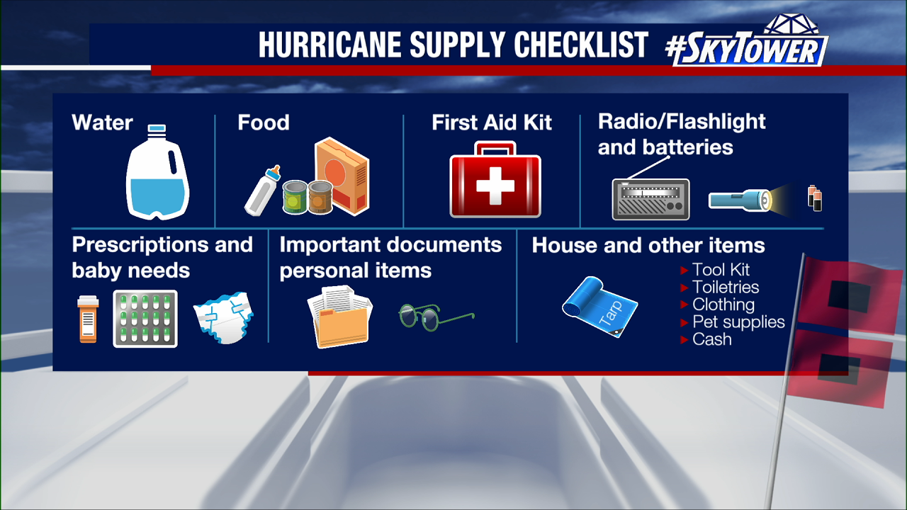
Do what you can to prepare now and stock up on sandbags. Remember, we have 90% of the season ahead of us. Here’s a good checklist of things that are good to have in your hurricane supply kit.