
“Hurricane Beryl is a likely harbinger of a hyperactive season” – according to experts at Colorado State University.
The July update was just released. CSU forecasters are calling for an even more active 2024 Atlantic hurricane season.
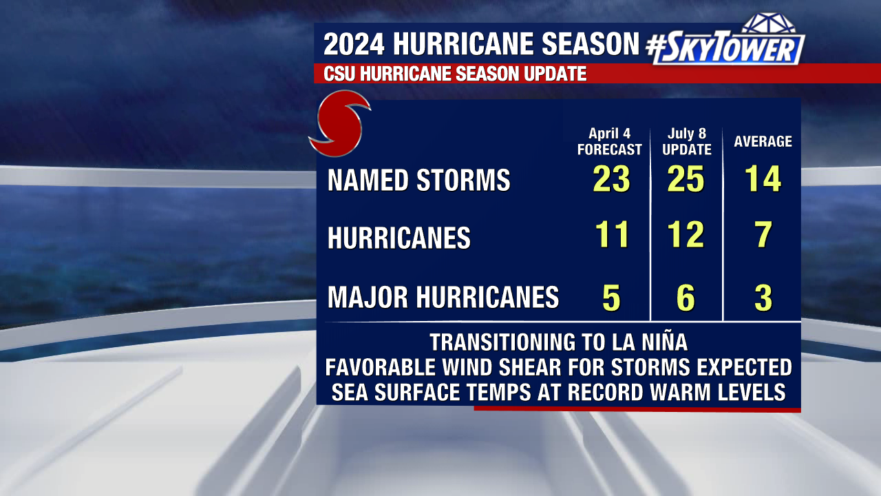
This comes after the April outlook was already the most aggressive we’ve seen from an early season forecast. Originally calling for 23 named storms, 11 hurricanes, of which 5 would become major hurricanes (category 3 or higher).
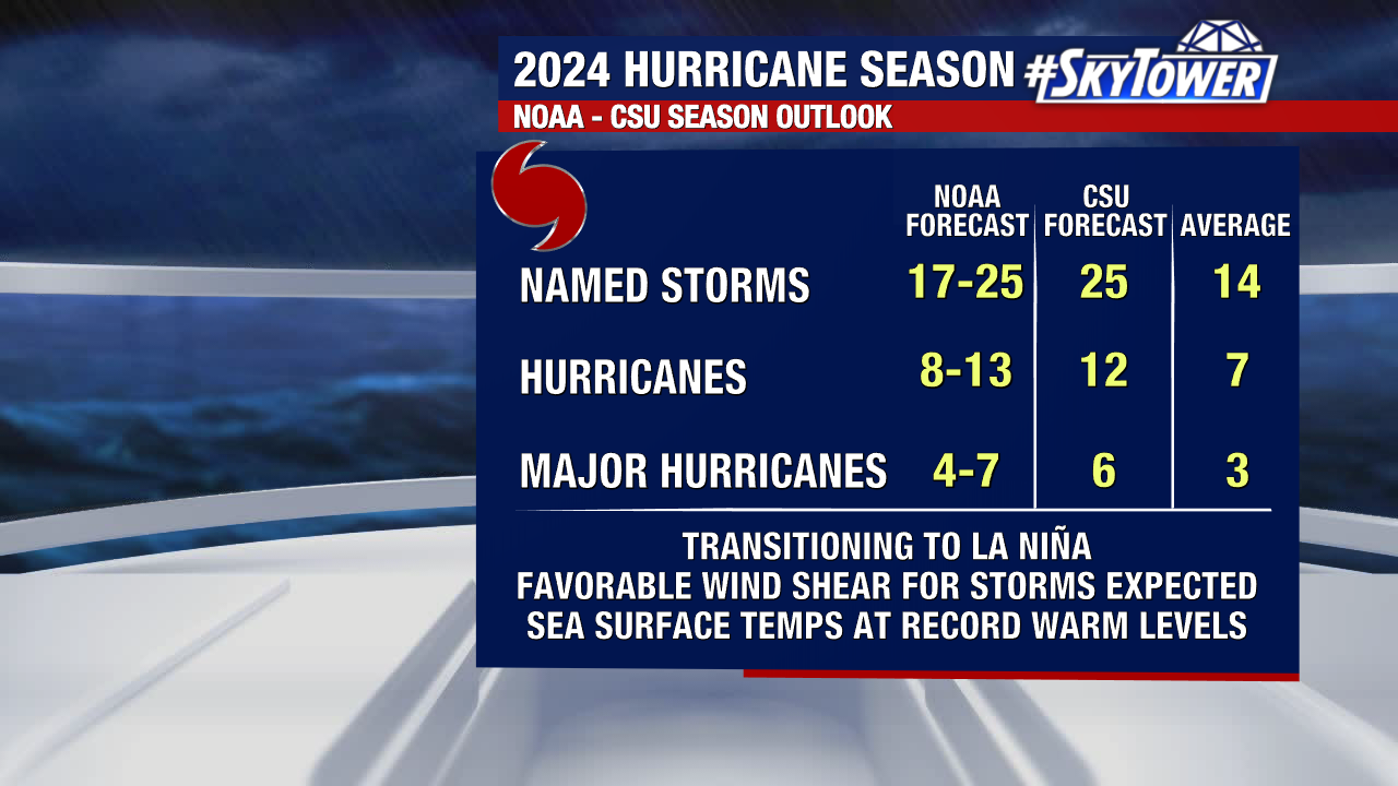
Now the July outlook calls for: 15 named storms, 12 of which become hurricanes, and major hurricanes. And across the board, look at how much higher these numbers are compared to average!
While it’s not the trend we’d like to see, this update isn’t a big surprise after Beryl’s record-breaking early season stats.
There are two big factors that tie into this outlook: record warm waters and an anticipated transition to La Niña.
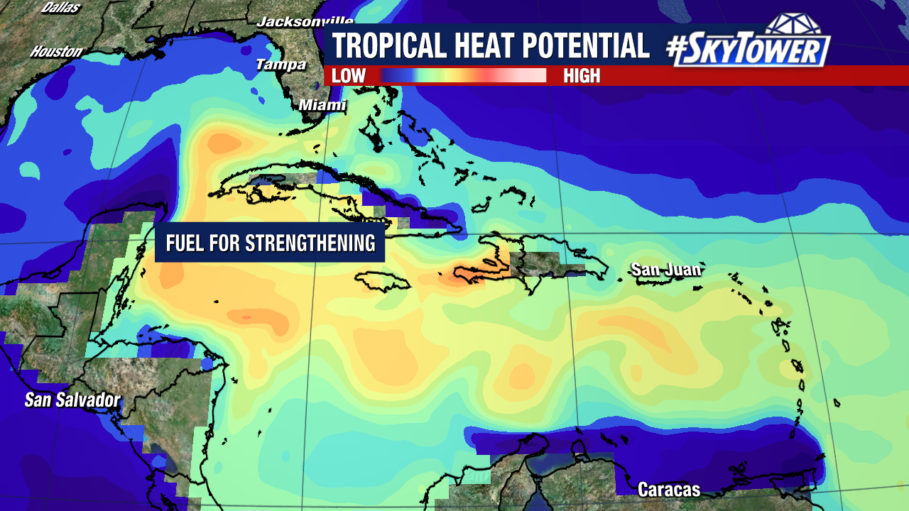
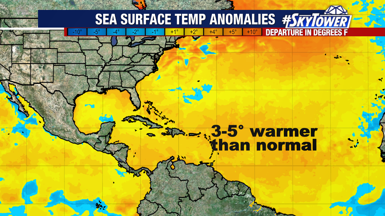
Sea surface temperatures in the main development region still remain near record warm levels, which is the main source of fuel for hurricanes.
We already saw that with Hurricane Beryl, which rapidly intensified thanks to fuel from these bath-like waters.
Also the transition to La Niña during the peak of the hurricane season will allow for more favorable conditions for hurricanes.
La Niña refers to the cooling of ocean surface temperatures in the Pacific. This has a series of impacts: pushing the jet stream more north, weakening trade winds and lowering wind shear in the Atlantic.
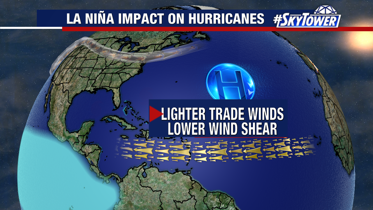
Lower wind shear is a big factor is aiding hurricanes to travel across the Atlantic.
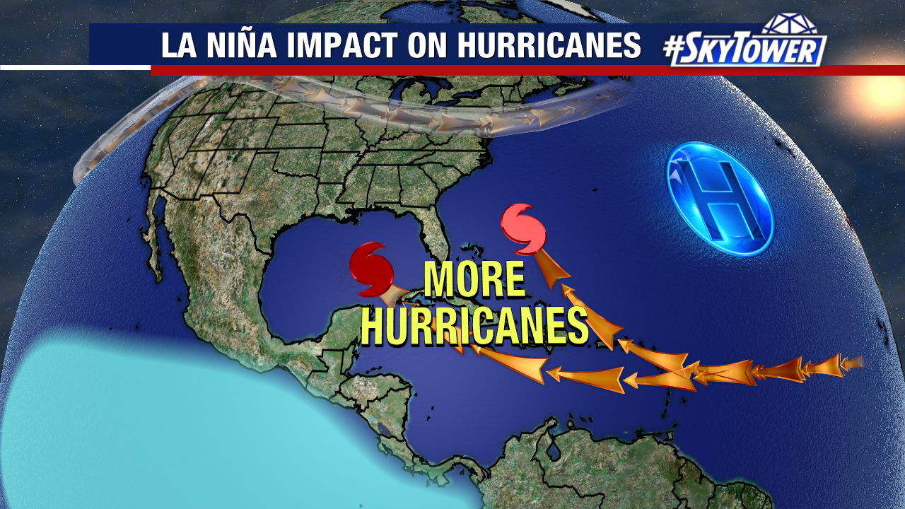
CSU forecasters say “we anticipate a well above-average probability for major hurricane landfalls along the continental United States coastline and in the Caribbean.”
It’s important to remember this is just a forecast but it only takes one hurricane making landfall to make a season active. Now is the time to get prepared and have a plan in place.