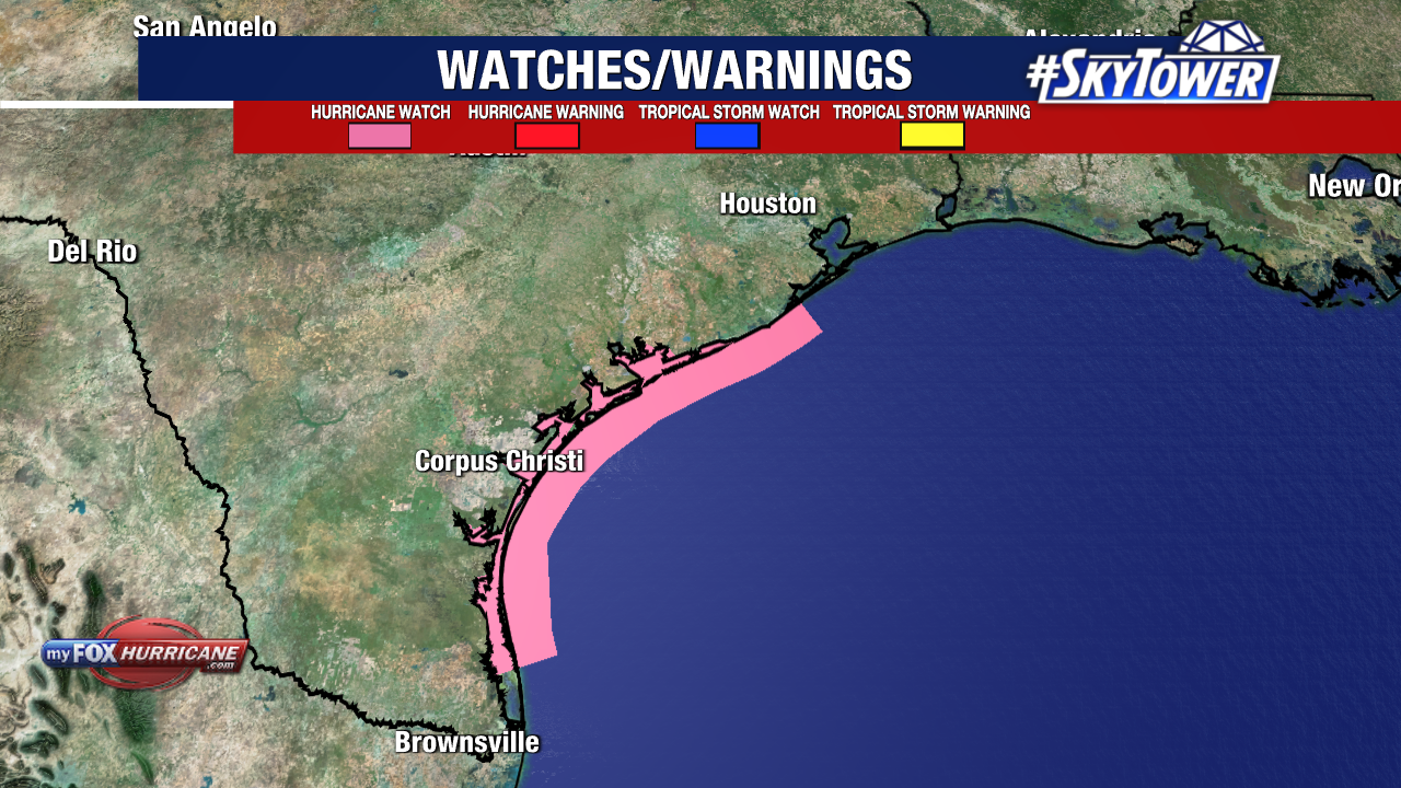
Another landfall is expected as Beryl continues to spin over warm Gulf waters. The Texas coastline is now under a Hurricane Watch and a Storm Surge Watch.
The Hurricane Watch includes most of the Texas coast, running from just south of Galveston to South Padre Island.
Beryl is currently moving west-northwest at 12mph. The storm is expected to start to curve more north late Sunday into early Monday as it approaches the south coast of Texas.
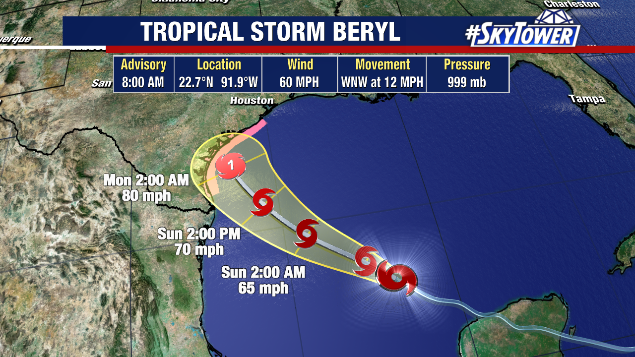
Beryl has plenty of fuel to feed off as it spins over warm Gulf of Mexico waters. The slower speed of this storm will give it more time to strengthen Saturday and Sunday.
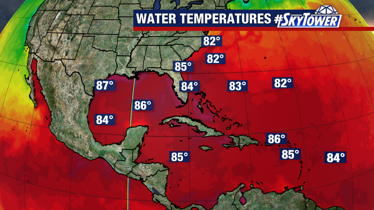
Water temperatures just off Texas are 87°, which is about when we expect the storm to strengthen back into a hurricane.
Beryl is forecast to become a Category 1 hurricane just ahead of landfall early Monday morning. Conditions will worsen later on Sunday, with tropical-storm-winds currently extending 115 miles from the storm’s center.
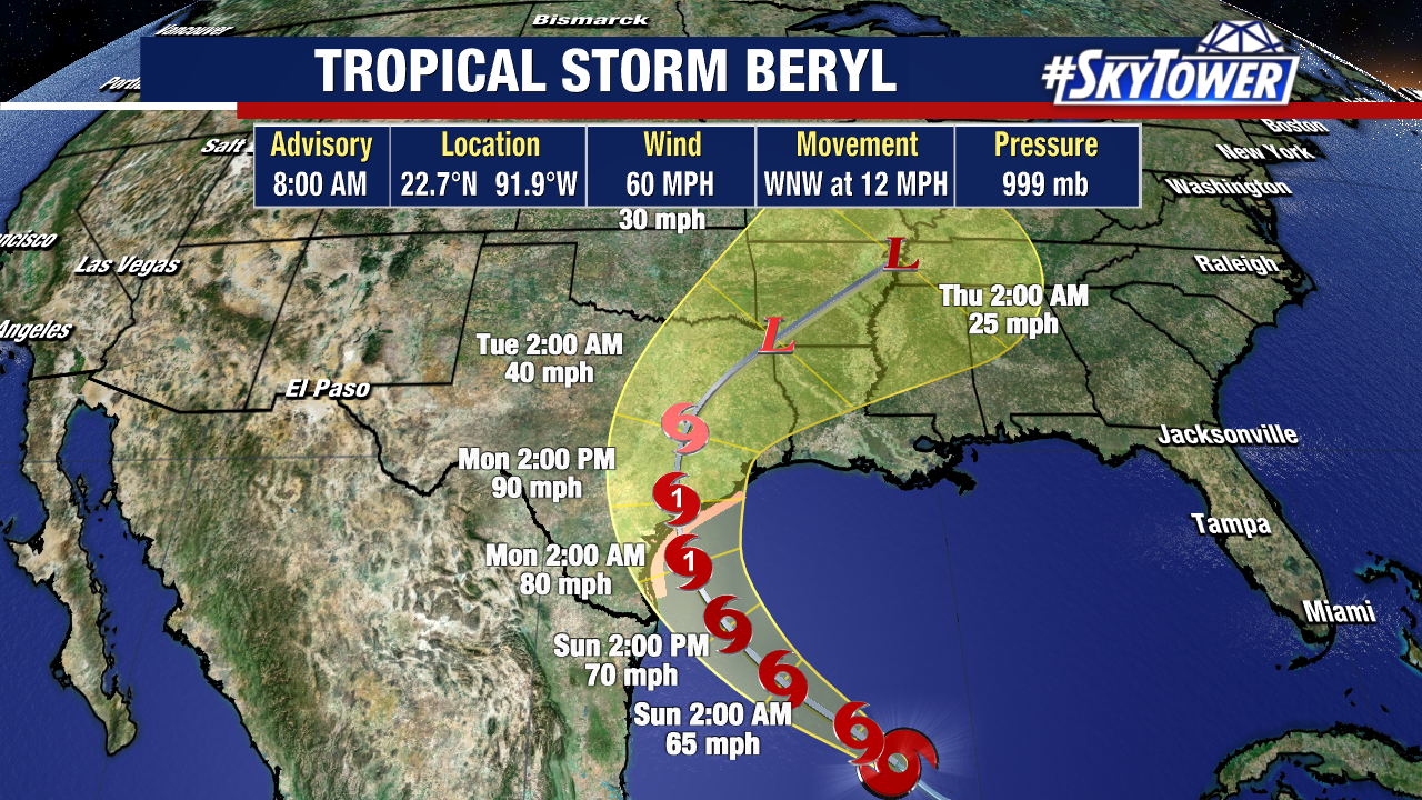
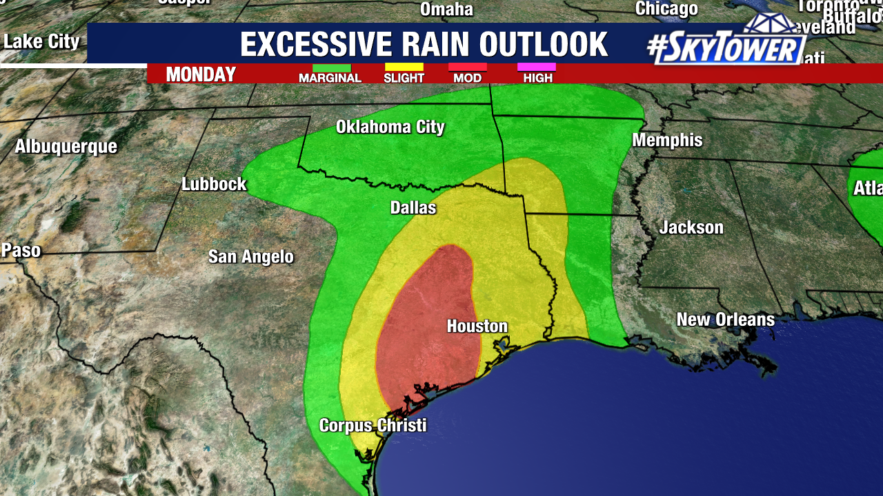
Landfall will likely be near or just north of Corpus Christi, with torrential rains traveling inland starting Monday.
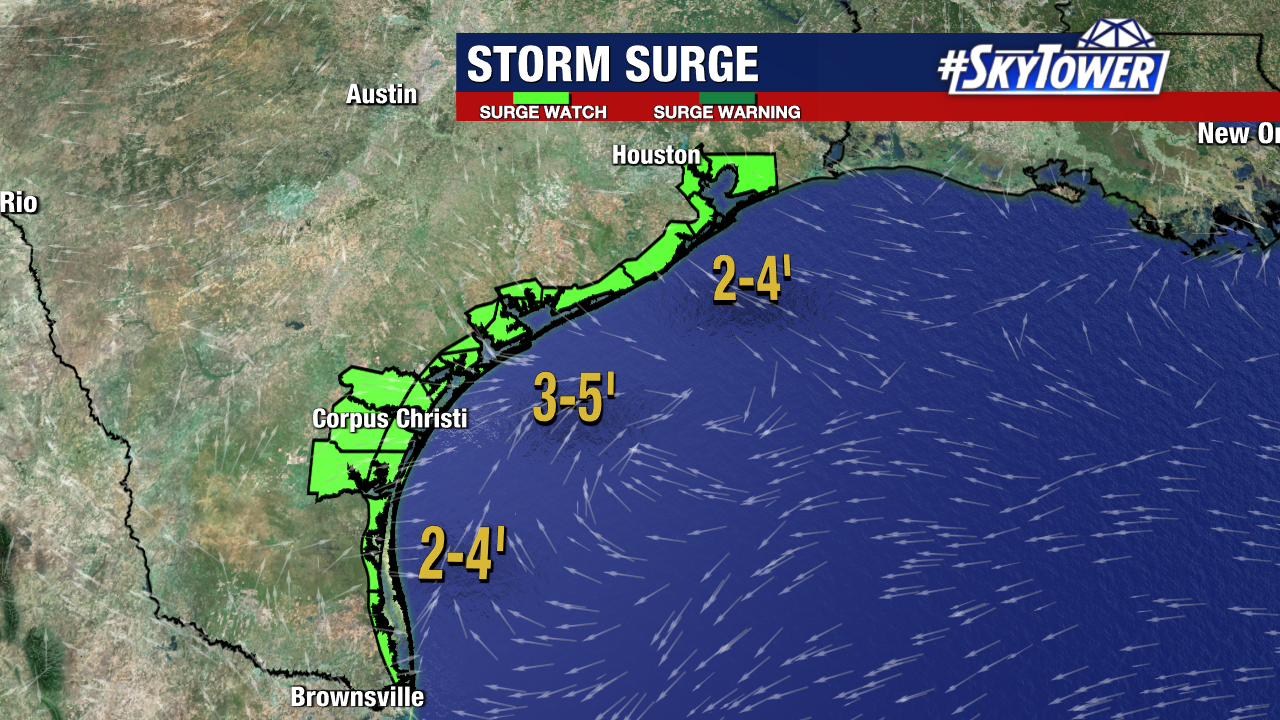
Storm surge of 2-4′ is likely for most of the Texas coastline, with 3-5′ expected closer to where Beryl makes landfall. Rainfall totals of 5-10″ will be possible, with higher amounts up to 15″.