
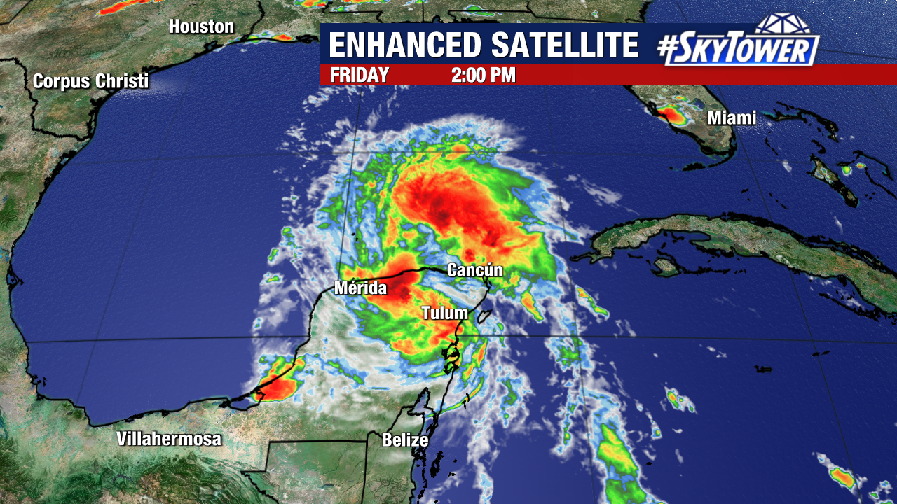
Beryl has weakened into a tropical storm with sustained winds of 70mph as of the 2pm advisory from the National Hurricane Center. Beryl may weaken more over the next few hours before re-emerging over the western Gulf of Mexico today.
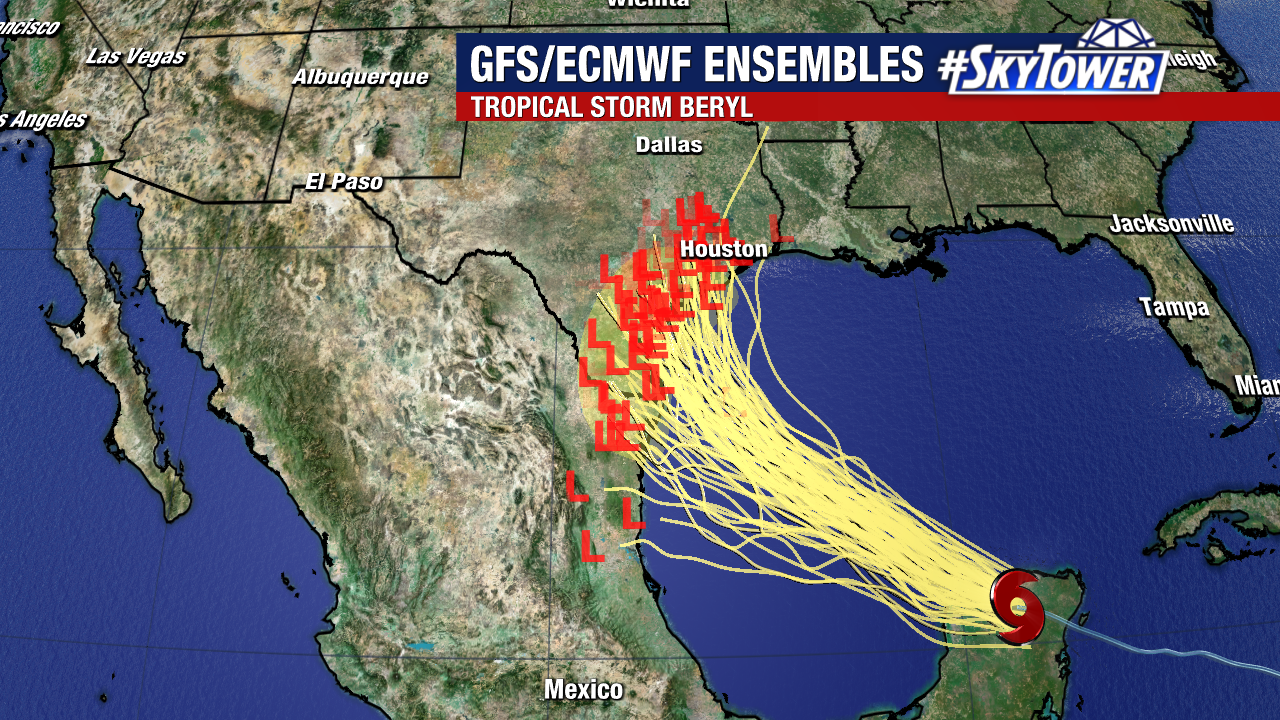
From there, the fuel provided by the western Gulf’s abnormally warm sea surface temperatures should strengthen the storm as it turns northwest. The latest NHC forecast for Beryl continues to reorganize it into a hurricane before making another landfall along the coast of Mexico or Texas. The entire coast of Texas is now within the forecast cone.
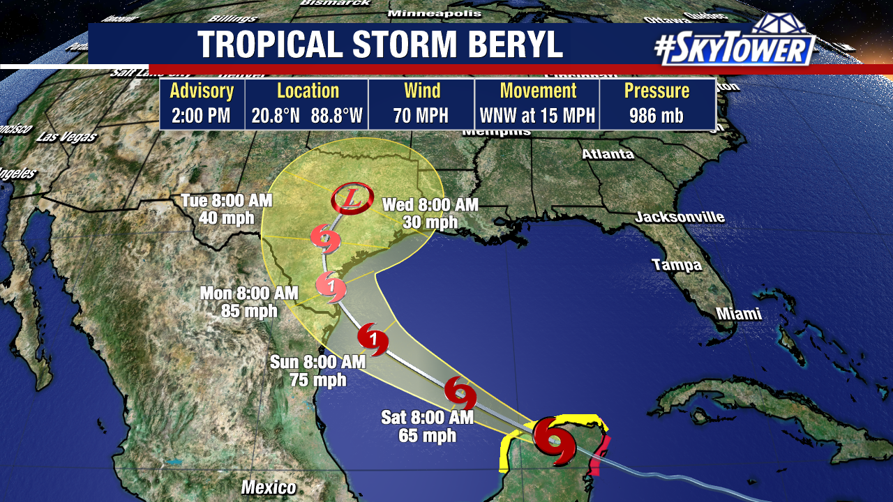
The estimated arrival time for this landfall would be Sunday night or Monday. Coastal flooding, heavy rain, and powerful hurricane/tropical storm-force winds would be the primary hazards facing the western gulf coast given our current forecast. Additionally, thunderstorms capable of producing tornadoes will be possible north of where the storm’s center makes landfall.
Thankfully, there are no additional storms or disturbances being monitored at this time. A stout plume of Saharan dust is actively tampering activity in the middle of the Atlantic.
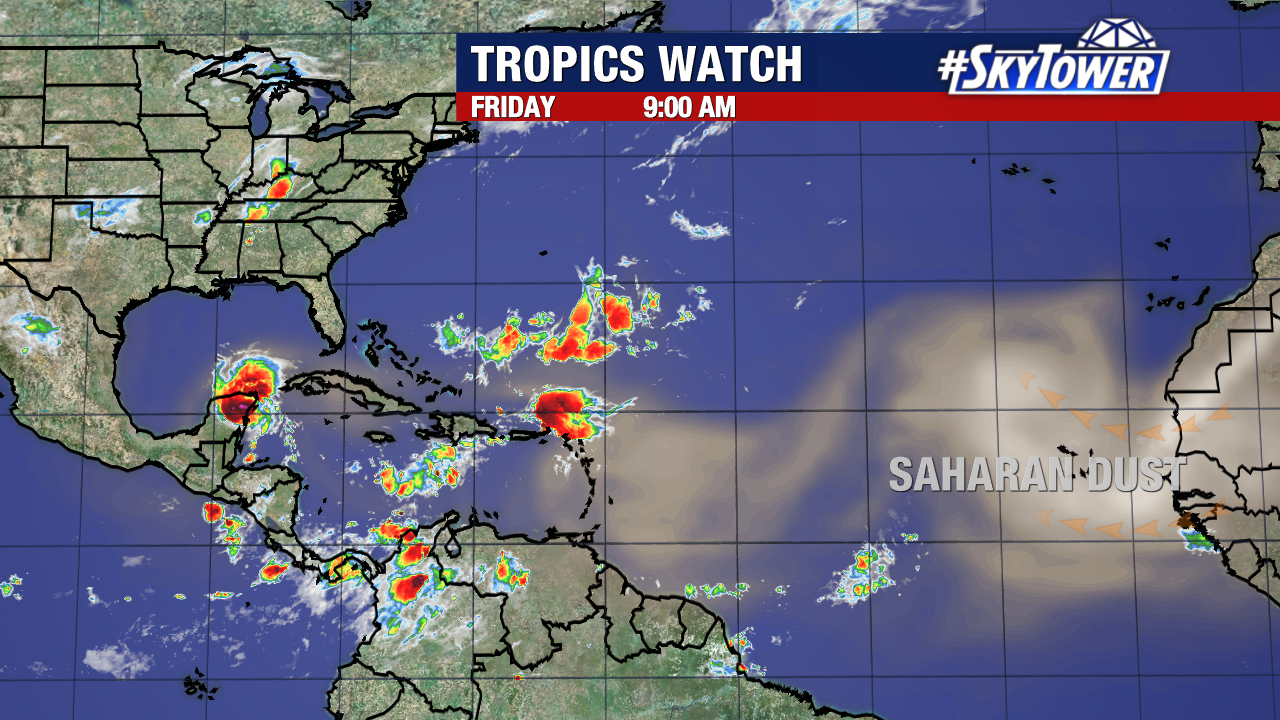
No new named storms are expected to form over the next week.