
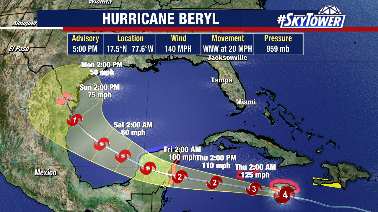
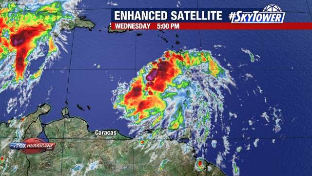
Satellite and radar imagery show that Hurricane Beryl is brushing the southernmost parts of Jamaica with its powerful eyewall. The threat for damaging waves, hurricane-force winds, and life-threatening storm surge continues for much of the island. Category 4 Hurricane Beryl still has winds of 140mph, although it is expected to notably weaken over the next few days.
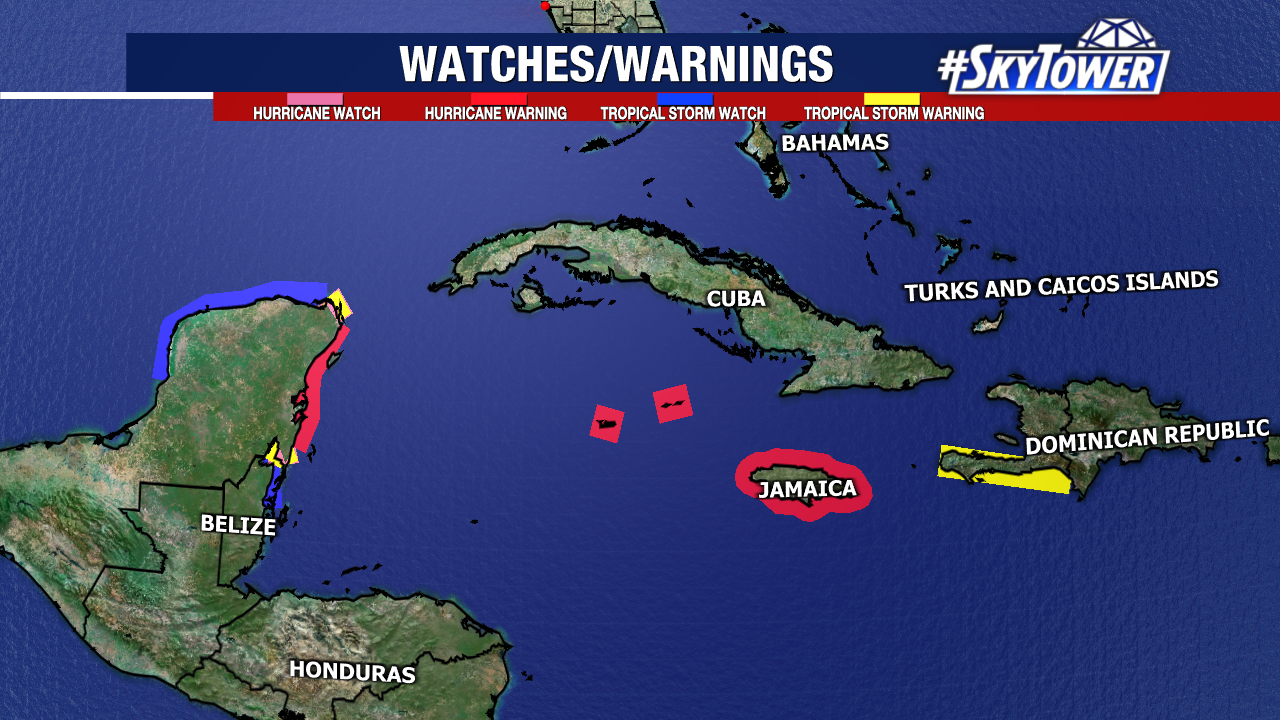
Hurricane warnings remain in effect for Jamaica, The Cayman Islands, and portions of the Yucatan Peninsula. A slew of other watches and warnings are in effect for nearby areas.
Beryl is still expected to make landfall in the Yucatán Peninsula early on Friday as a hurricane. After spending most of Friday over land and weakening, it should re-emerge over the western Gulf of Mexico as a tropical storm.
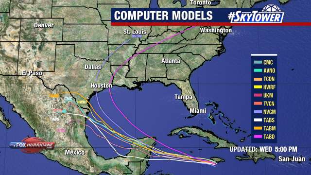
There is still uncertainty with Beryl’s track in the Gulf. A weakening ridge of high pressure may try and pull the storm toward the coast of Texas, or steer the system into eastern Mexico if it remains strong. Additionally, a stronger storm would likely try and pull farther north. Interests in the western Gulf of Mexico should monitor this system carefully.
Behind Beryl, we are also watching Invest 96L near the Lesser Antilles. This tropical wave is unlikely to become a named storm as it continues to be engulfed by Saharan dust. It has a low (20%) chance of formation over the next week.