
Hurricane Beryl has weakened slightly as it continues to charge through Caribbean waters. With weaker sustained winds, Beryl is now a Category 4 hurricane moving at a very fast 22mph.
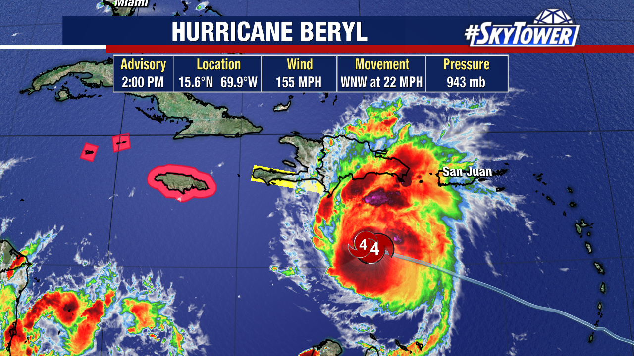
Peak winds have dropped from 165mph to 155mph. Along with the drop in winds, the pressure has risen, which is another sign the storm is weakening. A lower barometric pressure means a stronger or strengthening storm.
While it is a small change, this tells us the storm has passed peak strength after it stayed a Category 5 most of Tuesday.
This is still a major hurricane as it approaches Jamaica and the Cayman Islands. The Cayman Islands are now included in the Hurricane Warning.
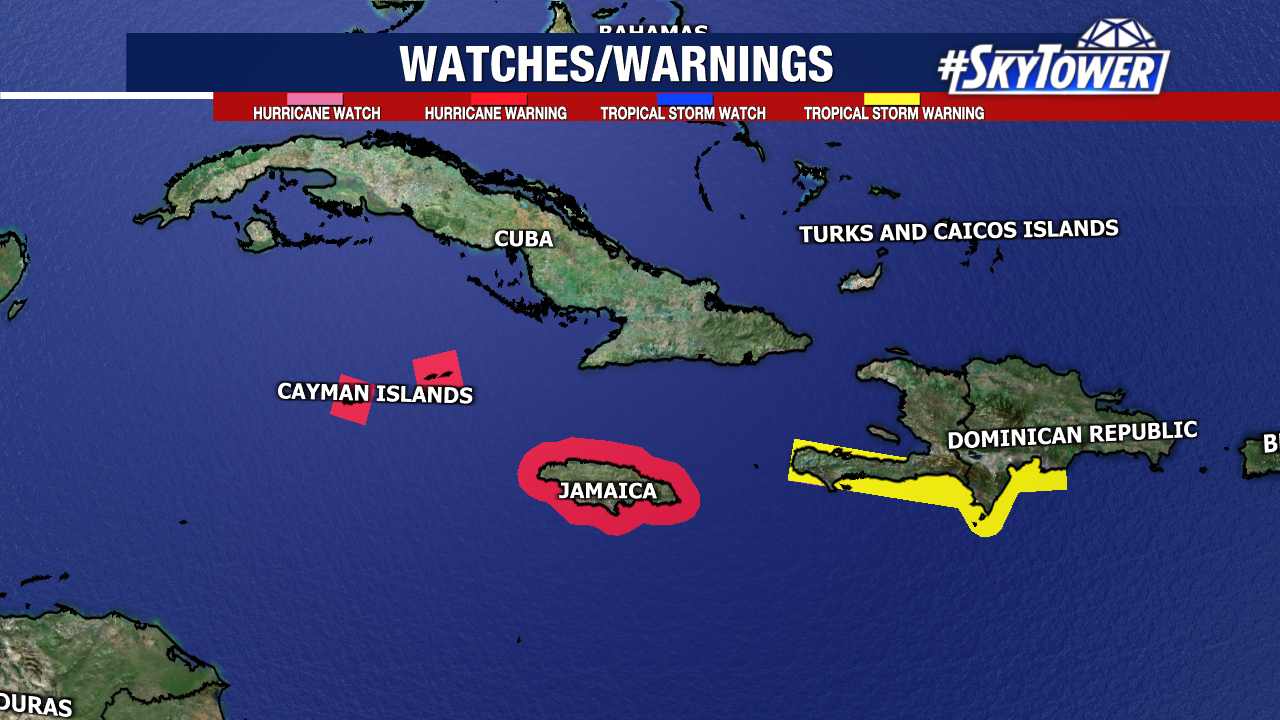
The brunt of this storm will impact these islands on Wednesday. Jamaica could take a direct hit from the eye, and if it doesn’t, the island will still get the worst part of the storm as it passes just to the south.
Hurricane-force-winds extend 40 miles from the center, while tropical-storm-force winds extend out about 175 miles.
NHC predicts life-threatening storm surge of 5-8 feet above normal tide levels along the immediate coast of Jamaica/Caymans. These islands could get 4-8 inches of rainfall, with localized areas getting closer to a foot of rain.
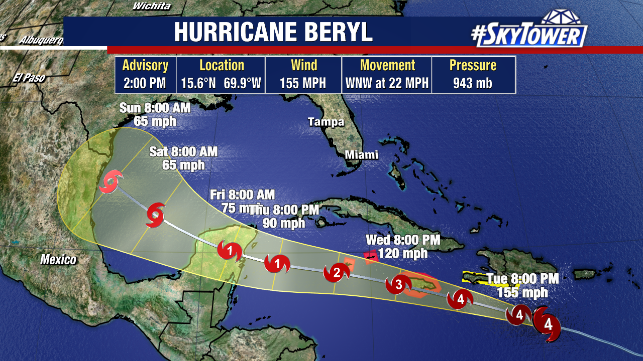
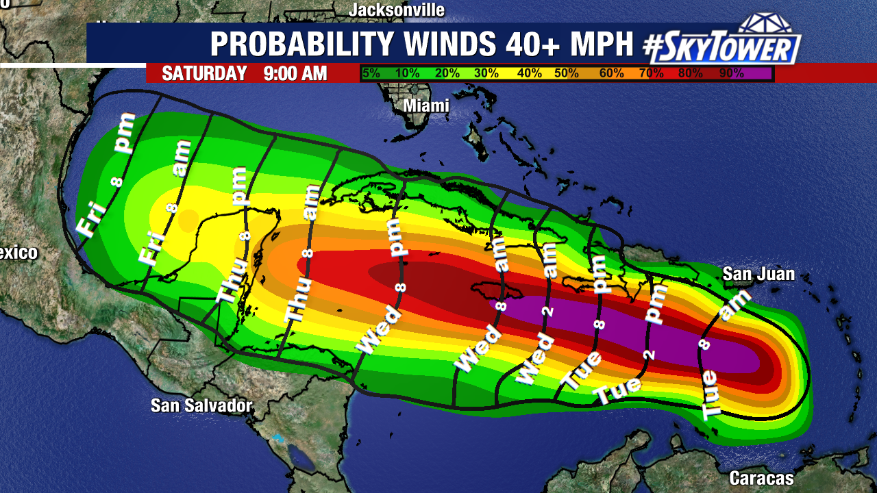
The afternoon advisory keep Beryl on a similar track to what we’ve been thinking, mostly west with a northwest turn at the end of this week.
Thursday-Friday the storm will pass the Yucatan Peninsula, where further weakening is expected. At this point, the coast of Texas can’t be ruled out to see some tropical impacts once Beryl moves into the Gulf of Mexico.