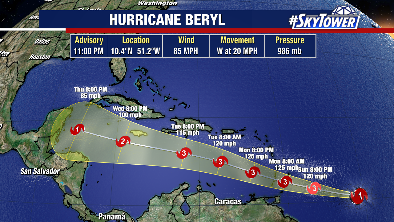
Hurricane Beryl continues to strengthen in the Atlantic. As of the latest update, it now has sustained winds of 85mph.

Hurricane Beryl is now expected to strengthen into a major Category 3 hurricane before crossing into the eastern Atlantic early next week. From there, The National Hurricane Center now has Beryl maintaining hurricane status as it approaches the Western Caribbean by the end of next week. There are currently no immediate tropical threats to Florida.

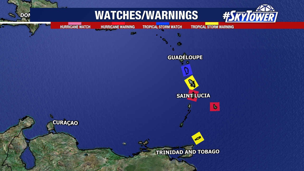
Hurricane Watches and Warnings have been issued for parts of the Lesser Antilles, as they brace for Beryl to likely pass by at the beginning of this week.

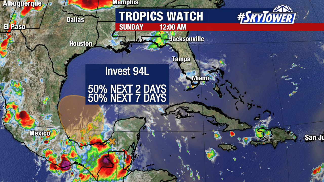
Otherwise, we are monitoring two separate tropical waves. One wave entering the Bay of Campeche with a medium (50%) chance of forming over the next few days. This would bring minimal or no impacts to the United States as it would likely remain weak and push west into the Mexican coastline.

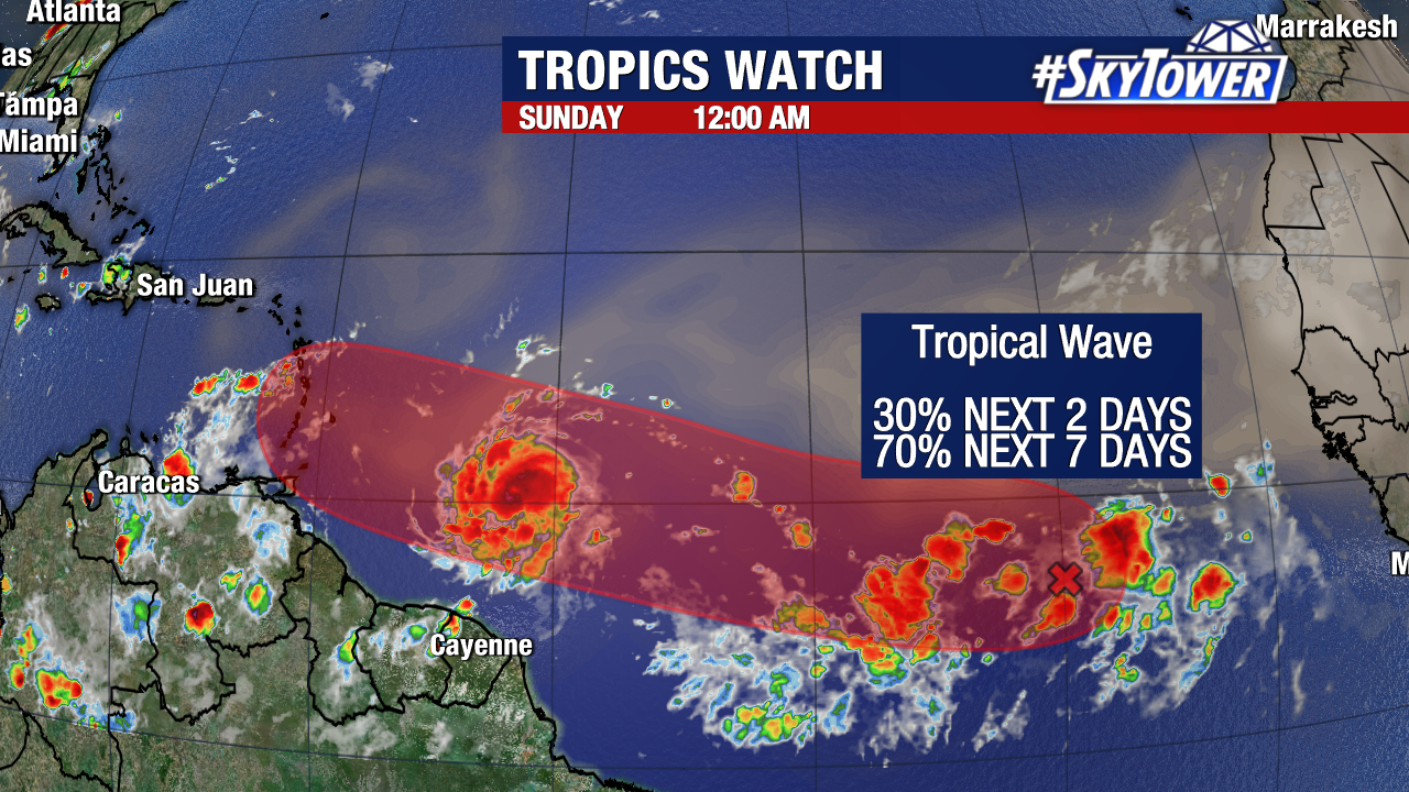
Behind Beryl, we are keeping an eye on a separate disturbance with a high (70%) chance of formation over the next week. If this forms into a tropical storm or a tropical depression, models are in increasing agreement that it will push west toward the Lesser Antilles by the middle of next week.
Our next tropical storm or hurricane would be assigned the name “Chris.”
