
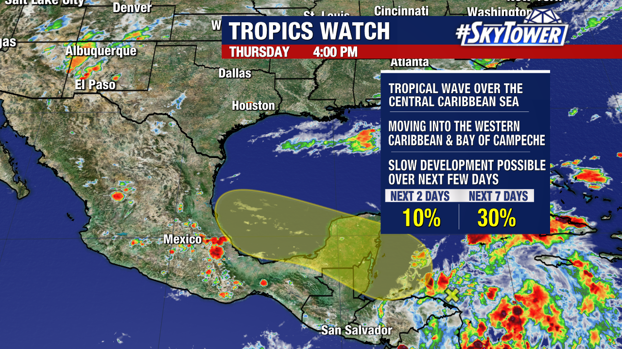
Odds of development continue to increase for each of the two waves we’ve been tracking over the past week.
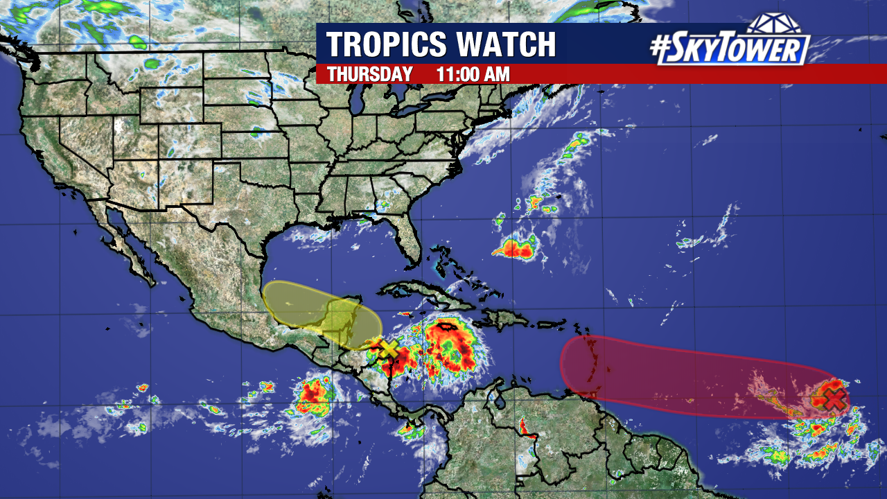
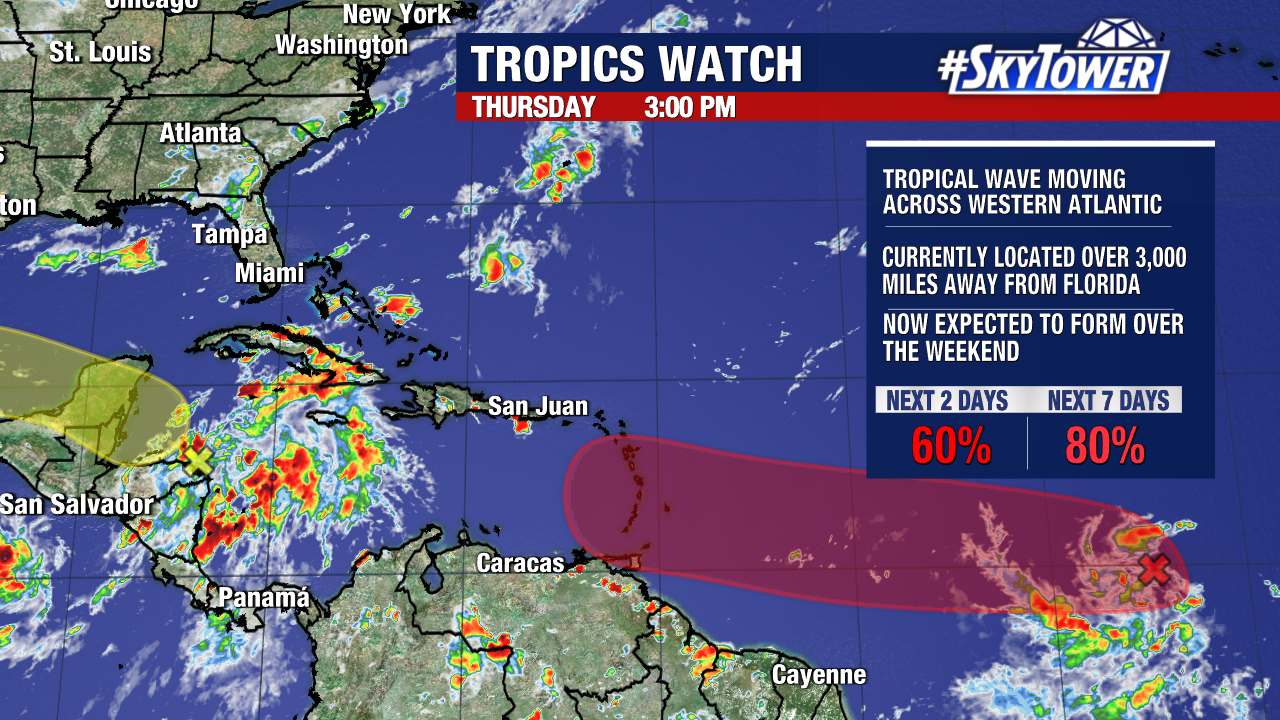
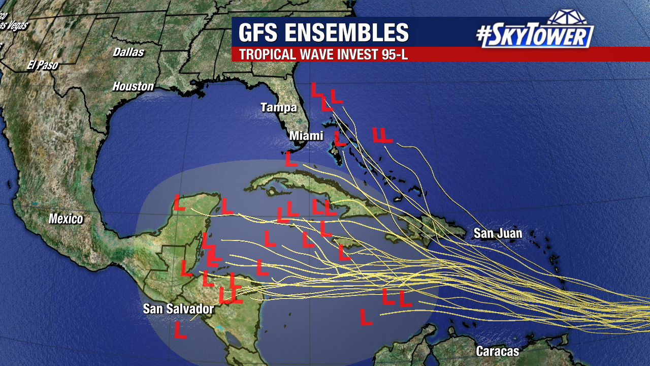
In the middle of the Atlantic, we are keeping tabs on Invest 95L. There is now a high chance that his tropical wave becomes a tropical depression or tropical storm over the next few days.
Models are in agreement that the system will continue to move west and into the Caribbean by Monday. As it progresses west, the unseasonally warm waters of the Caribbean may help it strengthen. Among the models that develop the system, the majority of them now strengthen it into a hurricane.
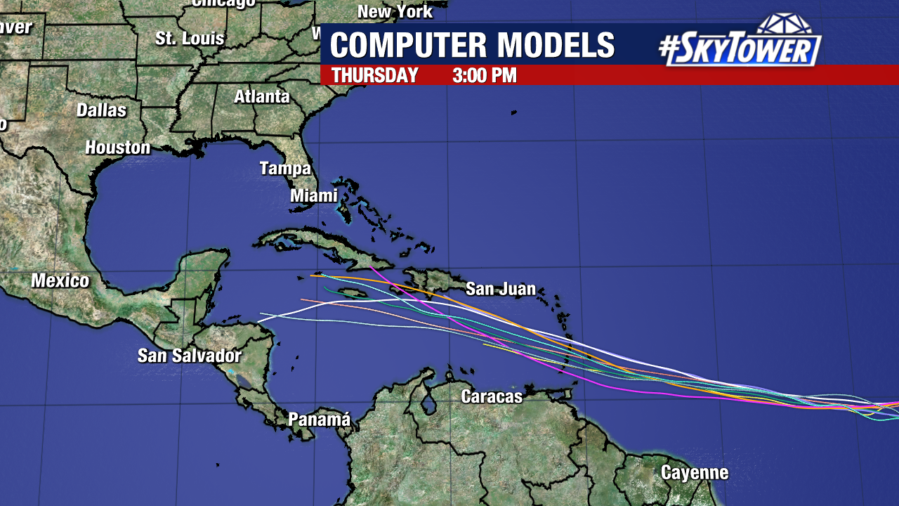
There is high confidence among those weather forecast models that the wave will pass through the Greater Antilles and into the Eastern Caribbean.
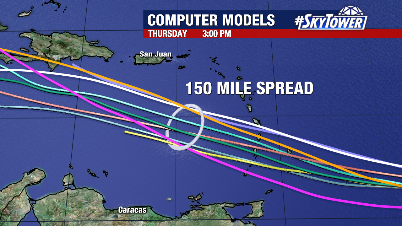
Beyond that, it is far too early to speculate on the potential path of the storm. It is currently about 3,000 miles away from Florida, so we have a long time to monitor it.
The name “Beryl” would be assigned to the next tropical storm or hurricane that forms.