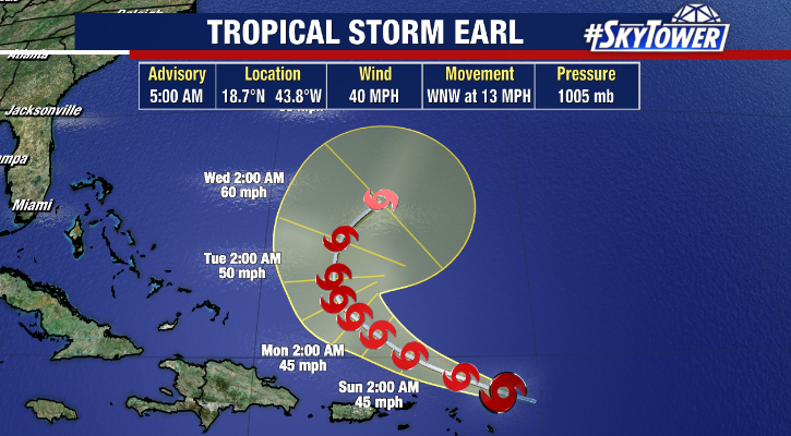
The tropical disturbance near the Leeward Islands has formed into a tropical storm, according to the National Hurricane Center. Tropical Storm Earl became better organized and developed late Friday night east of the Caribbean.

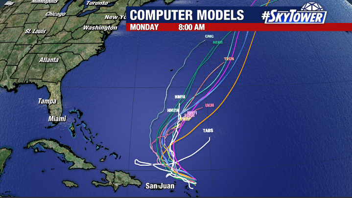
As of Saturday morning, Earl remains a weak tropical storm with maximum sustained winds of 40 mph. Earl is moving WNW at 13 mph. Earl is forecast to continue on its generally west-northwesterly trajectory in the coming days moving north of the Caribbean Islands as it is steered by a ridge of high pressure. Some heavy rain and flooding impacts are possible for parts of the Leeward Islands, U.S and British Virgin Islands and Puerto Rico this weekend. Then, a turn to the northeast is possible thanks to a trough developing over the Atlantic as Earl slows down. This means Earl should not impact the United States. However, we will continue to monitor the model trends.

Earl is currently battling some upper level wind shear which should inhibit significant strengthening in the short term. There are still some questions regarding the long term strength forecast of Earl.
Meanwhile, Danielle, which became a hurricane on Friday, has weakened to a tropical storm. Danielle remains a nearly stationary system in the north Atlantic and some strengthening is still possible in the coming days. Danielle is expected to drift west, then northward but will not impact the U.S.

