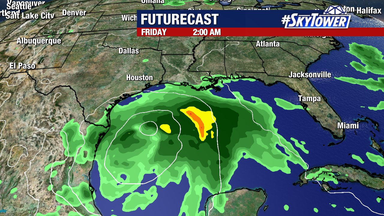
It’s a common spot for tropical development this time of year. It looks like a broad area of low pressure should form early next week over the Bay of Campeche, and gradually move north through the week.
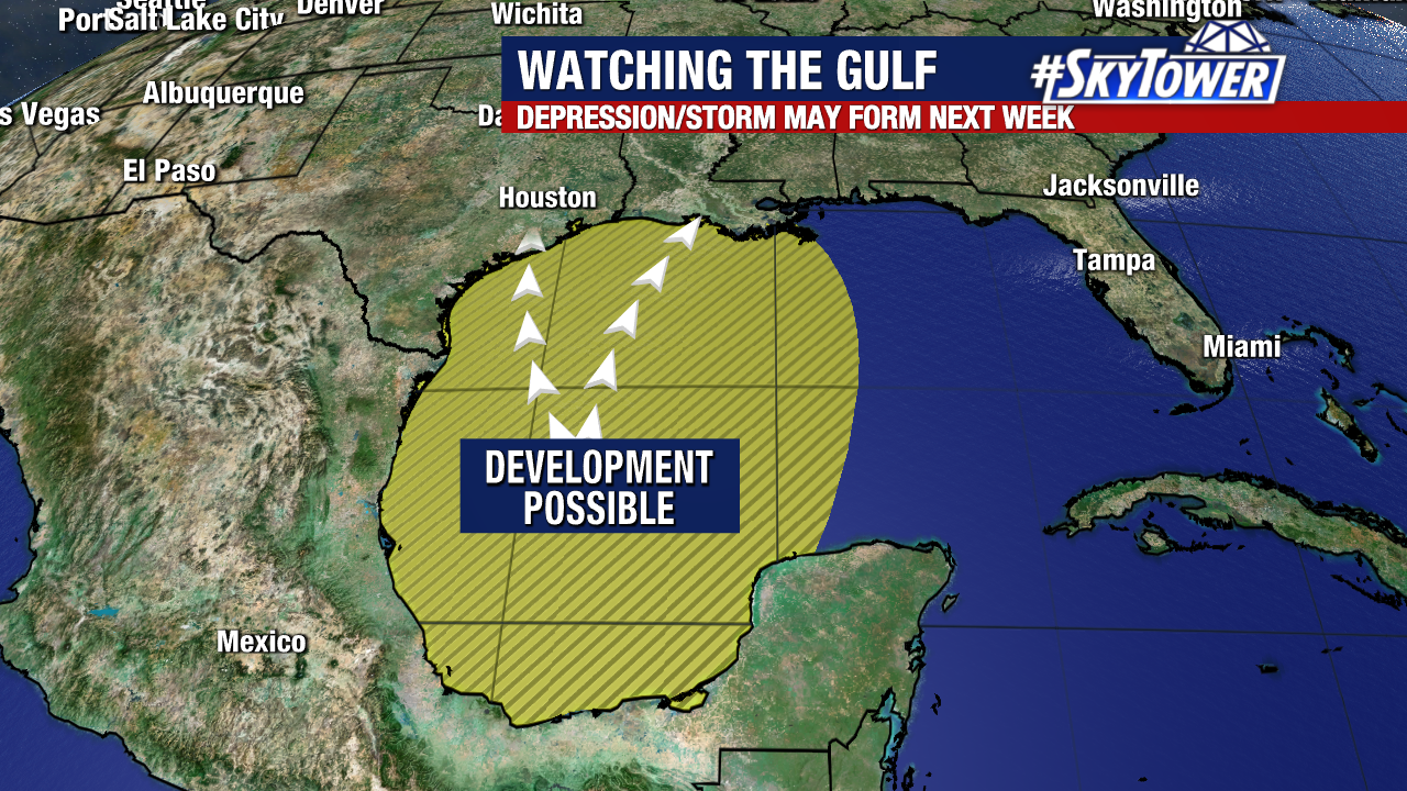
It’s tough to talk specifics about any U.S. impacts at this point since we’re still 7-8 days out, but the most likely issue would be heavy rainfall/localized flooding. Residents along the central and western Gulf Coast should keep tabs on this over the next several days and be sure to check back with us for updates.