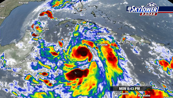
Delta became a tropical storm on Monday morning, and has been taking full advantage of the favorable environment it’s in – strengthening through the afternoon and into the evening.

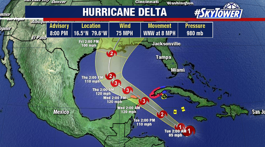
The storm is now a hurricane and further intensification is likely over the next couple of days as it moves through the western Caribbean and into the southern Gulf of Mexico. It seems pretty likely that it will become a major hurricane later Tuesday or on Wednesday.

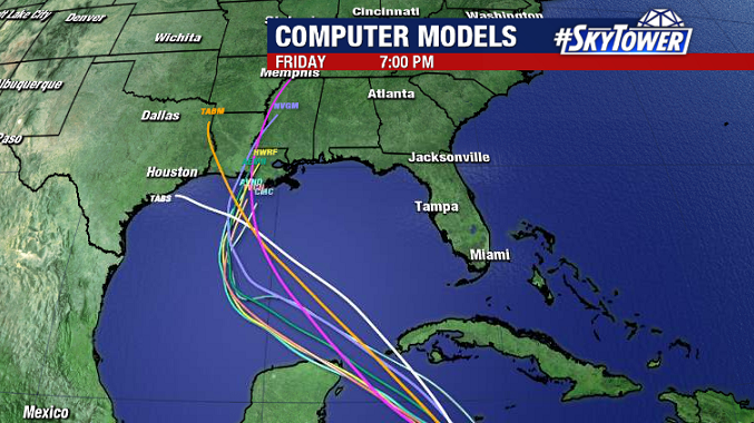
While intensity forecasting is always tricky, track forecasting tends to be much more reliable in the 3-5 day time frame. That is the case with Delta. Models have been in very good agreement on the storm moving past the Yucatan Peninsula, and then curving north toward the northern Gulf Coast – landfall some time on Friday. Areas from Louisiana, eastward to the Florida Panhandle need to be watching this very closely.

While there’s likely to be at least some shear, and also slightly cooler water temperatures to help limit the storm somewhat in the 24 hours leading up to landfall, we’re still talking about a dangerous storm that’s going to cause some wind/surge issues where it comes ashore. We’ll keep you updated through the week.
