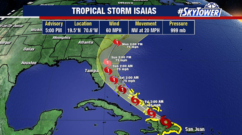
Tropical Storm Isaias is emerging north of Hispaniola this evening. The circulation has fared pretty well despite the land interaction, and slow strengthening is expected as it moves northwest into the Bahamas. The official forecast from the National Hurricane Center has Isaías becoming a hurricane by late Friday night.

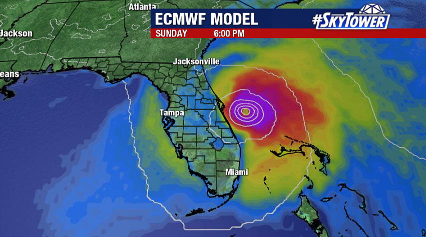
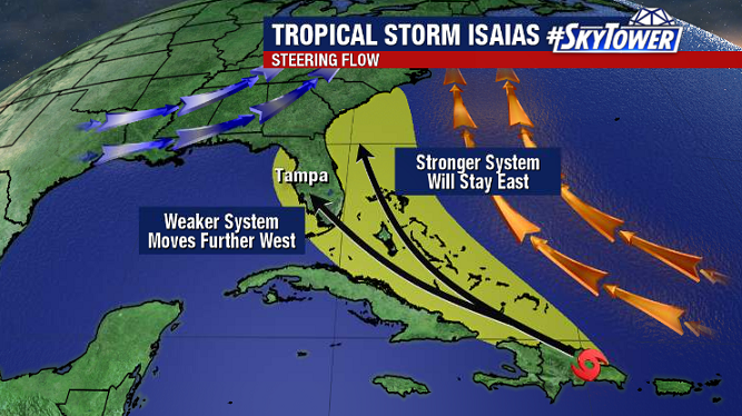
Models trends this afternoon have leaned toward a stronger storm. Stronger systems tend to be more influenced by steering flows in the mid-upper levels of the atmosphere.

For this reason, given the current setup with a trough in the Eastern U.S., confidence is increasing in a track near or just east of Florida – a scenario which largely keeps the worst impacts offshore.

Hurricane conditions are expected across the Bahamas this weekend, and it will be a very close call for Florida’s east coast late Saturday into Sunday. Early next week the focus will shift the Southeast U.S. coastline, with direct impacts a possibility in the Carolinas. We’ll keep you updated over the next few days.
