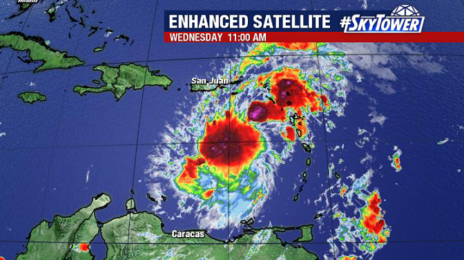
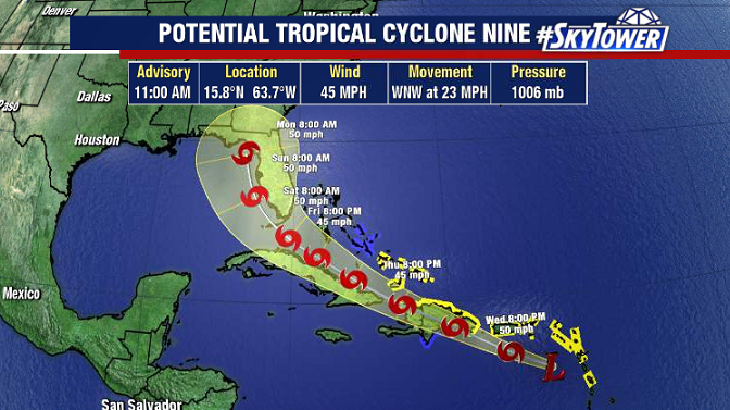
The watching and waiting game continues for Potential Tropical Cyclone 9 (fancy name for tropical wave close to development). The disturbance has now entered the Caribbean Sea and there’s been an uptick in convection over the last 24 hours.

As of 11am Wednesday, the Hurricane Hunters still haven’t found a well-defined low level center. As soon as that feature becomes apparent, we’ll be able to upgrade this to Tropical Storm Isaías.

Not having an official storm yet is problematic when trying to forecast tropical systems because model guidance is much less reliable when there isn’t a center for the model to use as a starting point. We’ve seen this already over the last two days as this disturbance has moved further south than what models have suggested. Where the center actually forms will have a lot to do with the storm’s eventual track and intensity – especially true when land interaction and areas of high shear are in play. Once the storm forms, we’ll start to get a clearer picture of how Isaías will evolve, and what impacts there may for certain areas.
For now, there’s no reason to get too worked up about this. Stay informed, stay prepared as always, and check back in with us over the next few days.
