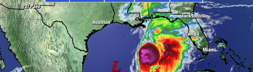
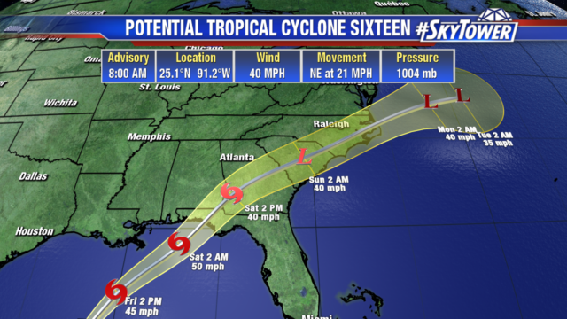
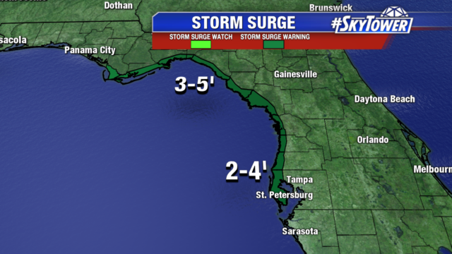
Potential Tropical Cyclone 16 is still a disorganized system dealing with a lot of wind shear. The wind shear will keep it from rapidly intensifying but some organization is expected today. It will likely become Nestor as either a tropical storm or sub-tropical storm. Either designation of the system has the same impacts in the Tampa Bay area; gusty winds, a couple inches of rain, and 2-4 foot storm surge along the coast from Clearwater northward at high tide. 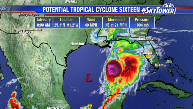
The system will make landfall in the panhandle Saturday morning, tropical storm warnings are in place for these areas.
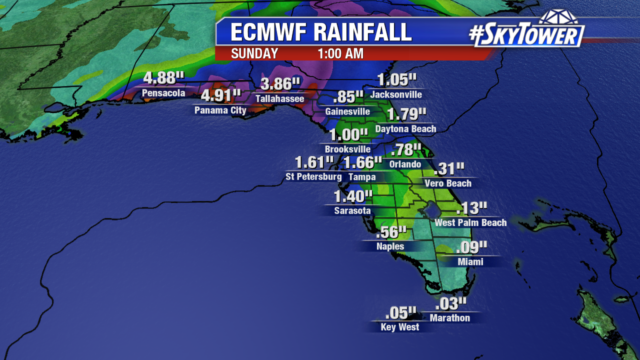
Light showers are already moving into the Bay area this morning and will continue to increase by the evening. Rain and storms will be ongoing Saturday morning with the potential for a few strong to severe storms, quick spin up tornadoes are possible. We will get a good soaking with widespread 1-3″ rainfall totals.
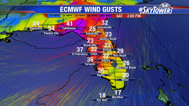
Saturday is going to be windy in Tampa, sustained winds around 25 mph with gusts to 37 mph. The panhandle could see gusts over 40 mph as the system makes landfall.
Coastal areas prone to flooding should monitor water levels as 2-4 foot storm surge is possible at high tide. The Big Bend area could see 3-5 foot storm surge.
By Saturday evening, the weather will begin to quiet down as the system races off to the northeast.