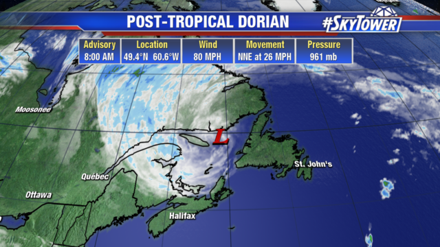
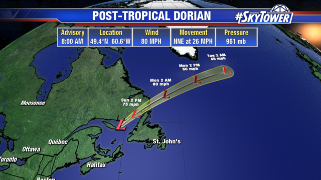
Dorian is now a post tropical cyclone and still has 80 mph winds. It will continue to bring a few inches of rain, strong winds and surge to Newfoundland and the Gulf of St. Lawrence.

Dorian will weaken due to land interaction as it heads northeast into the north Atlantic by Monday morning.

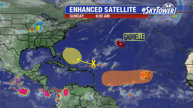
Tropical Storm Gabrielle is still no threat to land and will remain over the Atlantic ocean. A disorganized area of showers and storms (yellow) is associated with a tropical wave and sitting a few hundred miles northeast of the northern Leeward Islands. Wind shear will limit development for the next few days. The tropical wave (orange) several hundred miles west of the Cabo Verde Islands has a 40% chance of development over the next several days. It is still disorganized and will continue moving west, but this is an area we will be watching for quite some time before it impacts land.

