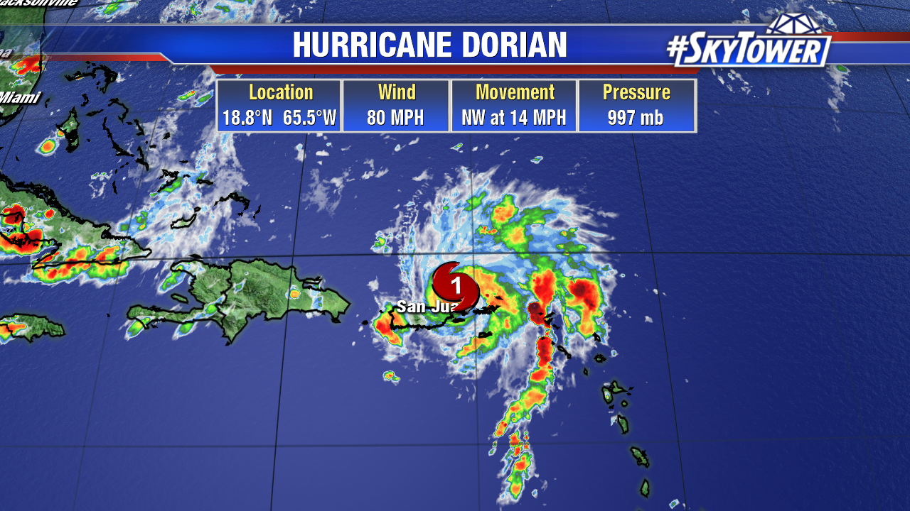
At 5pm Wednesday, Hurricane Dorian was located about 50 miles ENE of San Juan, Puerto Rico. Max sustained winds have now increased to 80 mph.

The good news is that Puerto Rico – still recovering from Hurricane Maria – was spared for the most part, as Dorian passed to its east today. Now the focus turns to potential impacts for the Bahamas and Florida over the holiday weekend.

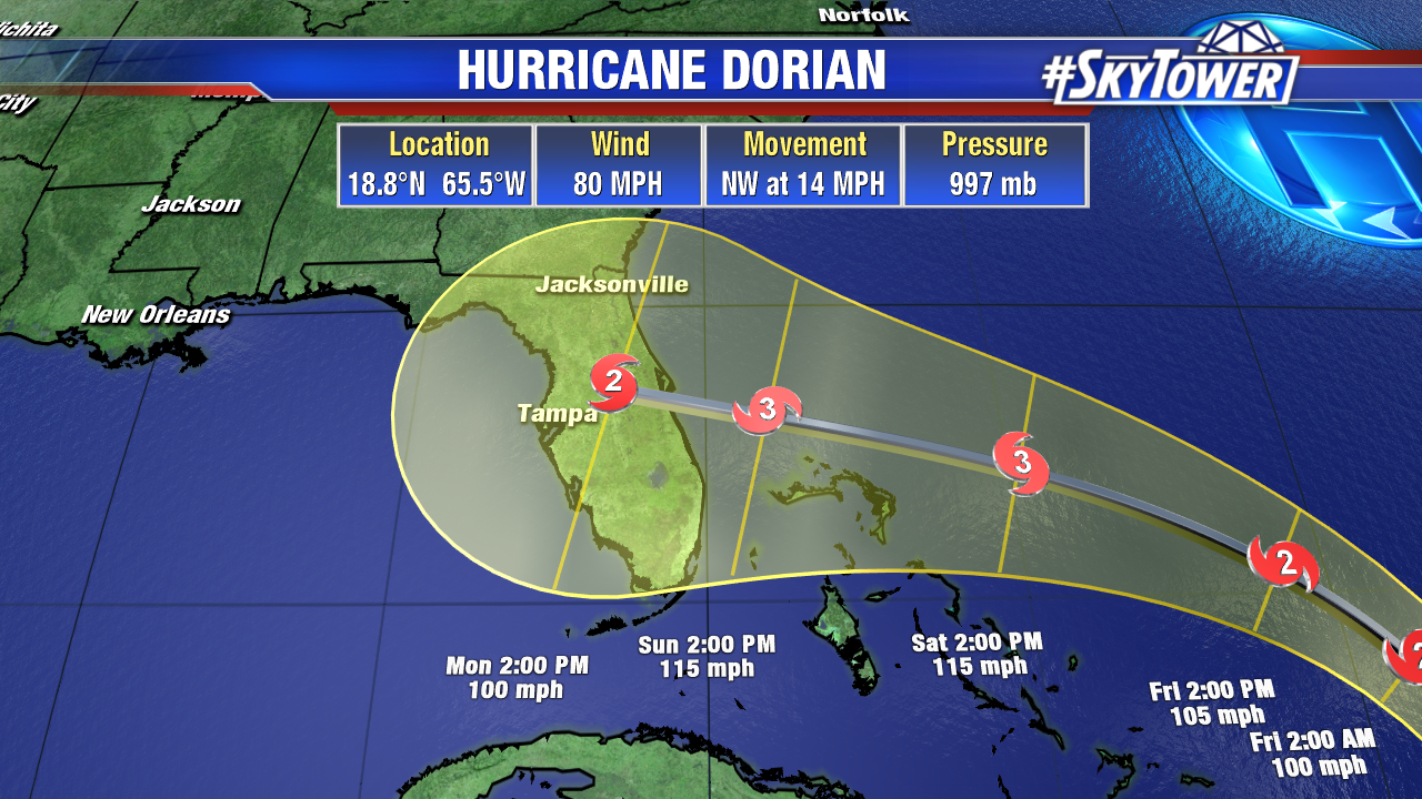
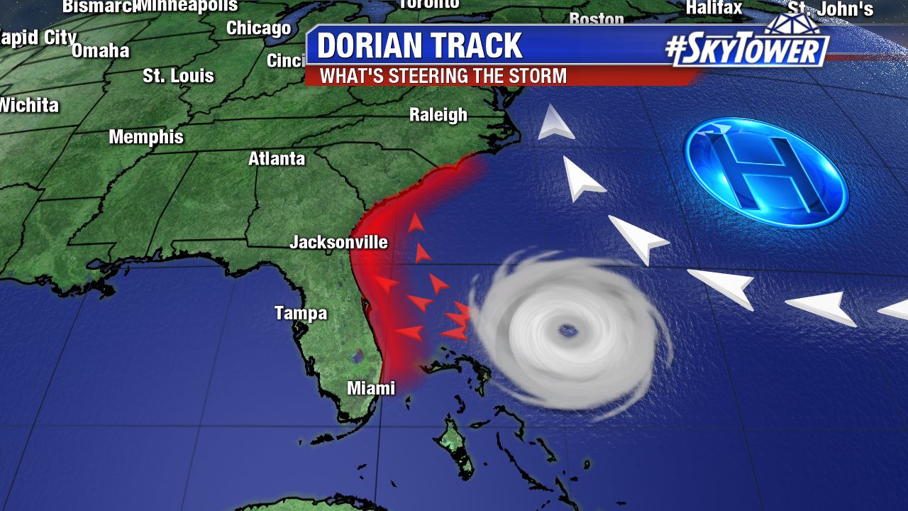
Steady intensification should continue over the next 3-4 days as the storm moves NW, and eventually turns WNW towards Florida. The eventual track really boils down to the strength of the ridge to its north. Right now, it looks as though that ridge will be strong enough to push the storm into the east coast of Florida. However, any weakness in the ridge would open the door for a turn to the north.

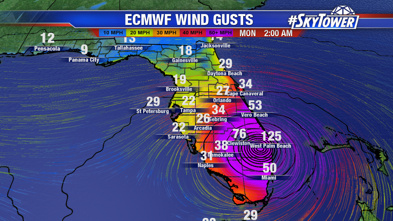
The afternoon Euro model run remained consistent with the idea of a major hurricane landfall in South Florida, and subsequently moving west across the state. The GFS solution, which seems a little less likely at this point, is a weaker storm making landfall north of Cape Canaveral. Impacts will be highly dependent on the exact track, and the storm’s angle of approach. We’ll be able to pinpoint those impacts as we get closer to landfall. By Friday, we should have a pretty good idea. At this point, those along Florida’s east coast should be preparing for the possibility of a major hurricane landfall either late Sunday or early Monday.

