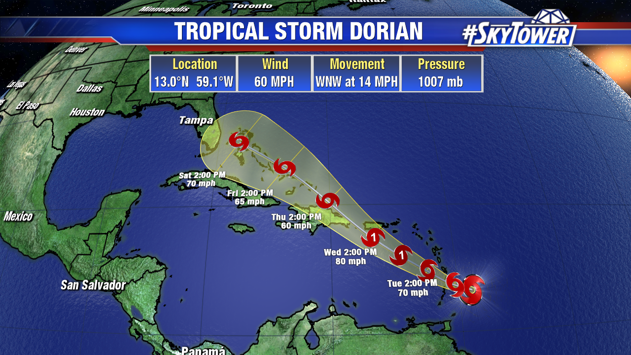
As of 8pm Monday evening, Tropical Storm Dorian was located about 140 miles ESE of St. Lucia. It’ll be moving into the Caribbean Sea over the next 12 hours as it continues its WNW motion.
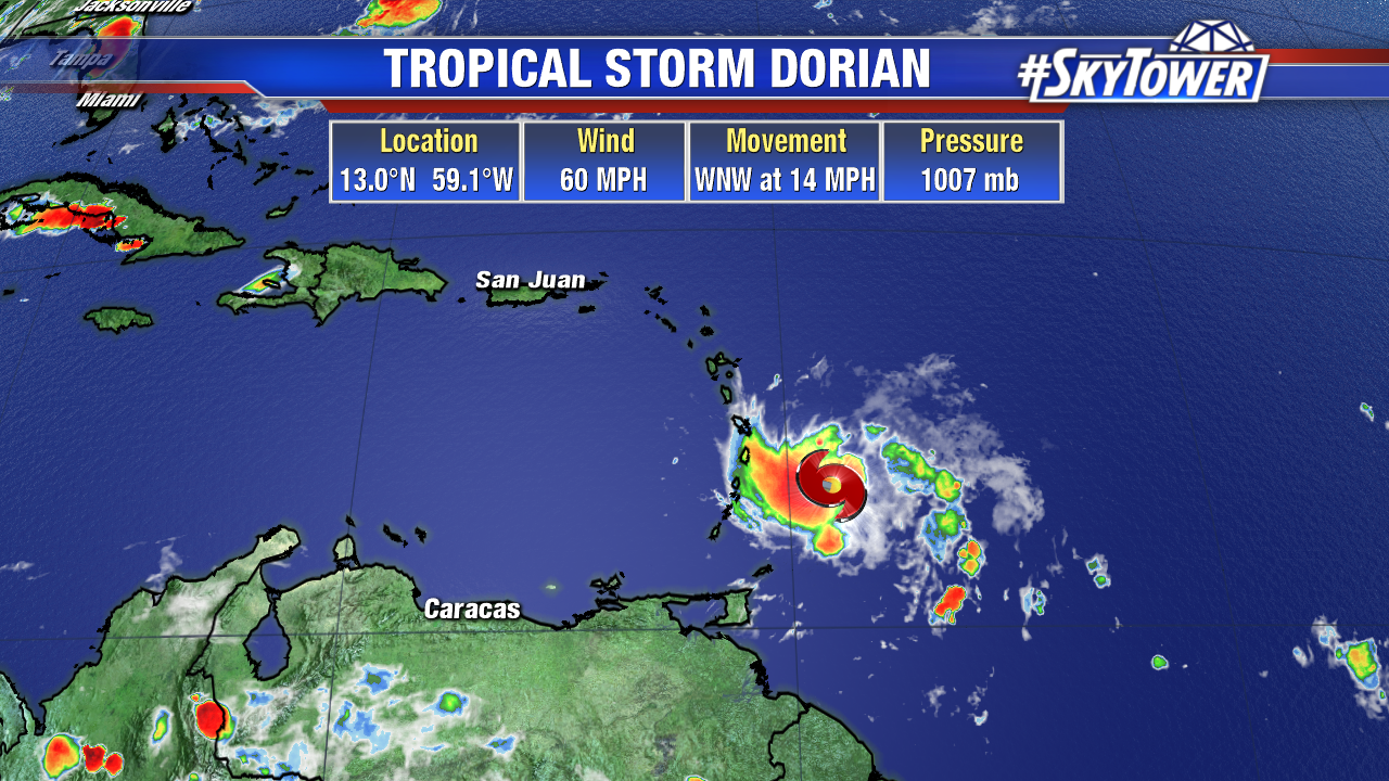
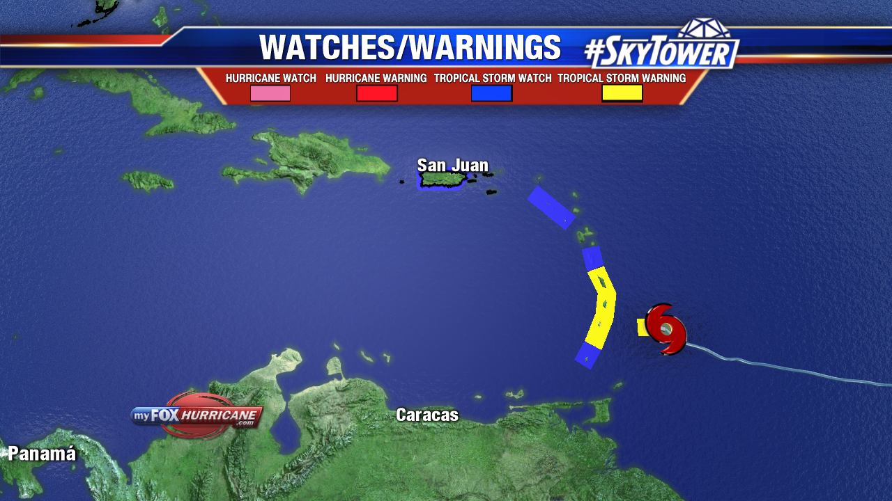
Max sustained winds are at 60 mph. Tropical storm warnings are up are in effect for a portion of the Lesser Antilles, and tropical storm watches have been posted for many other eastern Caribbean islands – including Puerto Rico.
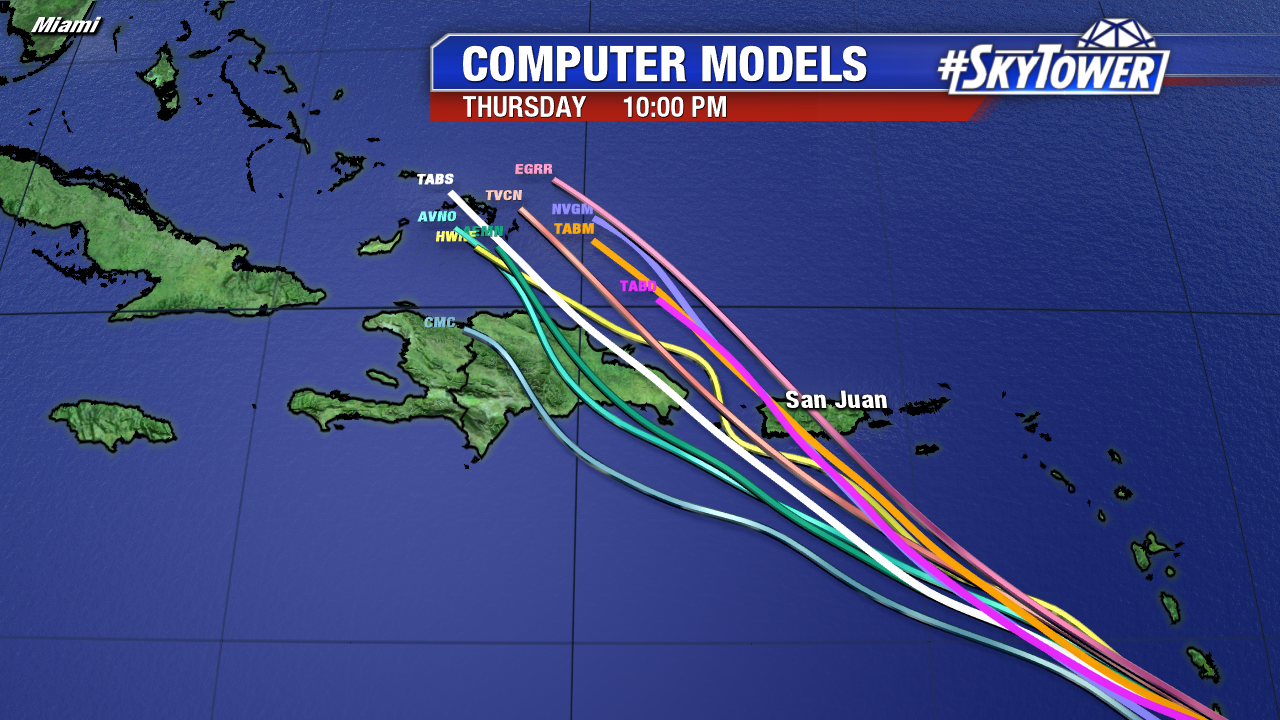
Dorian will continue its WNW track, in the general direction of Puerto Rico and island of Hispaniola, over the next 48 hours or so. At this point it’s still too early to talk about any possible impacts for the United States – for a few reasons.
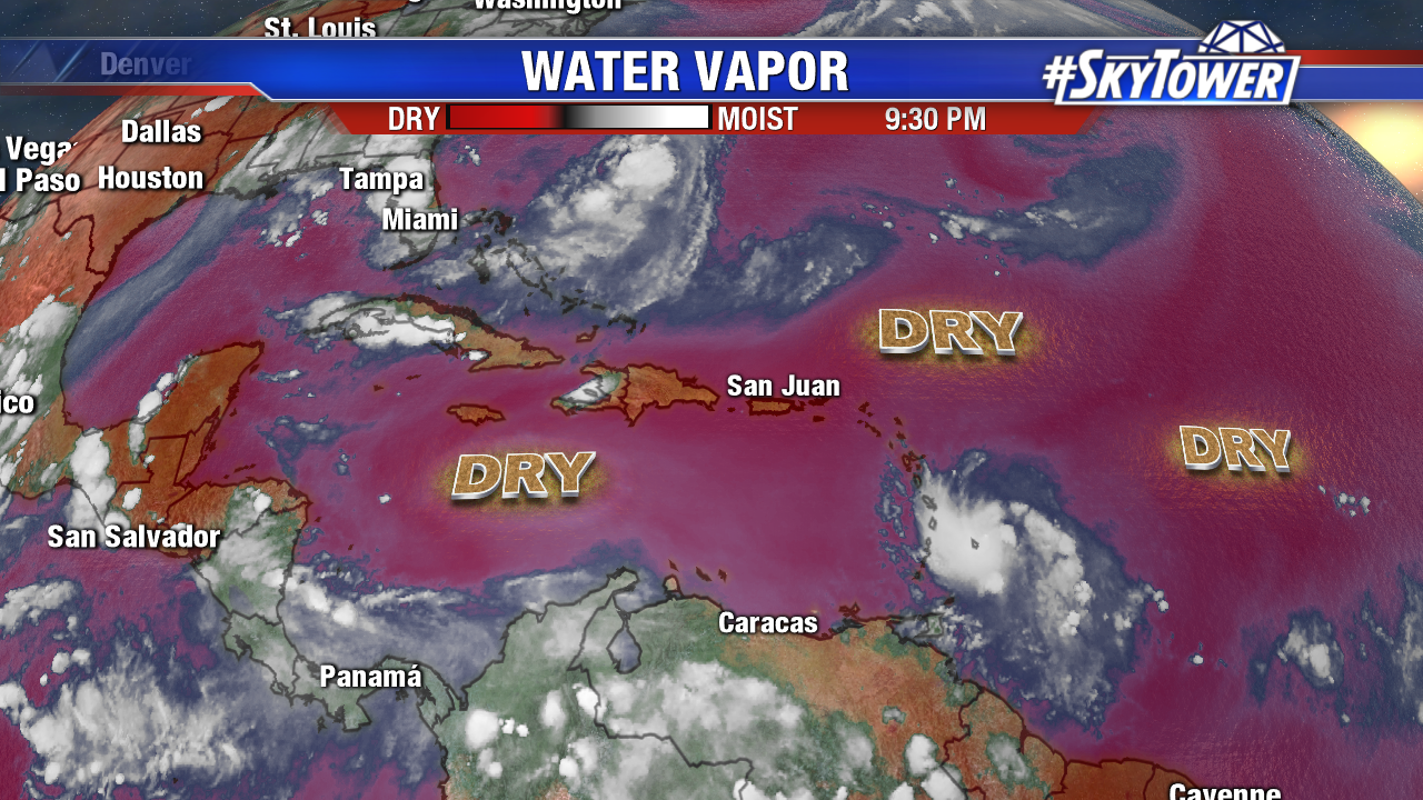
The system continues to be surrounded by an abundance of dry air. So far this dry hasn’t been able infiltrate the circulation, but that may not hold true forever. There are also some pockets of higher wind shear in Dorian’s path that it may have to contend with depending on the exact timing of the storm.
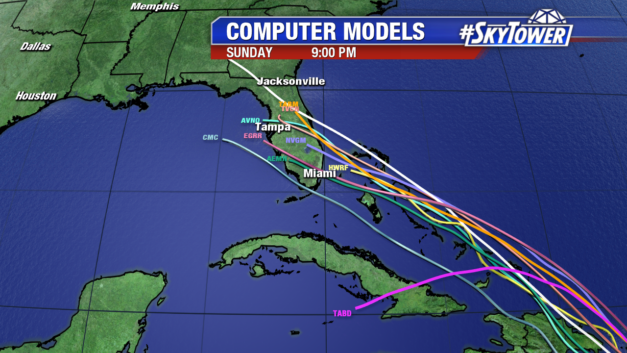
The biggest factor right now really has to do with its track through the Greater Antilles. The island of Hispaniola has mountain peaks topping 10,000 feet, and has been known to shred tropical systems apart. That being said, a track over the eastern tip of the island or through the gap between it and Puerto Rico would allow Dorian to emerge relatively unscathed ahead of an approach on the Bahamas and Florida. We’re in a wait-and-see mode until that exact track becomes more apparent. By Thursday we should have a very good idea of what holiday weekend impacts Dorian may have on Florida. Stay tuned.
