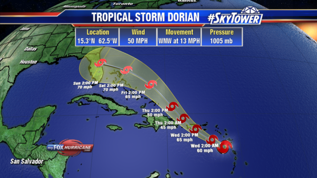
As of the 5pm update, Tropical Storm Dorian’s track has shifted a bit more to the northeast. This brings the storm through the northeastern Caribbean Sea tonight and then over or near western and central Puerto Rico on Wednesday. The center would pass just east of the Dominican Republic Wednesday night. Heading into Friday, Dorian would near the Turks and Caicos and then the Bahamas. It currently has 50 mph winds and is moving WNW at 13 mph. A shift more to the northwest is expected tonight.

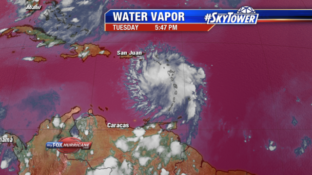
Dorian is expected to slowly strengthen as it nears Puerto Rico, nearing hurricane strength. Heavy rain of 4-6″ with locally 8″ totals could lead to flash flooding. The storm is currently battling dry air which is being pulled into mid levels, this is keeping the storm from quickly intensifying. After interacting with the higher elevations of Puerto Rico, it is expected to briefly weaken before conditions become favorable once again for restrengthening. It will be moving into more moisture, warmer water and lower wind shear as it nears the Bahamas.

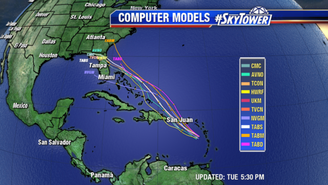
There is low confidence in the intensity forecast once it passes Puerto Rico as the models are showing a range of possibilities. A turn towards Florida’s east coast is looking more likely, but it is still several days out. The average margin of error with a 5 day forecast is over 200 miles. Even though the path and intensity could change, residents in the Turks and Caicos, Bahamas and Florida’s east coast should have a hurricane plan in place and monitor the storm closely.

