Pretty much the entire Atlantic basin isn’t all that favorable for tropical waves to develop right now. There is quite a bit of dry air, and pockets of wind shear as well. Yes, we have a couple areas of interest right now, but that’s all they are.

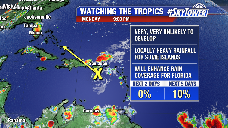
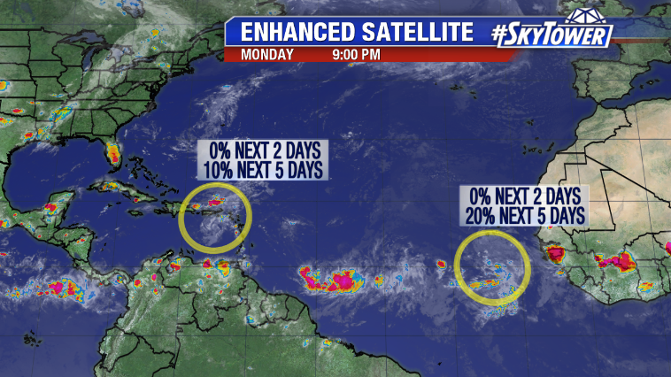
The first is a disturbance (Invest 95L) that is currently in the process of moving over the island of Puerto Rico. This has brought some locally heavy rain to the Virgin Islands and the Dominican Republic as well. This will head toward the Bahamas and South Florida over the few days, but development odds are very slim. More than likely this will simply aid in higher than normal rain chances across Central and South Florida over the weekend. There’s no reason to be concerned about this right now.

The second area we’re watching is in the far eastern Atlantic, just off the coast of Africa. This will take several days to move across the open ocean, during which time development is not likely. As it nears the Caribbean over the weekend, development may become a bit more likely. Plenty of time to watch.
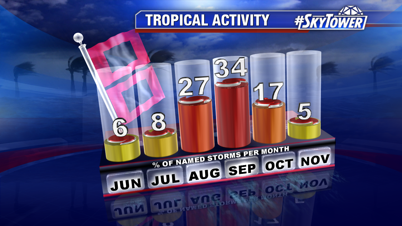
We’re about to head into the heart of hurricane season. Since 1950, the months of August and September have accounted for over 60% of named storms.

