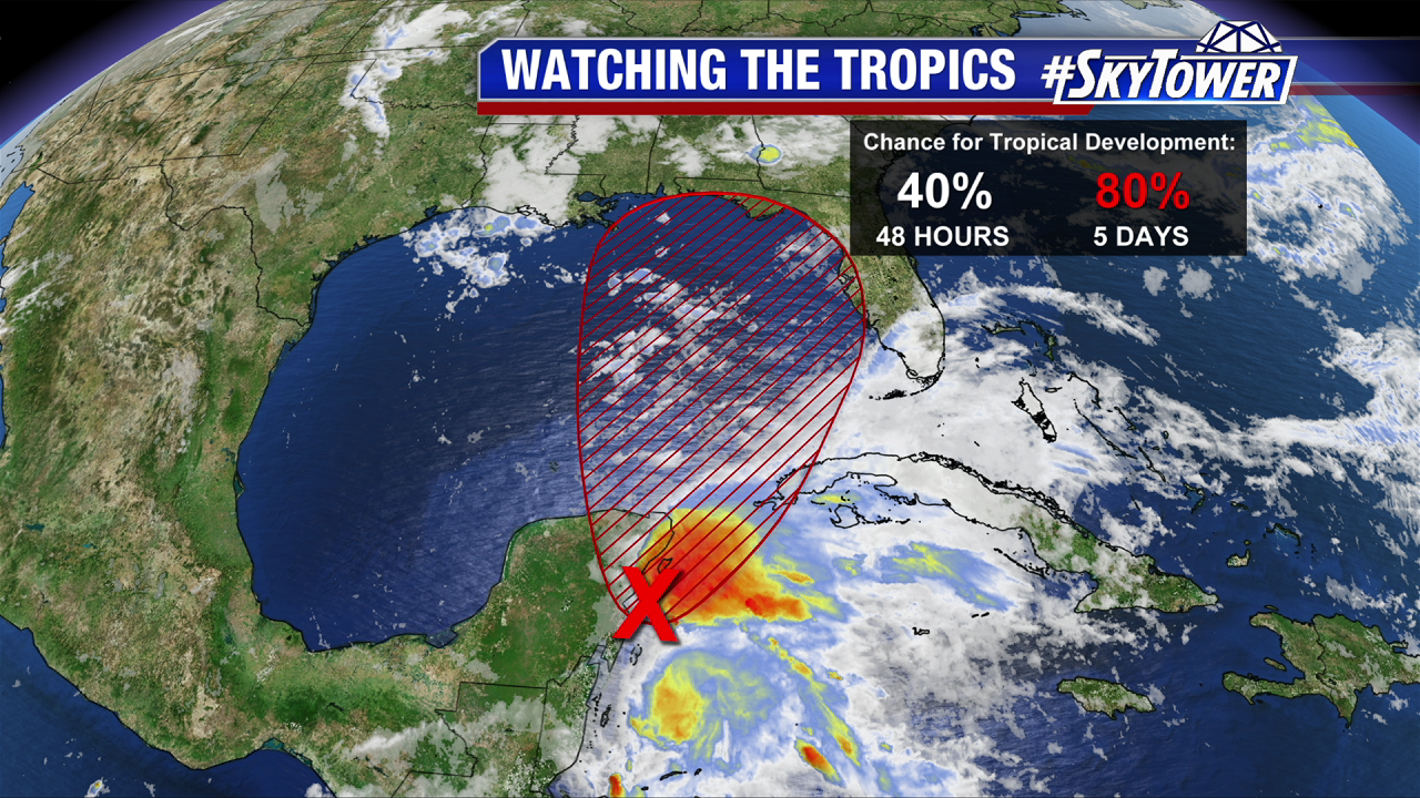
On Thursday morning, a broad area of low pressure was located over the southeastern Yucatan Peninsula. As expected, land interaction and strong upper-level winds have prevented further organization thus far. However, as this disturbance starts to move north on Friday and through the weekend, environmental conditions will be much more favorable for a subtropical or tropical depression to form. At this point, a weak Tropical Storm Alberto is not out of the question. The National Hurricane Center now has development odds at 40% over the next 48 hours and 80% over the next 5 days.

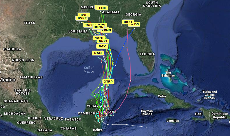
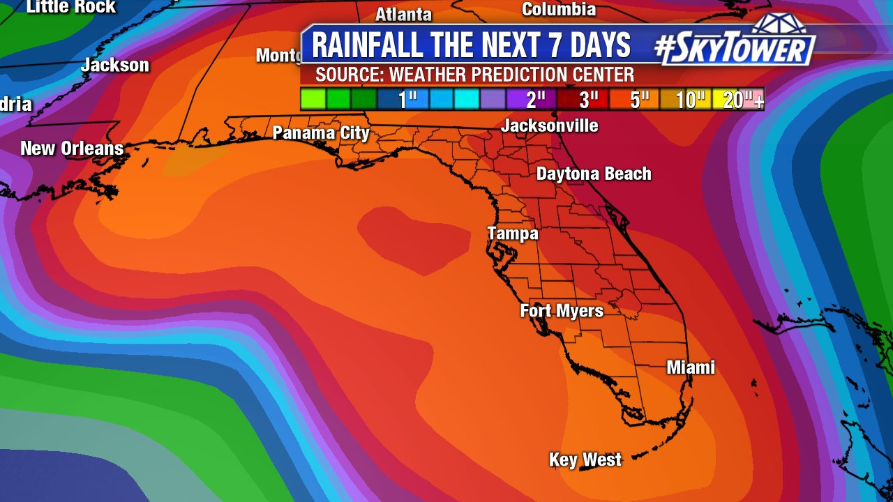
We’ve finally started to see some better model agreement over the last 24 hours. The consensus solution seems to be a slowly strengthening area of low pressure moving north through the east-central Gulf of Mexico through the weekend before stalling on the northern Gulf Coast early next week. Since we’ve been trending our forecast the last few days toward this type of scenario, it really doesn’t change the forecast much. The big impact will be rounds of heavy, in some cases flooding, rainfall for the central and eastern Gulf Coast, as well as parts of the Southeast, for several days.


One other thing we’ll be keeping an eye on is the potential for waterspouts and tornadoes. This is often the case with rain bands on the eastern side of a deepening area of low pressure. A lot of factors will play into that threat, and it may not materialize at all. Stay with us as we continue to fine tune the forecast over the next day or two. Safe to say, don’t count on many outdoor activities this holiday weekend.
