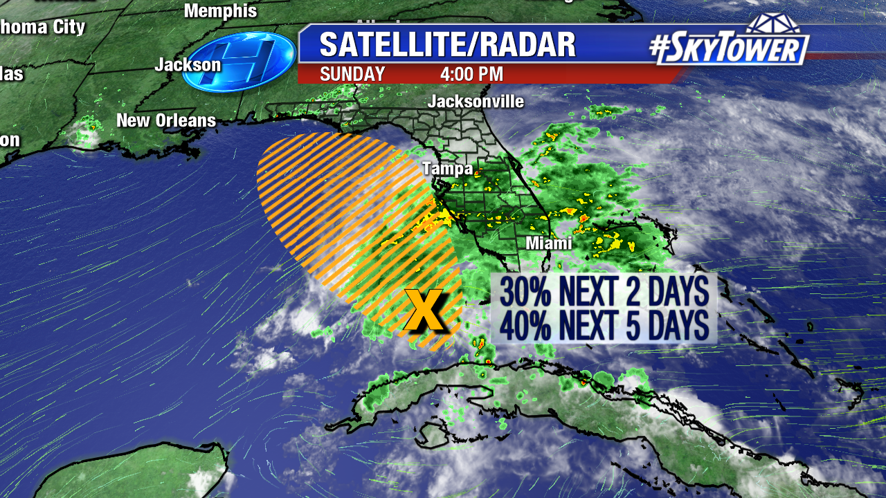
On Sunday evening, a large area of showers and storms associated with a broad area of low pressure extended from Cuba up through Central Florida. As this area meanders northward through the eastern Gulf over the next few days it may start to take on some tropical characteristics. However, regardless of tropical development, the outcome is essentially going to be the same – heavy, but beneficial, rains across much of the state of Florida.

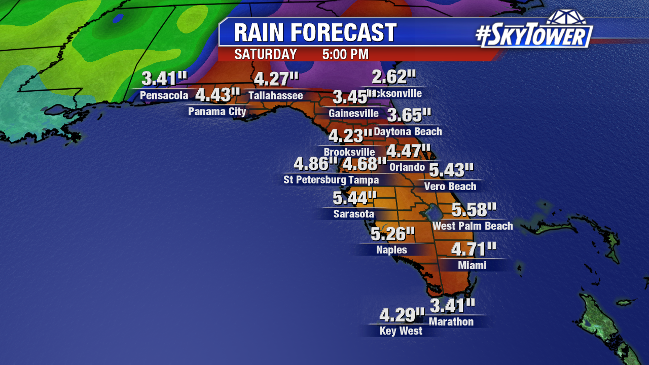
Below you’ll find rainfall totals through next Saturday from across the state. This is model output from Sunday afternoon’s Euro model. Don’t focus so much on the particular totals for each city, but rather the range. Expect a good 3-5″ across a lot of the state over the next week, with some isolated areas picking up even more.

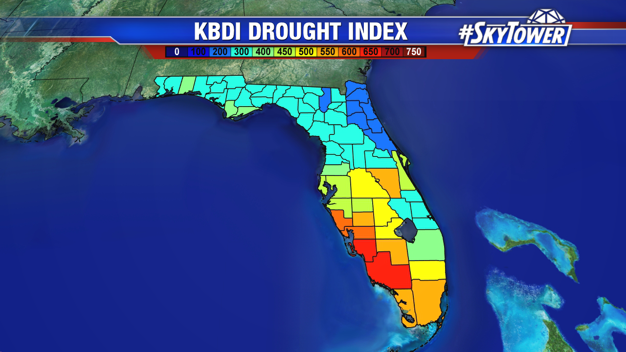
This rainfall should wipe out a lot of the drought issues we’ve had in certain areas this Spring. Below you’ll find the KBDI Drought Index from Sunday, May 13. The higher the number, the drier it is.

