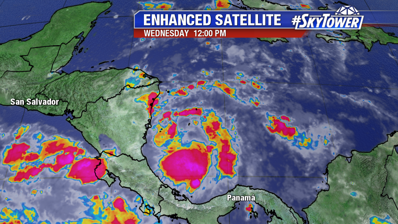
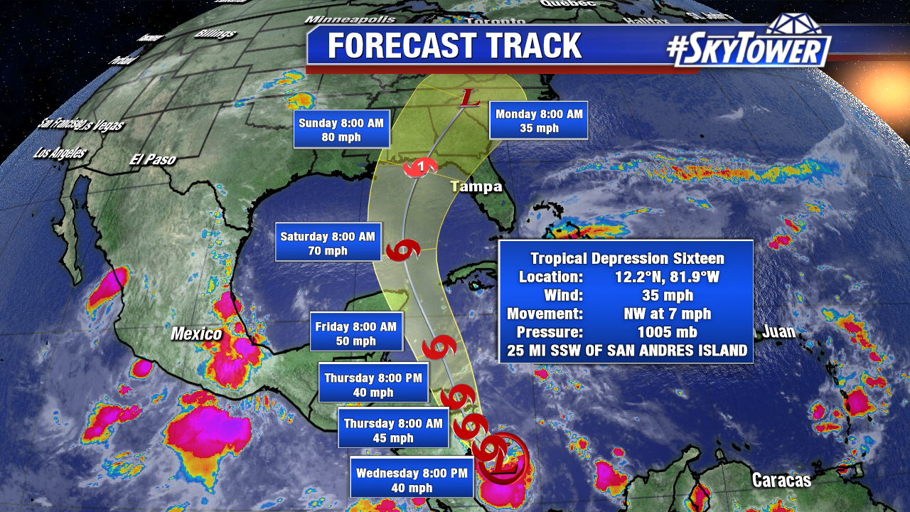
Tropical Depression 16 forms in the southwest Caribbean at 11 AM Wednesday and an upgrade to Tropical Storm Nate is likely. Hurricane Reconnaissance Aircraft are en route to investigate the new tropical cyclone midday Wednesday. The data from the afternoon mission will be ingested into Wednesday evening computer models. This data is much needed, as Nate will threaten the northern Gulf coast, including Florida, as a strengthening storm. A hurricane is on table at this point. As we’ve seen multiple times this season, systems are prone to strengthen rapidly this year. Water temperatures in the future path of Nate are in the low to mid 80s. Wind shear remains favorable for steady intensification in the Caribbean. By the time future Nate enters the Gulf late Friday/early Saturday, hostile upper level winds maybe much lower too. Interest along the northern Gulf coast from Louisiana to Florida need to pay close attention to the forecast, as a Gulf landfall appears likely. It is too early to talk specifics, but heavy rain, strong winds, spin up tornadoes, and storm surge are all expected. Even if Nate makes landfall west of Tampa Bay, the flood prone area is on the messy east side of future Nate. A southwest wind would induce coastal flooding/storms surge, as was the case with Hermine in 2016.


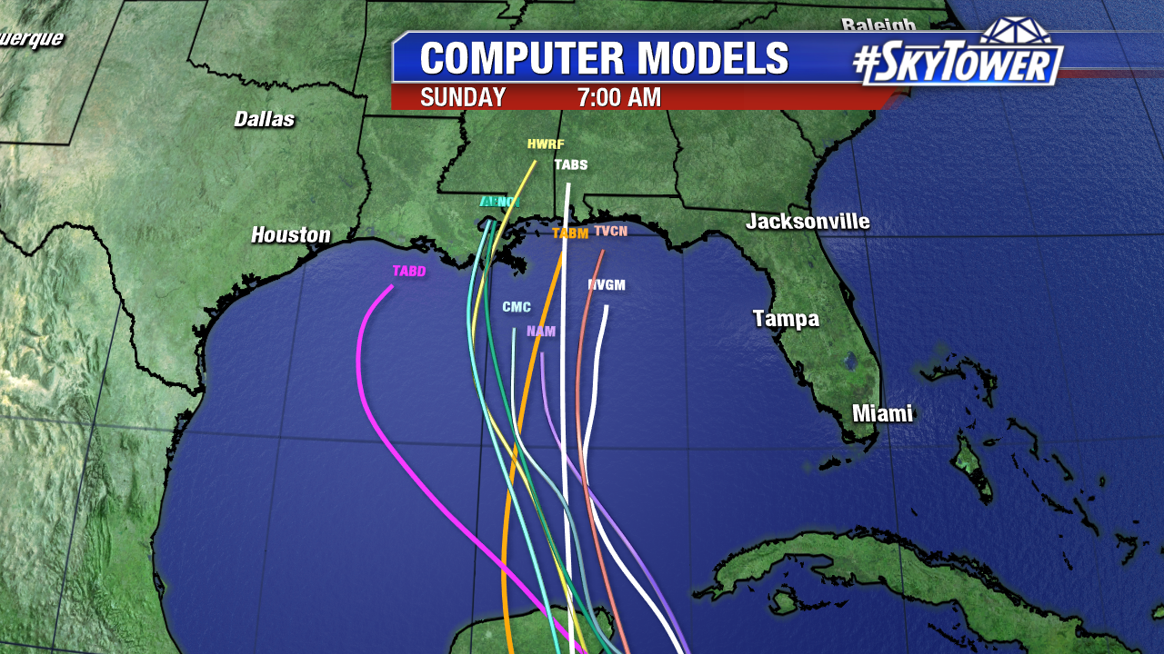
There is quite a spread in Wednesday morning computer models. This is very common, with a weak, newly formed tropical depression. The time frame for greatest Gulf coast impacts will be Saturday and especially Sunday. Coastal Louisiana to the Panhandle of Florida are all on the table for a possible landfall. Intensity is still in question too. The GFS is further west than the ECMWF. The GFS hints at Louisiana while the Euro eyes the Florida Panhandle. Stay tuned and informed.

