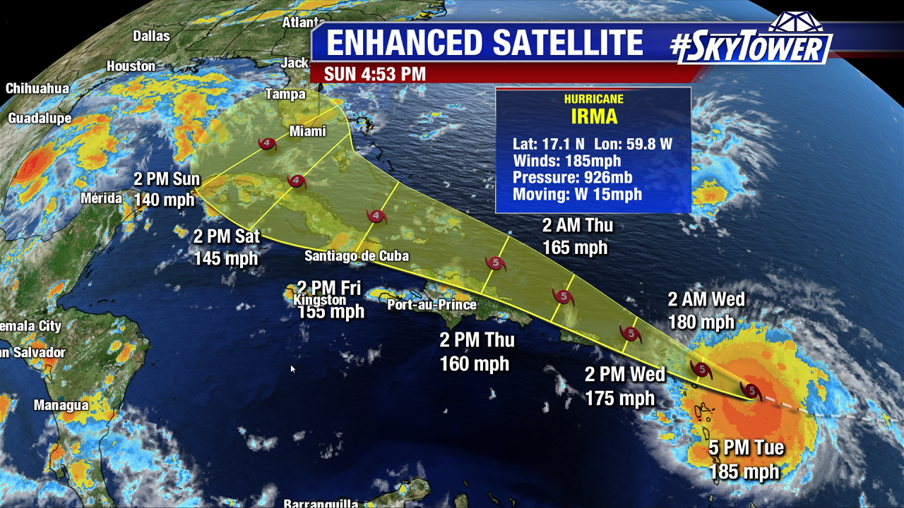
Irma is among the strongest hurricanes on record in the entire Atlantic Basin. Only 5 other hurricanes, including Wilma, have seen winds over 184 mph. It became the strongest hurricane in the Atlantic Basin outside of the Caribbean and Gulf of Mexico Tuesday morning. As of 5 PM the powerhouse storm maintains intensity as a strong category 5 with max sustained winds of 185 mph. Pressure is down to 926 mb as it barrels towards the northern Leeward Islands as it moves west at 15 mph. The wind field of the massive hurricane (more than 400 miles across) continues to grow in size. While hurricane force winds still extend out 60 miles from the center, tropical storm force winds now extend out 170 miles.
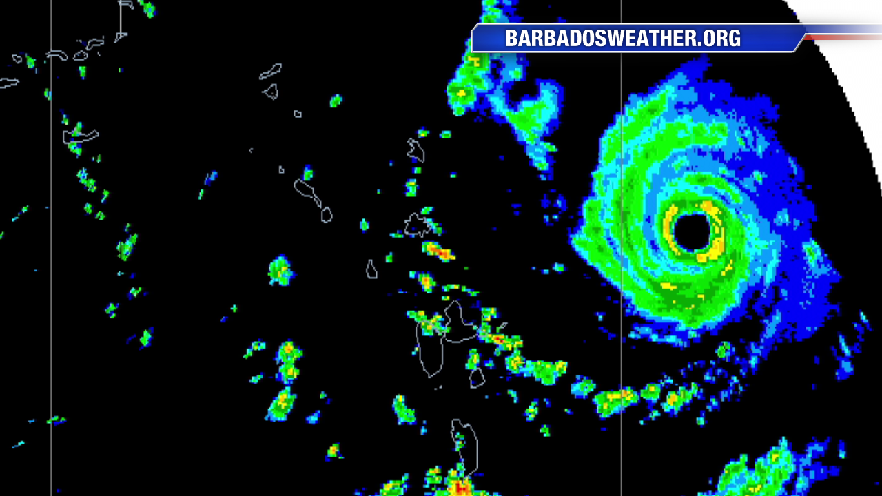
The northern Leeward Antilles will experience a direct hit Tuesday night and early Wednesday. Below is composite radar from BarbadosWeather.org. Notice a defined eye and impressive eye wall. Hurricane Hunters have been out there basically around the clock since Tuesday morning. The storm may weaken a little Tuesday night during a pending eye wall replacement cycle. Up next are the British and U.S. Virgin Islands followed by a close call for Puerto Rico late Wednesday into Thursday. The strongest damaging winds are east of the center of circulation. As Irma moves northwest the flow around the storm will bring a significant storm surge to the British and Virgin Islands and the northern coast of Puerto Rico. Storm surge will be even higher for Turks and Caicos and the southeast Bahamas. Up to a 15-20 foot surge is possible in these areas. Hispaniola and Cuba may disrupt the very dangerous hurricane and lead to some weakening. A category 4 hurricane takes aim at the Florida Keys and South Florida late Saturday and Sunday. Irma will likely be the strongest hurricane to strike these areas since Andrew in 1992. The 5 PM track from the National Hurricane Center has not changed much since early Tuesday.


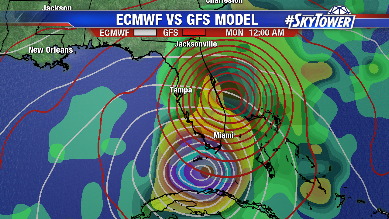
All eyes are on Florida and the timing of a turn north early the weekend. Unfortunately, there are still some discrepancies in our two most reliable models. The 12Z GFS is still further east and a bit quicker. The 12Z European model is slower to turn north and is further west. Both models bring an intense major hurricane northward through the state through Monday. It is still too early to talk specific rainfall, wind, storm surge etc as Irma is still 5 days out from any impacts. That 5 day error is 225 miles. There is still a possibility the long-range track shifts further east or west.

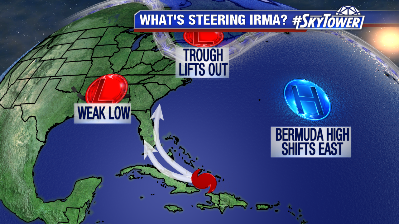
Florida is likely to see major hurricane impacts this weekend and Monday. The question remains, if it heads further west, due north over the state, or further east. As a trough lifts out of the Northeast later this week the Bermuda High shifts east. That high then builds back in across the Atlantic. At the same time an upper level disturbance moves through the south central U.S.. Irma will lift north due to a weakness between these two features. The strength of both of those features is still up in the air. Stay tuned and be prepared.

