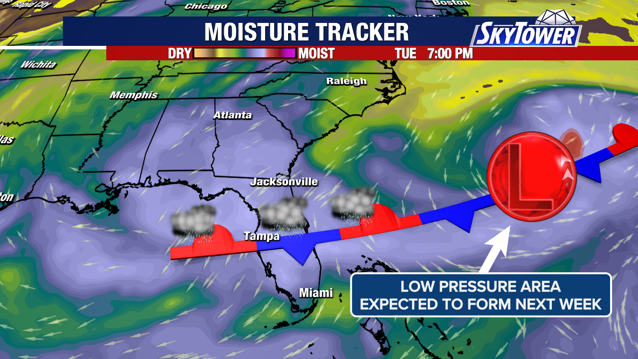
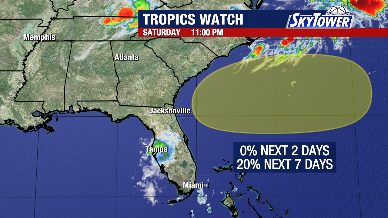
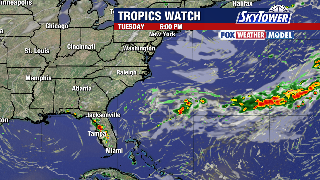
The area we’ve been watching off the southeast coast has a very limited chance of developing and is expected to fizzle out.
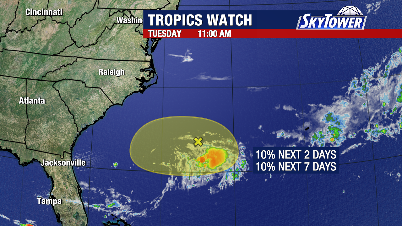
It currently has a 10% chance of developing into a tropical depression over the next two days and the environment becomes even less favorable past that as dry air moves into the area.
Outside of this, things are quiet as Saharan dust drifts across the Atlantic and parts of the Caribbean.
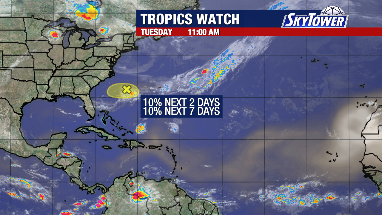
This dust significantly dries out the atmosphere and suppresses tropical activity. The Saharan Air Layer starts about 1 mile above the surface and has 50% less moisture than standard tropical air.

Bertha is the next name in line this season.
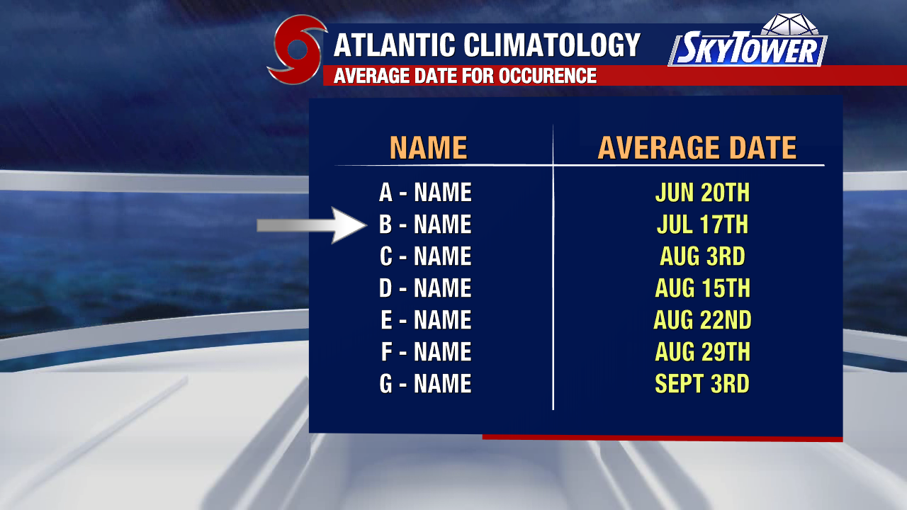
On average, the B storm forms by July 17.