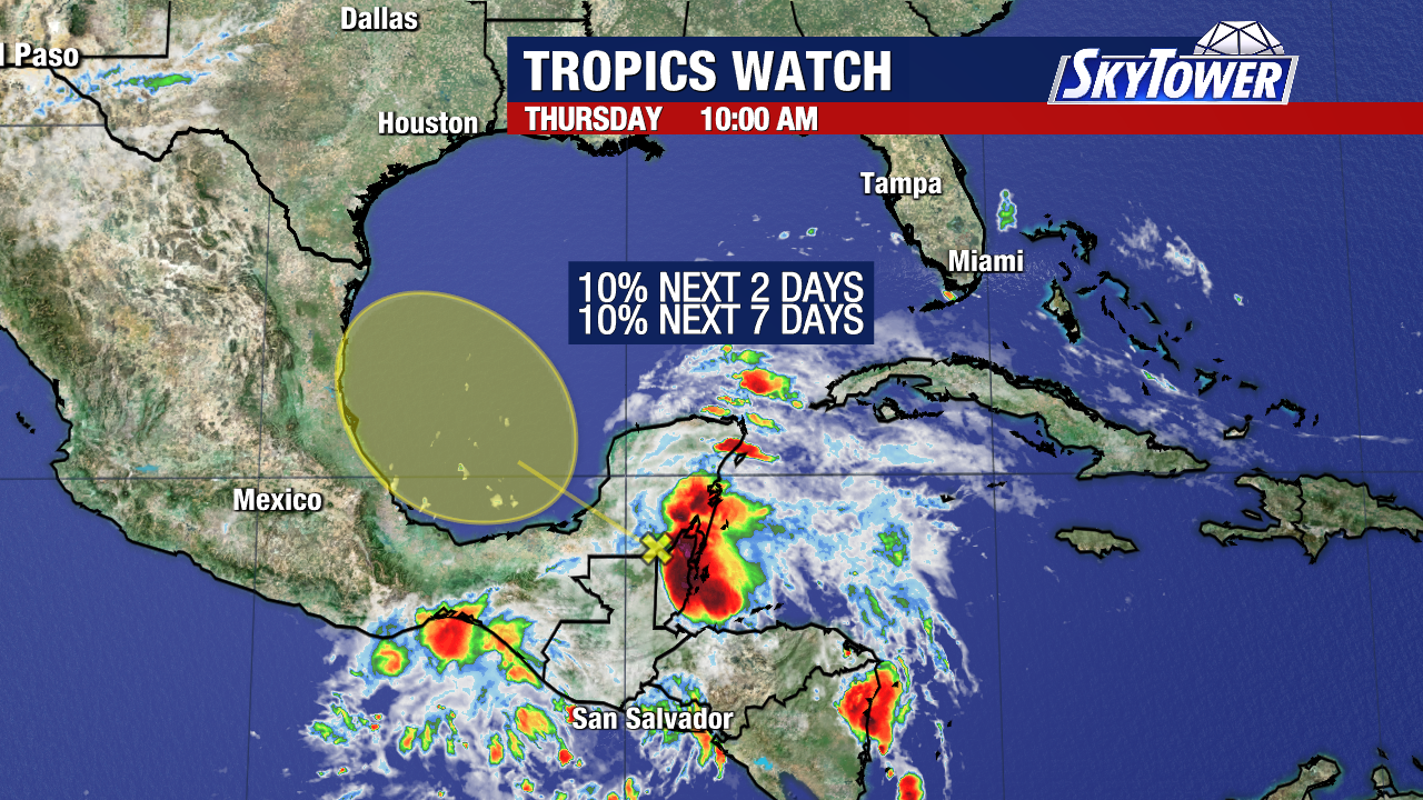
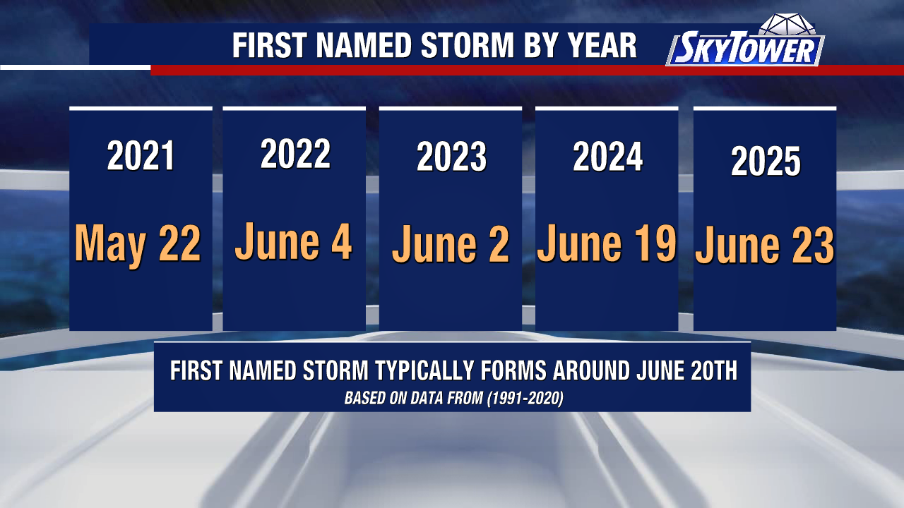
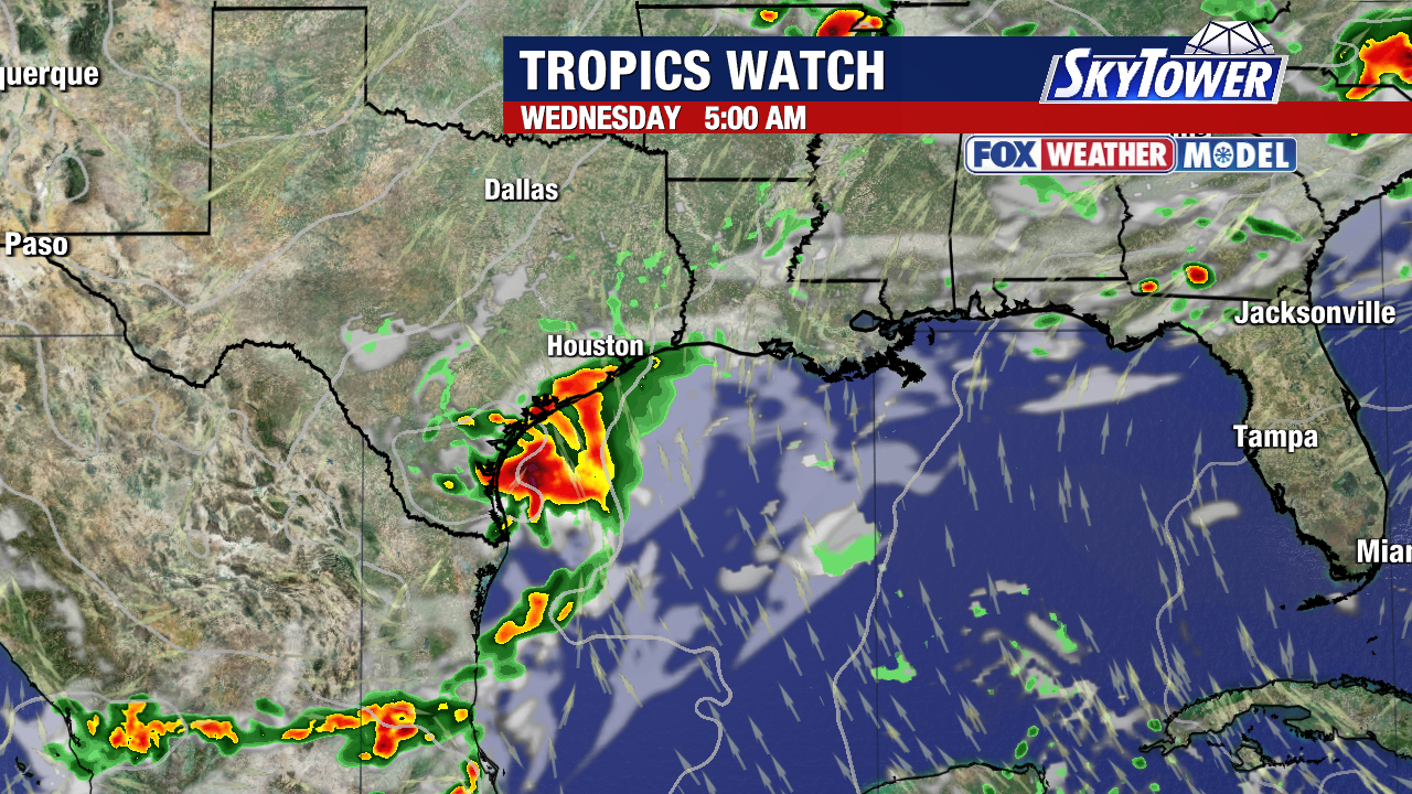
The first invest of the Atlantic hurricane season has been tagged in the NW Gulf. The area has a 40% chance to develop over the next 2 days and 50% over the next 7 days.
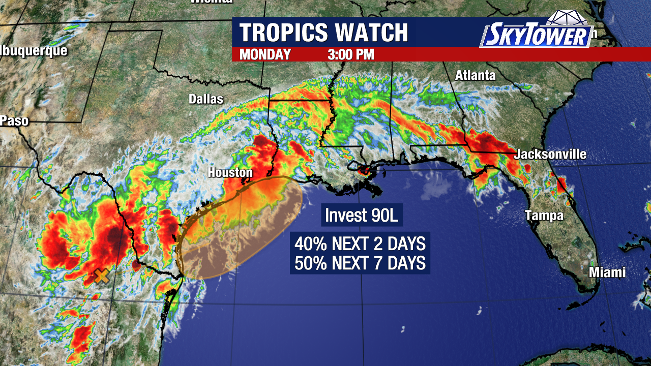
A disturbance over eastern Mexico will emerge in the northwestern Gulf and may find a window of weak wind shear and favorable conditions to become a short-lived depression or storm.
The main impact will be periods of heavy rain, gusty coastal winds, and flash flooding through Friday across the Gulf state and parts of the southeast.
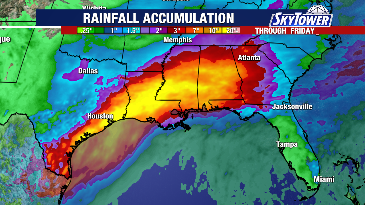
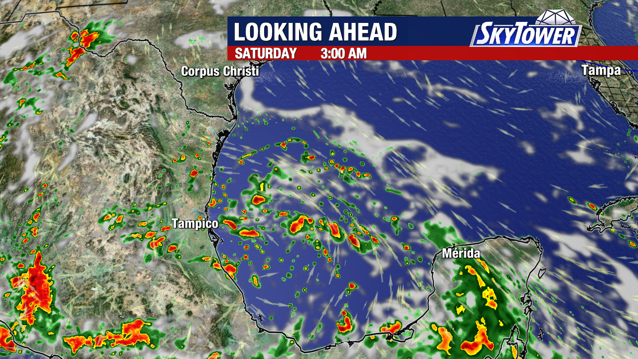
Regardless of tropical development, flooding rains are a concern across several states.
Late Tuesday into Wednesday is the most the likely window for Invest 90L to form as it continues to pull deep tropical moisture into the south.
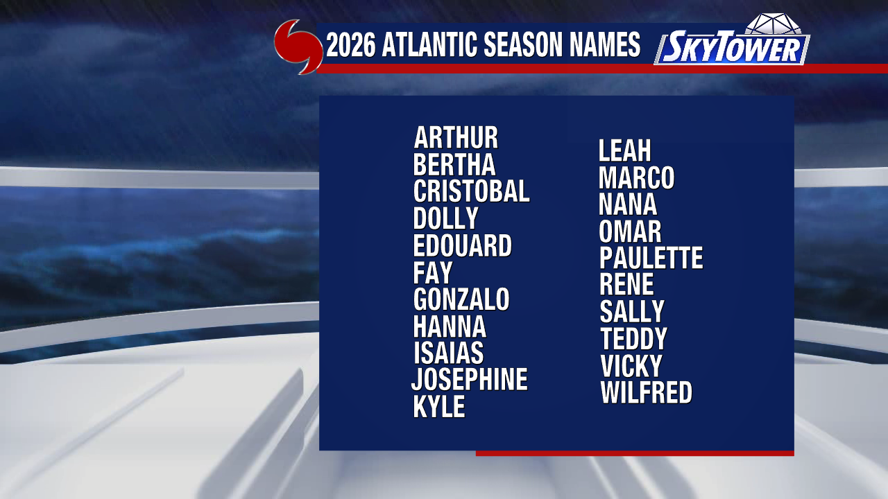
Arthur is the first name on the 2026 Atlantic hurricane season list.