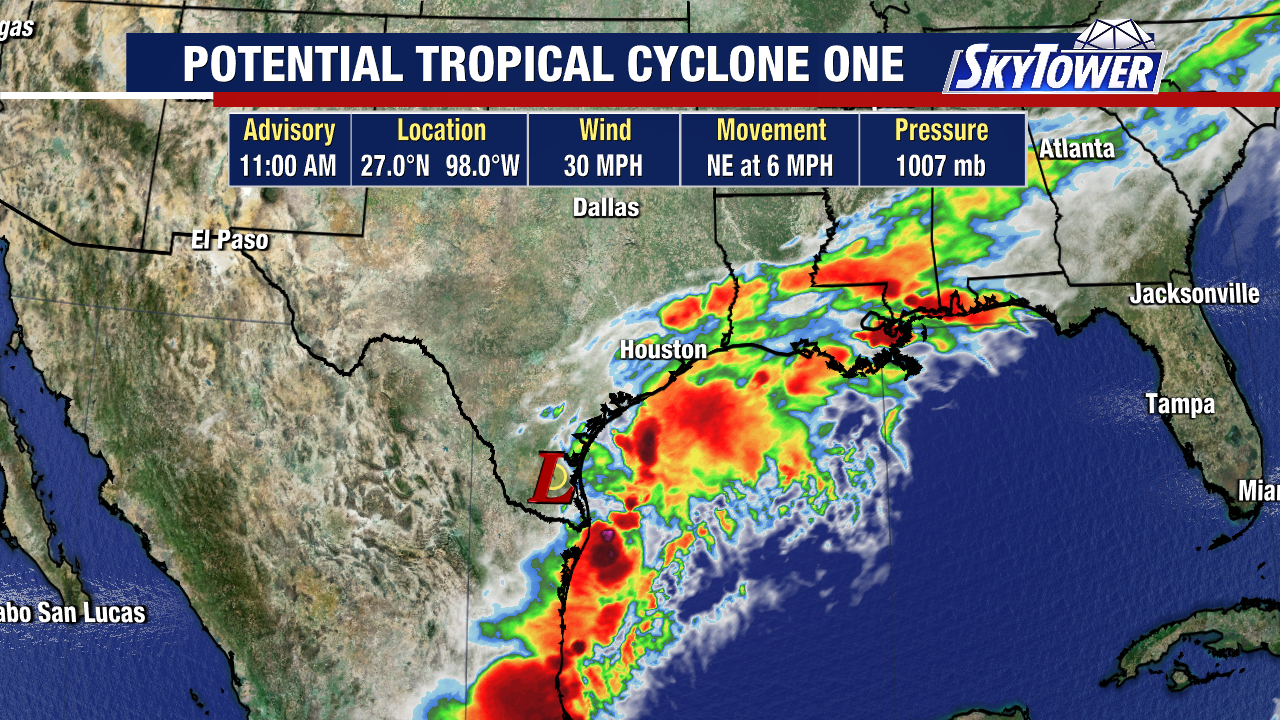
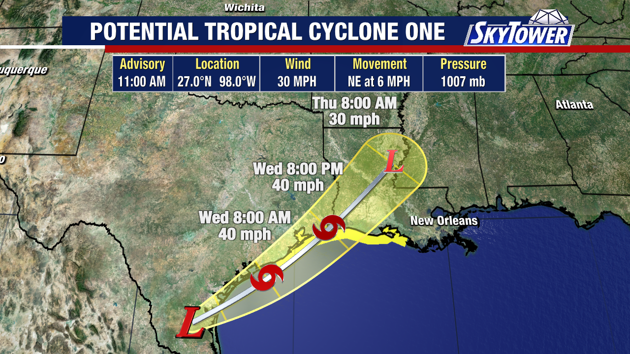
Potential Tropical Cyclone is forecast to strengthen into a tropical storm later today into early Wednesday as an area of low pressure skirts along the coast of Texas.
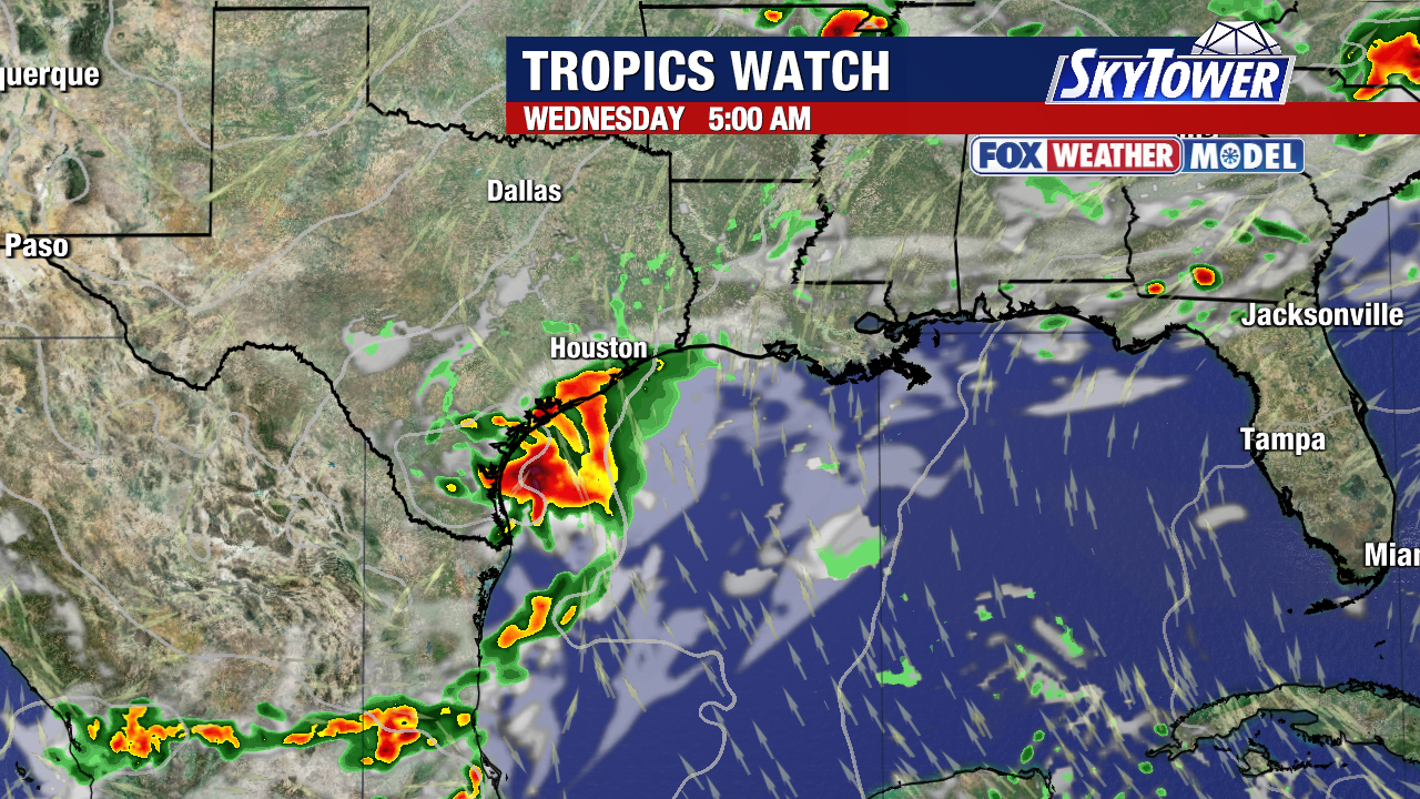
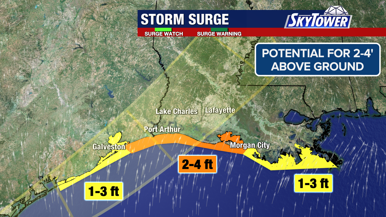
Tropical Storm Watch up from Sargent, Texas to Morgan City, Louisiana. Storm surge of 2-4′ above ground is possible along and east of the storm. Surge of 1-3′ is forecast for other areas of TX and LA.
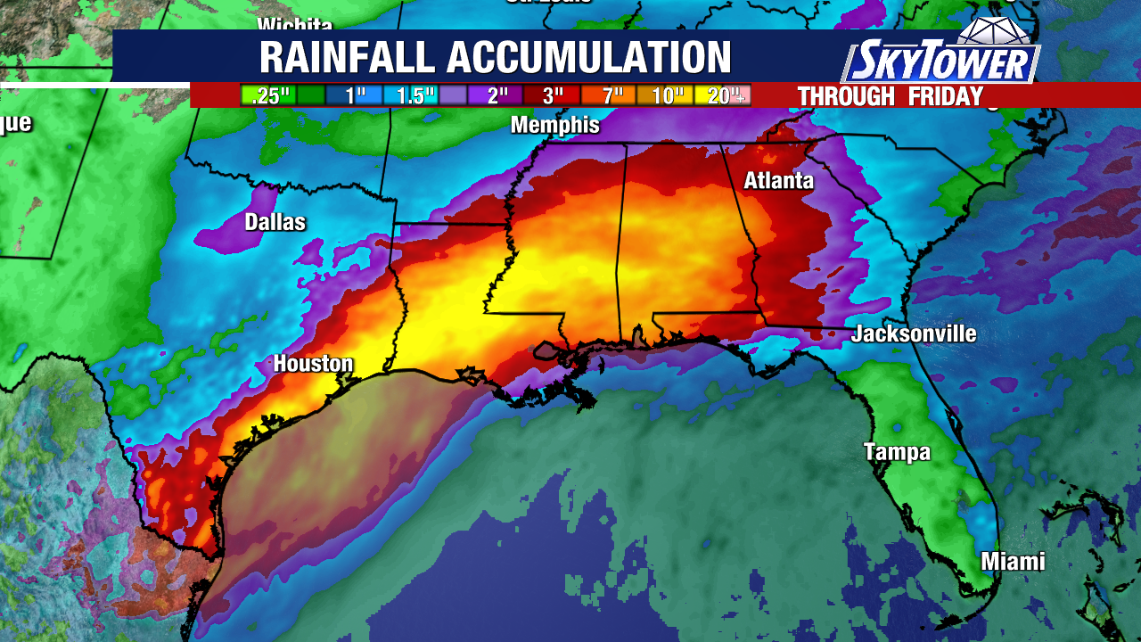
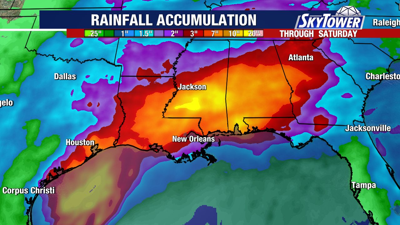
This will be a weak tropical system but heavy rain & flash flooding will be impactful either way for Texas, Louisiana, Mississippi & Alabama. 4-8″ of rainfall is possible with isolated areas getting a foot of rain.
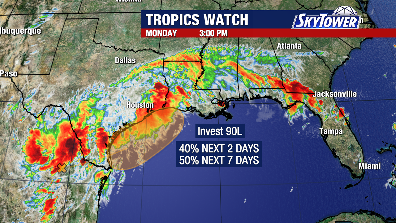
It’s currently called Potential Tropical Cyclone One meaning nothing has officially formed but tropical storm conditions are expected within 48 hours.