
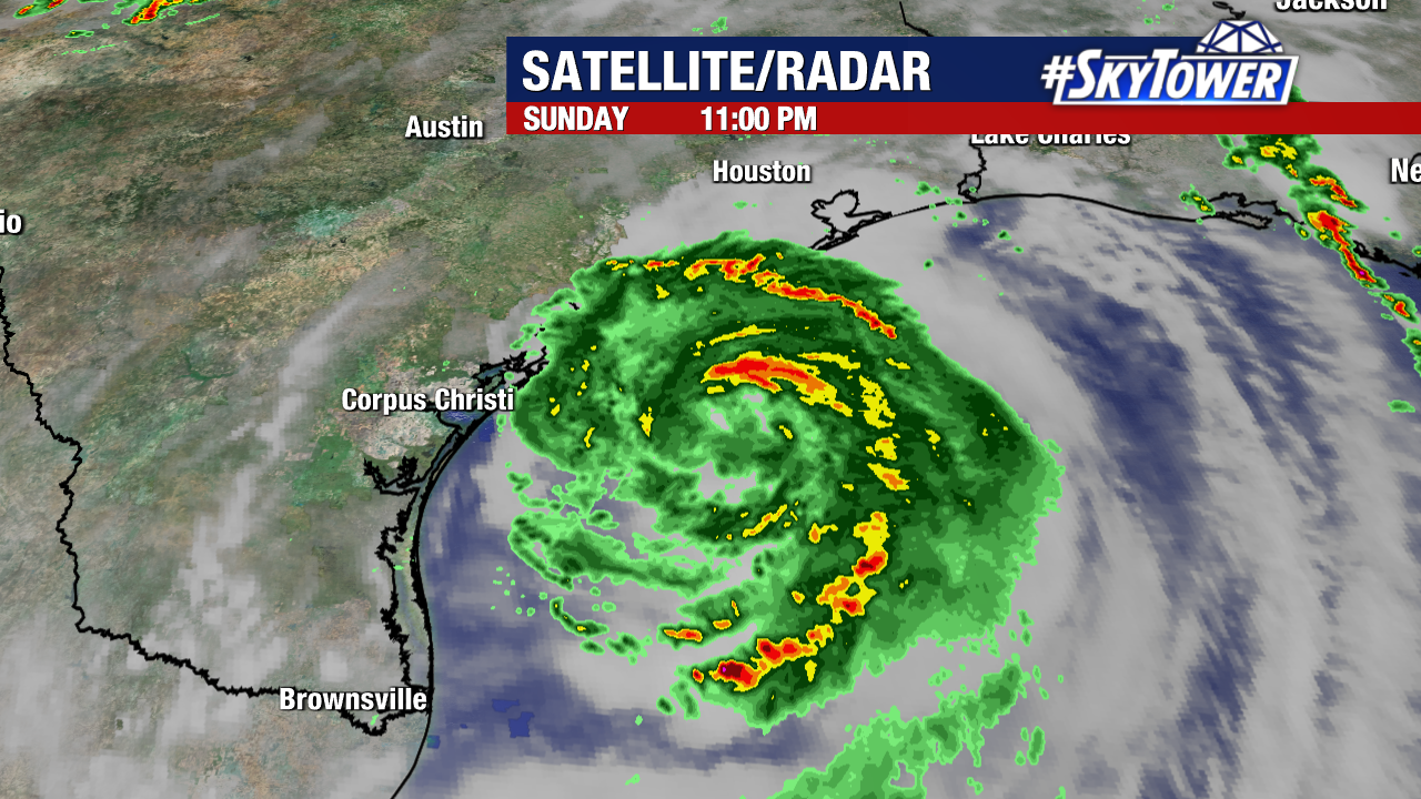
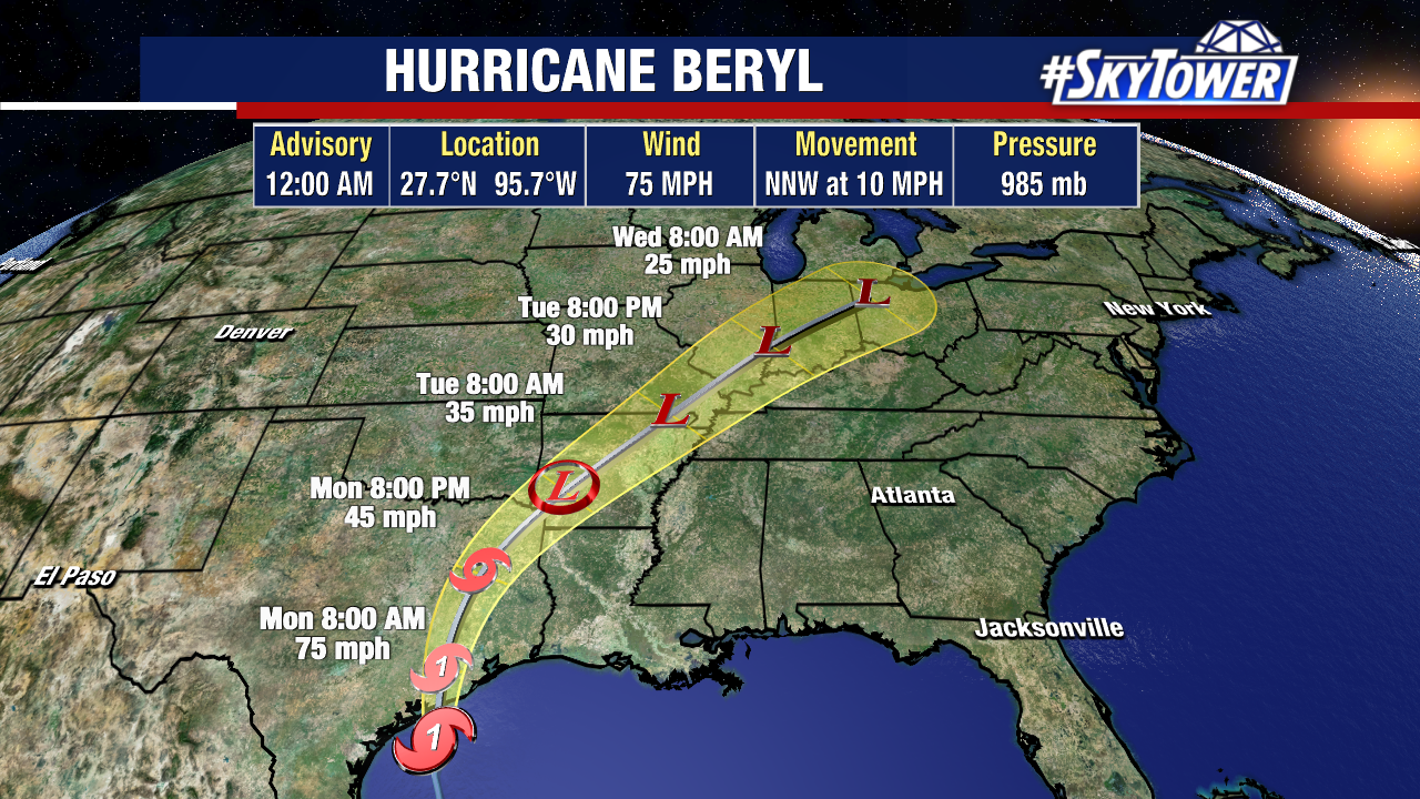
Beryl has restrengthened into a hurricane, hours ahead of landfall along the Texas coastline. Models are in agreement that landfall will occur early tomorrow morning (likely before sunrise) somewhere east of Corpus Christi and west of Galveston.
While Beryl may try and strengthen more, it is not expected to become a major hurricane before pushing onshore. Beryl will then weaken into a tropical depression before leaving the state of Texas. From that point, heavy rain and gusty winds will drift up the Mississippi River valley and into the Midwest.
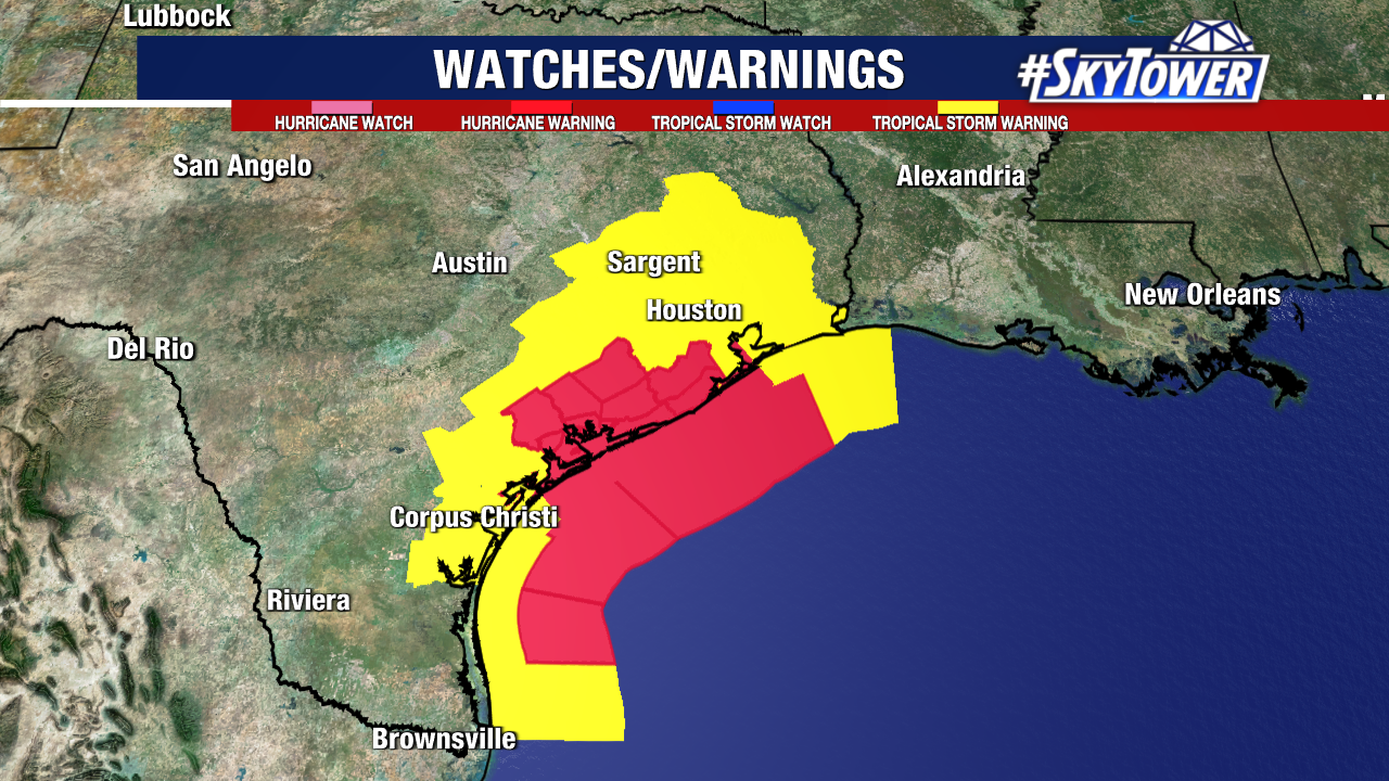
Hurricane and tropical storm warnings remain in effect as tropical storm-force winds have already arrived along the Texas coastline.
Storm surge remains a large hazard with Beryl. In the 5pm advisory, the National Hurricane Center has increased its forecast for expected storm surge.
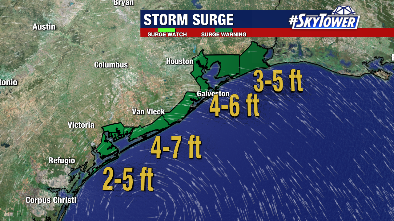
This does not account for the additional rainfall that will add to that total. Isolated rainfall totals may reach or exceed 10 inches over the next few days in some spots.
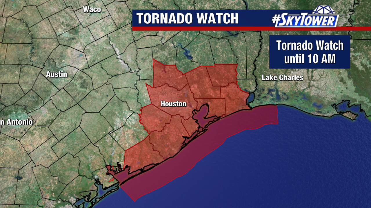
Additionally, Beryl’s rain bands may form storms capable of producing tornadoes. That tornado threat will be maximized on the right side of the storm’s center. A tornado watch is now in effect for this region of the Upper Texas Coast.