
It’s something we’ve never seen before in June. The southeastern Caribbean Islands are bracing for a Category 4 landfall within hours from Hurricane Beryl.
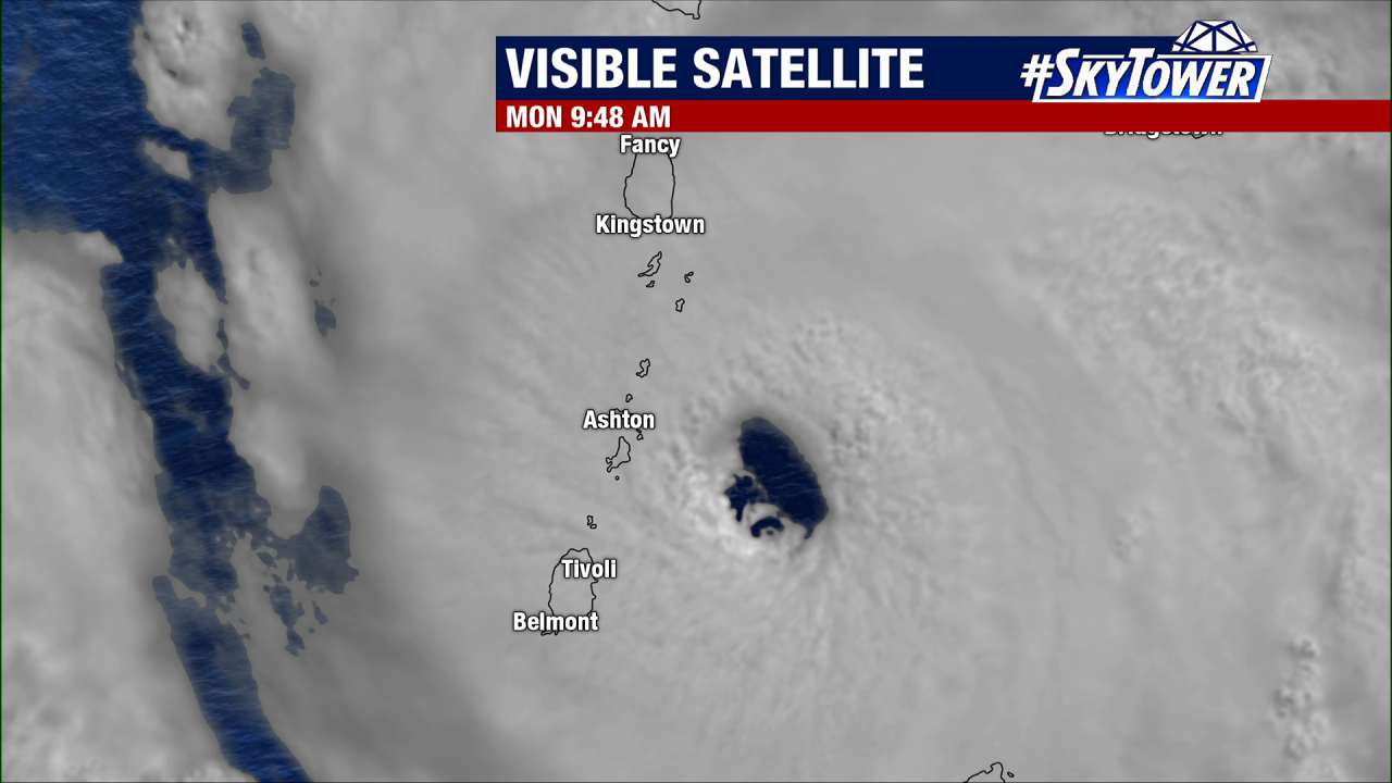
Beryl has 130mph winds and this is a very dangerous situation for Barbados, Grenada, the Grenadines, St. Vincent and Tobago. These areas are all under a Hurricane Warning as Beryl is expected to bring life-threatening storm surge and hurricane-force-winds.
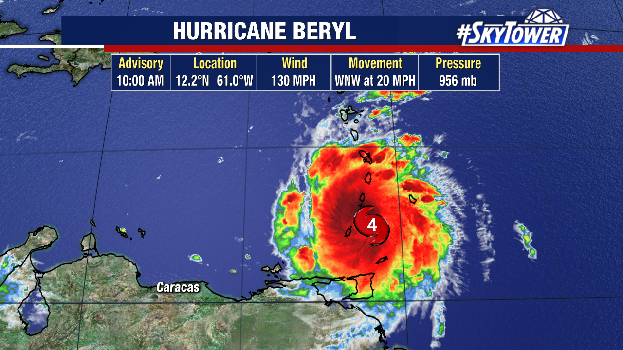
The storm underwent an eyewall replacement last night – early Monday morning. During this timeframe, it briefly weakened to a Cat 3 before reaching Cat 4 strength again just hours away from expected landfall.
As far as records go, Hurricane Beryl is the first Category 4 storm to develop in June. It is the earliest Category 4 hurricane on record.
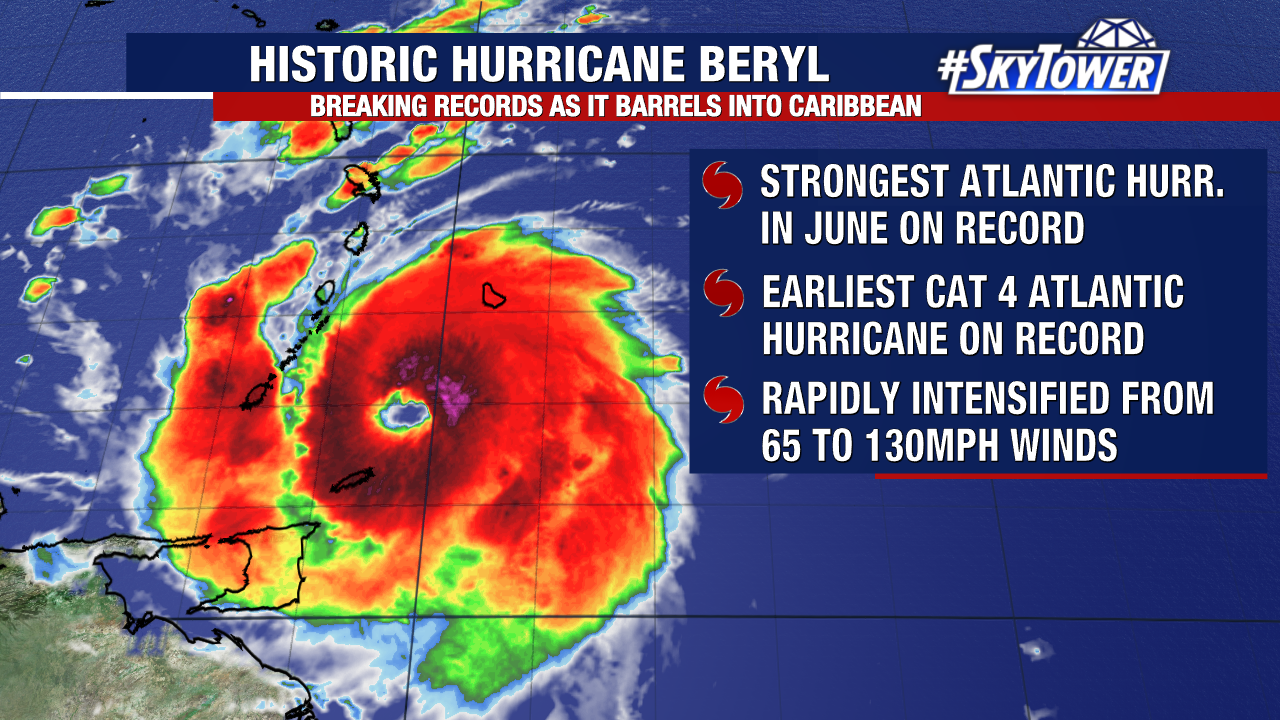
A storm of this magnitude in this part of the Atlantic is something we typically see in August or September, during peak hurricane season.
Hurricane Beryl rapidly intensified over the weekend, strengthening from a tropical storm at a major hurricane. Winds went from 65mph to 130mph in about 24 hours.
After a landfall in the Windward Islands today, Beryl is expected to remain a powerful hurricane as it moves across the Caribbean Sea.
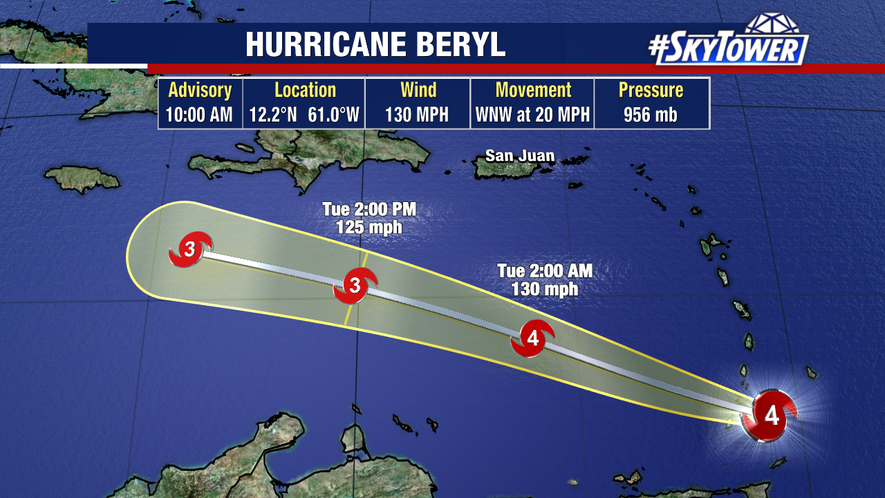

Later this week, Beryl will have to battle stronger wind shear which could impact the storm’s strength. Dominican Republic, Haiti, Jamaica, the Cayman Islands and Hispaniola should remain on high alert as we watch Beryl’s track.