
Recon data today has found that Melissa is one of the strongest storms on record in the Atlantic basin. In fact, the storm is so violent, a NOAA hurricane hunter mission was cut short due to extreme turbulence in the eye wall.
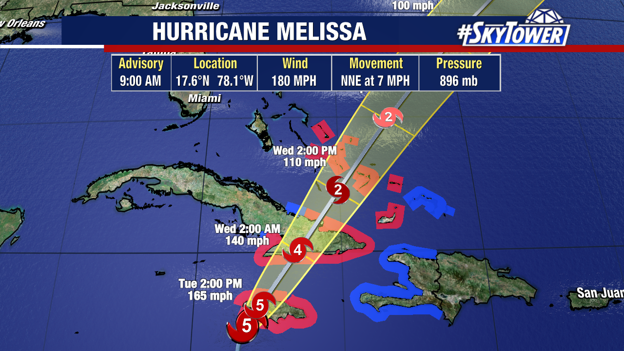
The projected track is just awful. A Category 5 hurricane making landfall in Jamaica late Monday night or Tuesday morning.
There is a long history of hurricanes making landfall in Jamaica, the most notable was Hurricane Gilbert. It made landfall near Kingston in 1988 as a Category 4 hurricane. Before Sandy made its trip up the east coast of the United States in 2012. it first went over Jamaica as a Category 1 hurricane. Jamaica’s mountainous terrain makes the threat of mudslides and landslides from Melissa much worse. Entire communities will become isolated with no power or communication. Unfortunately, Melissa will probably go down as the worst storm to hit the island in modern times. Praying for the good people of Jamaica.