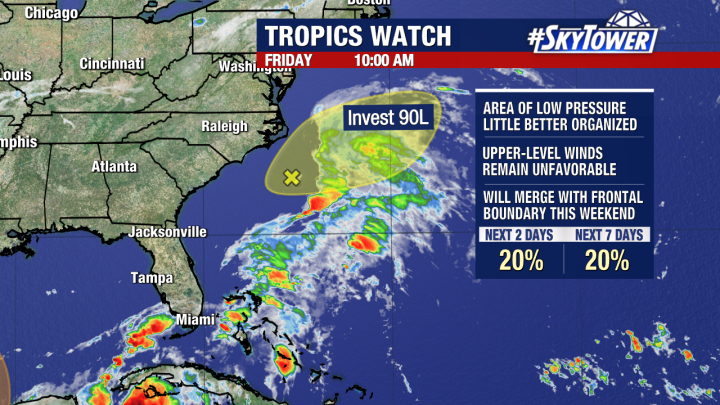
Invest 90L is moving away from Florida which caused massive flooding over portions of the state this weekend. The likelihood of formation from this low is small because of strong upper-level wind shear.
Attention now turns to the southwest Gulf of Mexico. Presently, there is not much happening in this region. Models are coming more agreement that an area of low pressure will form in the Bay of Campeche late weekend and into early next week. This is an area that is currently favorable for development because of warm waters and light wind shear.
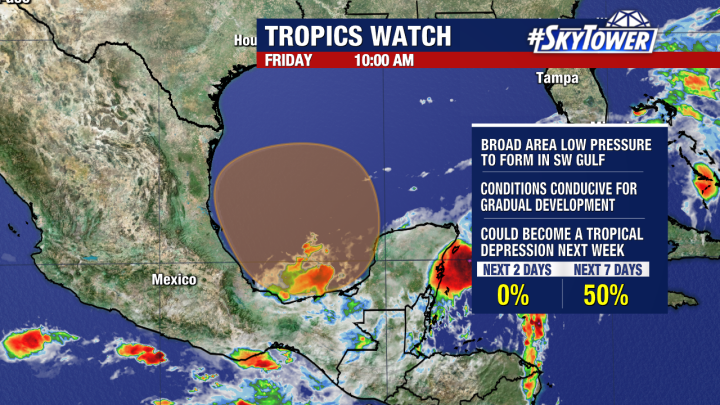
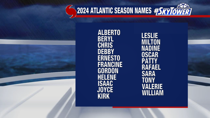
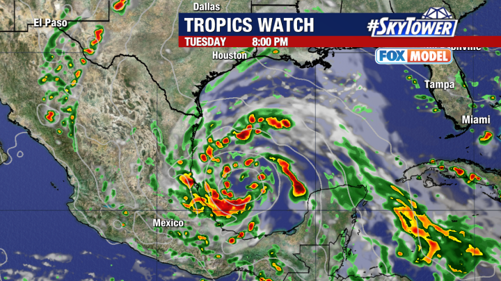
Our high resolution Fox Model indicates gradual development of this system early next week as it drifts slowly toward Mexico. At this point, we may have our first tropical depression of the hurricane season and will be watching to see if this becomes Tropical Storm Alberto, which is the first name on the 2024 list of names. Regardless of any development of this system, it will not pose a risk to Florida.
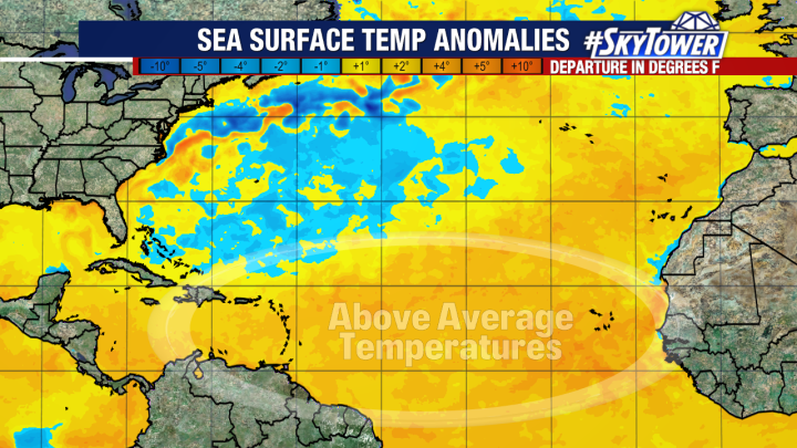
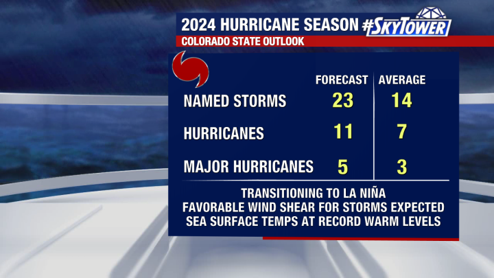
Earlier this week NOAA officially announced that El Niño is over and we are now in ENSO neutral conditions and expected to transition into La Niña over the summer months. This was expected and something that has been factored into the hurricane season forecast. The transition into La Niña along with above average SST all point to a very active hurricane season, one that has the potential to be one of the most active ever.
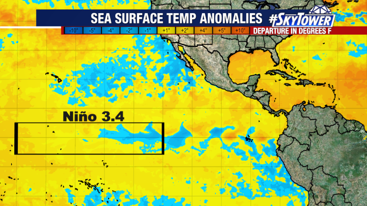
Cooling waters in the Pacific Ocean indicate the end of El Niño which have now transitioned us into ENSO neutral conditions.