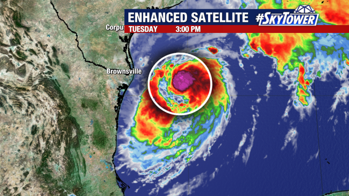
The center of Francine has been large and not well structured today with signs of dry air affecting the storms ability to consolidate a central core and become a hurricane. Late this afternoon there has been a burst of convection close to the center which could be the latest attempt for the center to “wall off” the dry air intrusion and begin to strengthen.
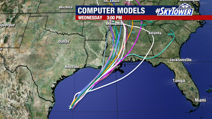
Models have continued the trend which began overnight to nudge the track of the storm eastward. If this eastward shift does happen, it will bring more of the effects of the storm to higher population areas of southeastern Louisiana including New Orleans.
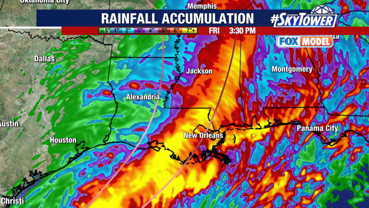
As the storm moves ashore it will bring up to 10 feet of storm surge along the southern coast of Louisiana an Lake Pontchartrain could see 3 to 5 feet of surge. In addition, rainfall amounts of 4-8 inches of rain with localized areas of up to 12 inches of rain from Louisiana into Mississippi and western Tennessee.
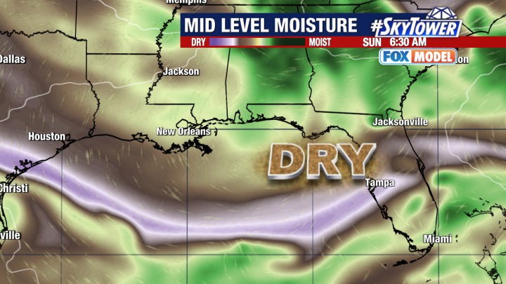
As the storm moves northward it will drag dry air into the Gulf of Mexico and eventually over Florida by the weekend. This dry air along with a shift to a west and southwesterly wind is likely to cut down on our rain chances in west central Florida by this weekend and into early next week.