Hurricane Season 2023 off to a quick start

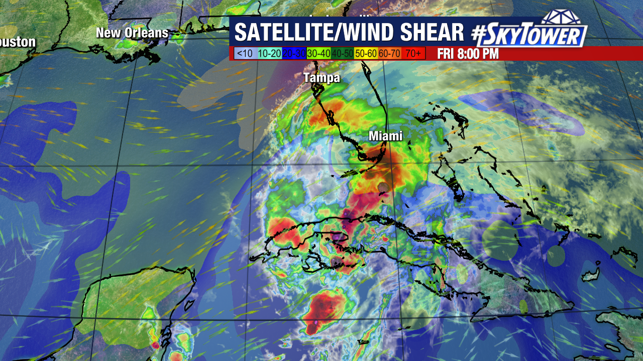
We began the season with an Invest on day 1 of the season. While this system is small and dealing with wind shear and dry air on its southern side, it has managed to become our first tropical storm of the year. Tropical Storm Arlene was named with the 1pm CDT advisory with winds of 40 mph.

While the proximity of the storm to Florida is helping to enhance afternoon thunderstorm activity, the track of the storm will move it away from Florida this weekend. This will move it into an area with stronger wind shear and dry air should limit any chance of more intensification of this system.

Mid-level dry air is present on the southern and southwestern side of the storm which also appears to now be wrapping in toward the center of the storm. The center of circulation is on the edge of deeper convection and partially exposed.

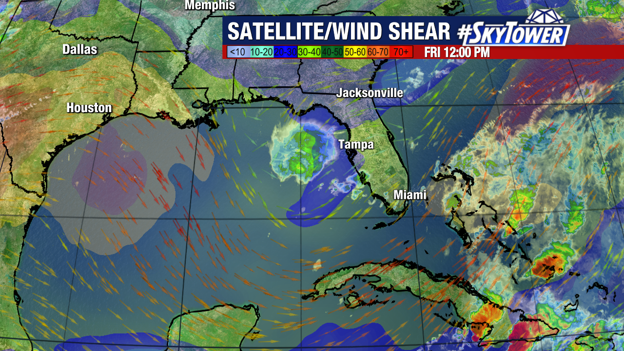
The “lopsided” look to the storm is because of the strong southwesterly shear over the storm and environmental conditions become even more hostile across the southern Gulf of Mexico as it is expected to move southward.

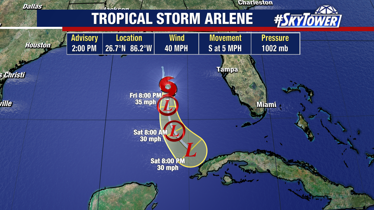
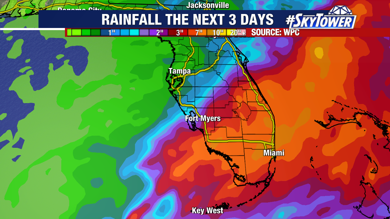
The track of the storm moving into a more hostile environment will quickly weaken this storm over the weekend just NW of the western tip of Cuba. The energy from this will likely help to create some downpours over Cuba over the weekend.

The list of 2023 names begins with Arlene and ends with Whitney.

Wind Shear and dry air continue to limit development

It has been the common theme over the past few days, wind shear and dry air will limit Potential Tropical Cyclone One from organizing. Being early on in the hurricane season there is still a lot of strong upper level winds over the Gulf of Mexico and plenty of drier air in the mid levels of the atmosphere. The outcome has not been a surprise, a tropical disturbance that continues to struggle to develop a well defined center of circulation.

The wind shear will continue to plague this system for its trip over Florida which will continue to limit its ability to organize and strengthen. The second major issue this system is facing is dry air. Tropical systems feed off of warm, moist air. Dry air chokes off the moisture feeding the storm. Dry air is quickly wrapping around the western side of this storm which is not allowing it to develop that ring of storms around the center. This will also lead to a rapid improvement in weather conditions once the limited center it has passes by.

This leaves only one main issue to watch for this storm. Rainfall. The rains will continue over south Florida and at times there will be tropical downpours which will add up over time and lead to the possibility of flooding. Because of the structure of the storm and the dry air which will quickly fill in behind the storm limiting wrap around bands of rain, there will be a sharp dividing line between heavy rain and who gets hardly any rain from this storm.

Color satellite imagery at sunset shows the strong convection remains well displaced from the center to the east and the lack of any convection on the entire western side of the storm. It is possible that this system does not become a tropical storm prior to landfall in Florida. We will continue to wait and see if this becomes Tropical Storm Alex.