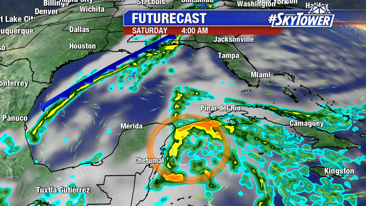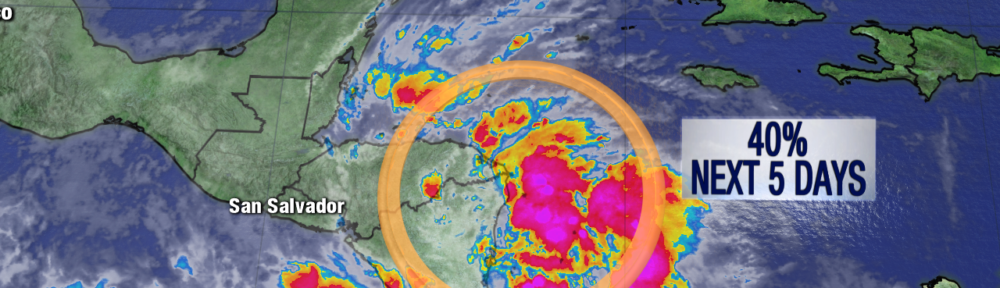
The 2017 Atlantic Hurricane Season may not be over just yet. The last couple of days we’ve been watching an area of disturbed weather over the Western Caribbean and Central America. So far, land interaction has been the main limiting factor, but conditions should be a little more favorable over the next day or so as this disturbance (Invest 93L) moves slowly north into the Northwestern Caribbean.
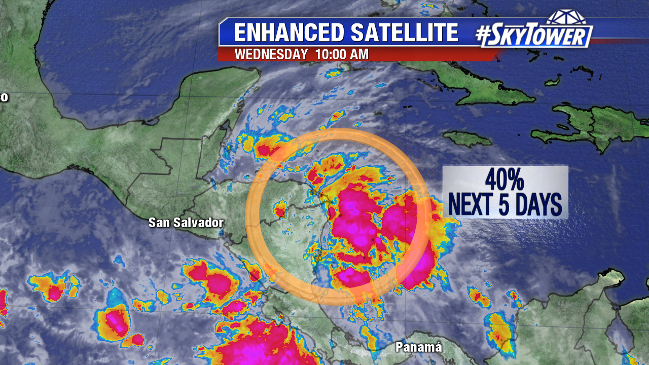
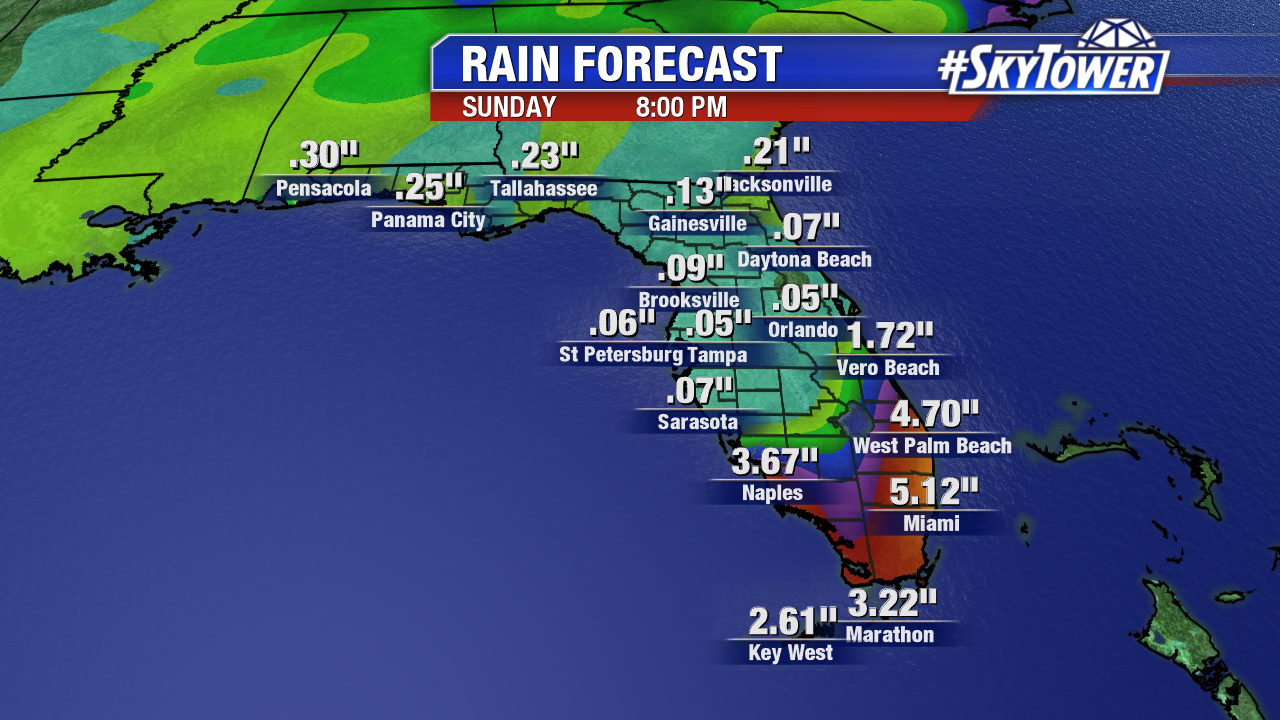
While this an area that is notorious for late-season hurricanes, model trends have not been particularly concerning as of late. As 93L moves into the southern Gulf over the weekend, it will be merging with the next cold coming across the Southeast and into Florida. This front will introduce stronger upper-level winds, likely preventing 93L from developing any further. Nonetheless, it bears watching. Regardless of development, heavy rains are headed for South Florida this weekend.