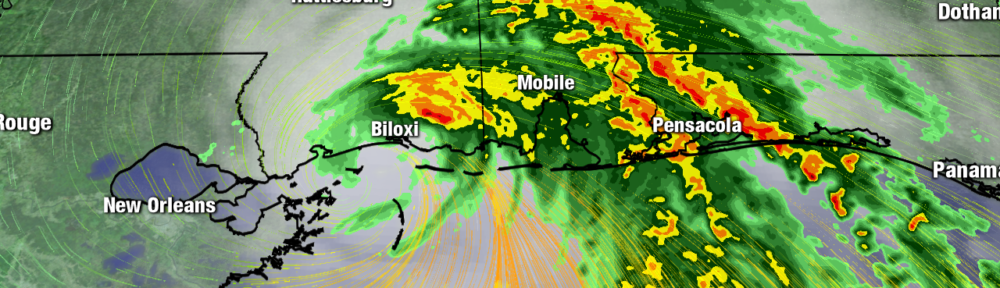
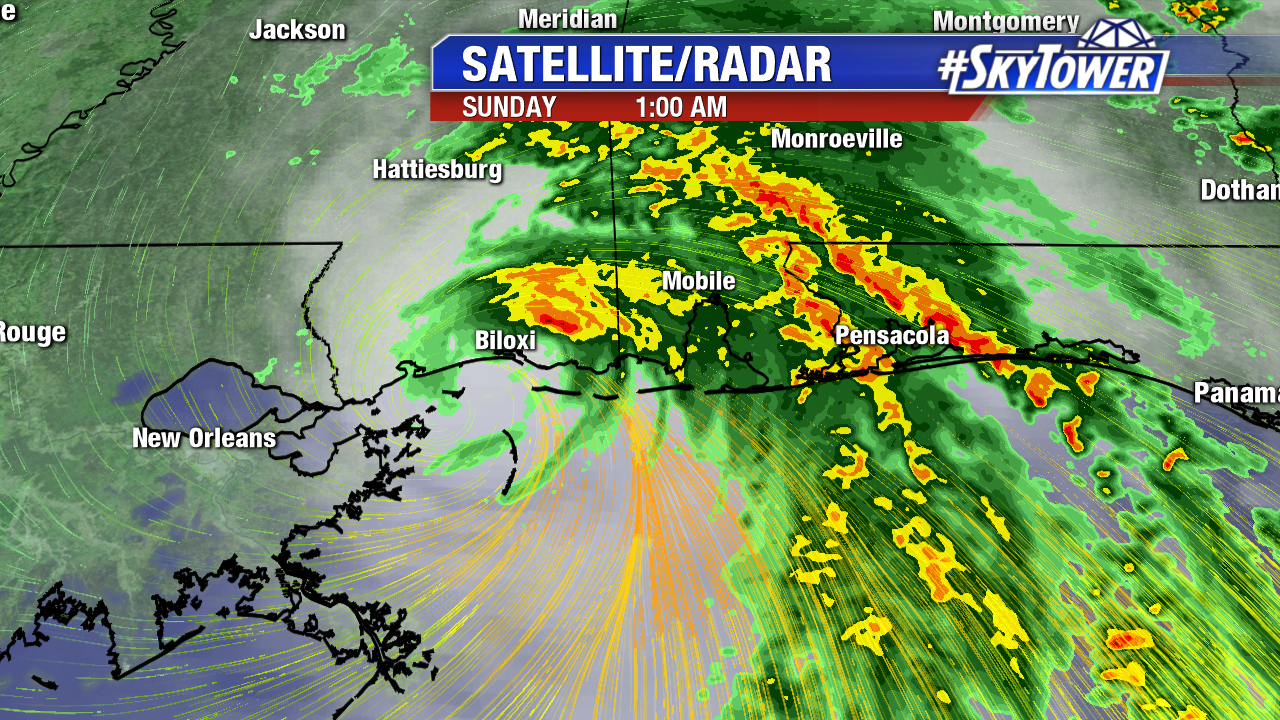
Nate become the 4th hurricane of the hyperactive 2017 season to strike the U.S. (including Puerto Rico) this weekend. The last season with four or more U.S. landfalling hurricanes was 2005. It made two landfalls.The first near the mouth of the Mississippi River Saturday evening, the second near Biloxi Mississippi at 1:30 AM EDT Sunday as a category 1 hurricane with 85 mph.winds. The heaviest rain, strongest wind, and greatest storm surge was felt near and just east of the center.
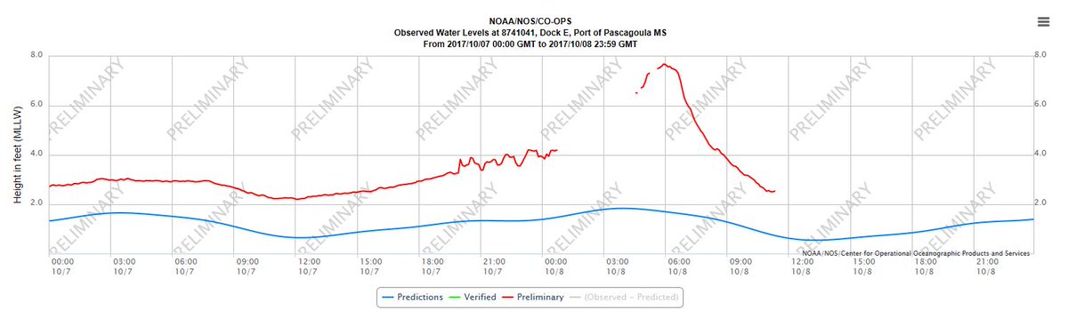
Nate will be remembered for its coastal flooding, a threat often underestimated with tropical system. A storm surge of 6.3 feet was recorded in Pascagoula Mississippi. Social media was blasted with photos and video of flooding in the Golden Nugget Casino in Biloxi. Mobile Alabama was also hit hard with coastal flooding. A storm surge of 5.4 feet was recorded there. The graphic shows the rise in water in Pascagoula, Mississippi courtesy NOAA.
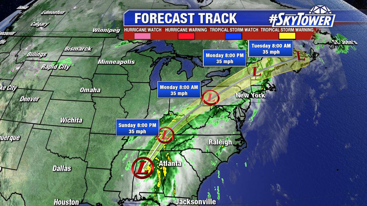
Nate weakens rapidly Sunday morning over land. As of 11 AM it is a tropical depression. Max sustained winds are at 35 mph as it races north-northeast at 24 mph. It will weaken to a tropical depression Sunday. Nate is big rainmaker for portions, of the Southeast, Tennessee Valley, and eventually the Northeast U.S through Monday.
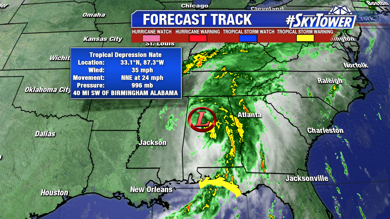
Here is the 11 AM forecast track from the NHC. Nate will quickly lose tropical characteristics over the next 24-36 hours.
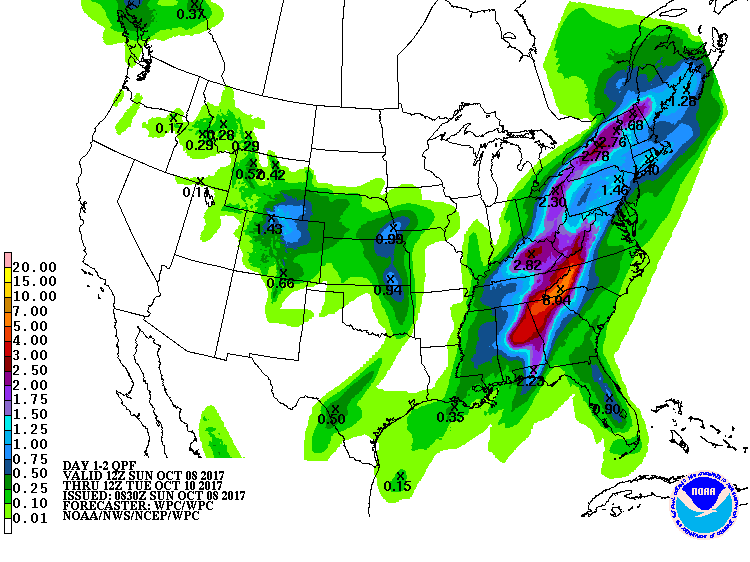
3-6 inches of rainfall, with isolated high amounts are expected from central Gulf coast up through the southern Appalachians. The Weather Prediction Centers estimates 7-8″+ are possible in spots. This train of moisture brings heavy rain the Tennessee Valley and the Northeast U.S. too. Here are rainfall estimates from the Weather Prediction Center through Tuesday morning.