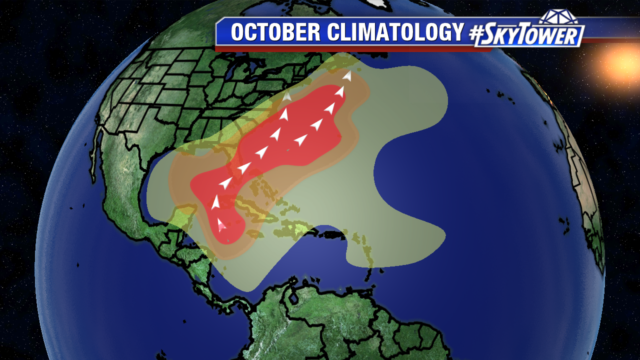
After a hyperactive September, our focus shifts to the Gulf of Mexico, Western Caribbean, and extreme Western Atlantic in October. While 17% of named storms form during the second to last month of the Atlantic season, systems that form in this region often drift towards Florida and portions of the Southeast U.S..

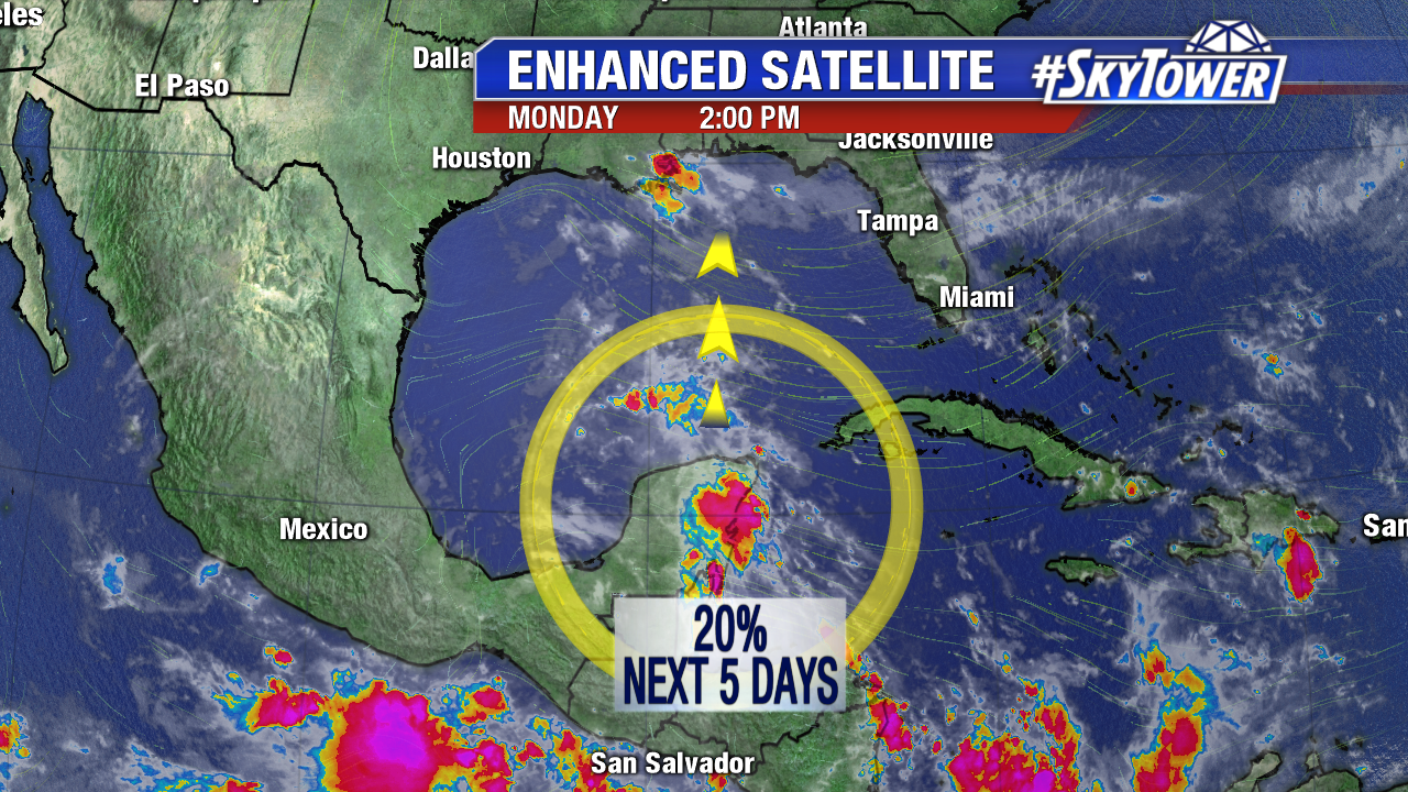
For more than a week, models have hinted that pressure may lower in the Western Caribbean in early October. On Monday, an upper level low stirs up convection near the Yucatan. A surface low may attempt to form in this region later this work week.. For now, those odds are low over the 5 days. This future area of disturbed weather could move into the southern Gulf of Mexico by Friday or Saturday.

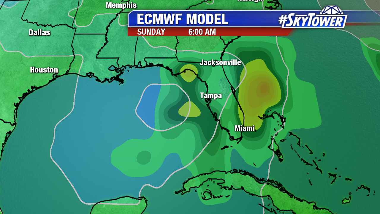
As is always the case with a developing tropical cyclone, computer model are all over the place. The European model hints that Tropical Storm Nate may approach the west coast of Florida Sunday or Monday. Wind shear may be high enough to keep anything that forms weak. Interest in Florida and the northern Gulf coast should continue to check back in.

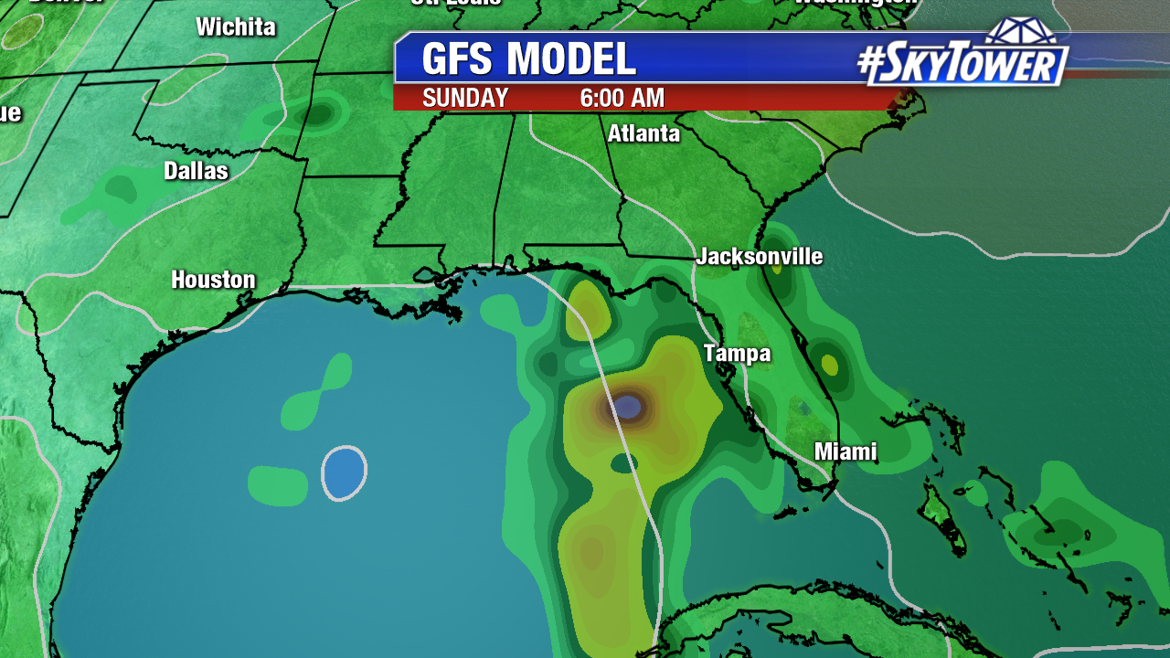
Meanwhile, the latest GFS backs off on any tropical depression/tropical storm development. It’s watch and wait situation in the days ahead.

