On Sunday evening, Hurricane Maria is still a category 2 storm with max winds over 100 mph. It will continue to slowly weaken over the next couple days as moves north into an increasingly unfavorable environment with higher wind shear.
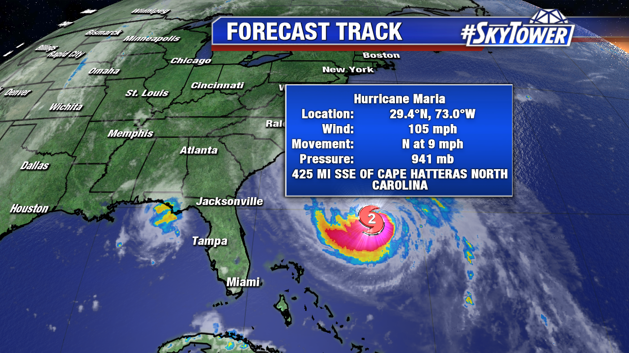
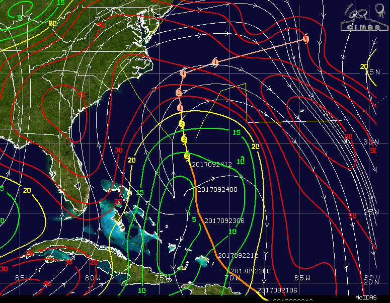
Image below (wind shear) courtesy University of Wisconsin/NOAA.
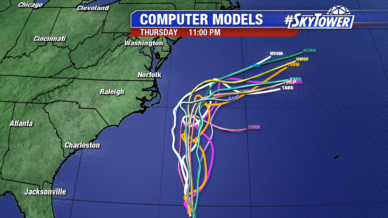
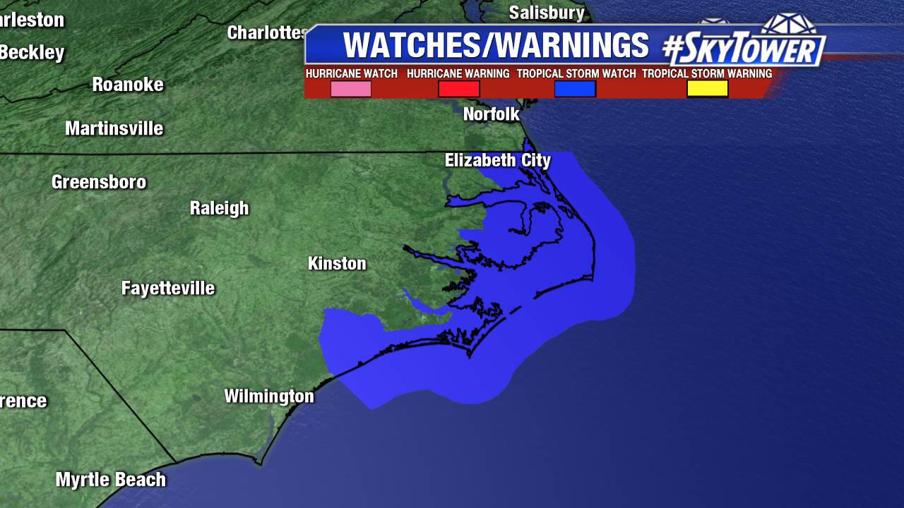
At this point, confidence is fairly high that Maria will ultimately get picked up and ushered out to sea mid-late week by a trough digging into the mid-Atlantic and northeast. That being said, the storm may pass within 100-200 miles of the Outer Banks of North Carolina before that happens and effects of the storm can be felt well away from the center. At the very least, high surf and gusty winds can be expected in the Outer Banks and a tropical storm watch has been issued for areas from Surf City northward to the North Carolina/Virginia border, including the Albemarle and Pamlico Sounds. A storm surge of 2-4 feet is possible from Cape Lookout to Duck including the sound side of the Outer Banks.