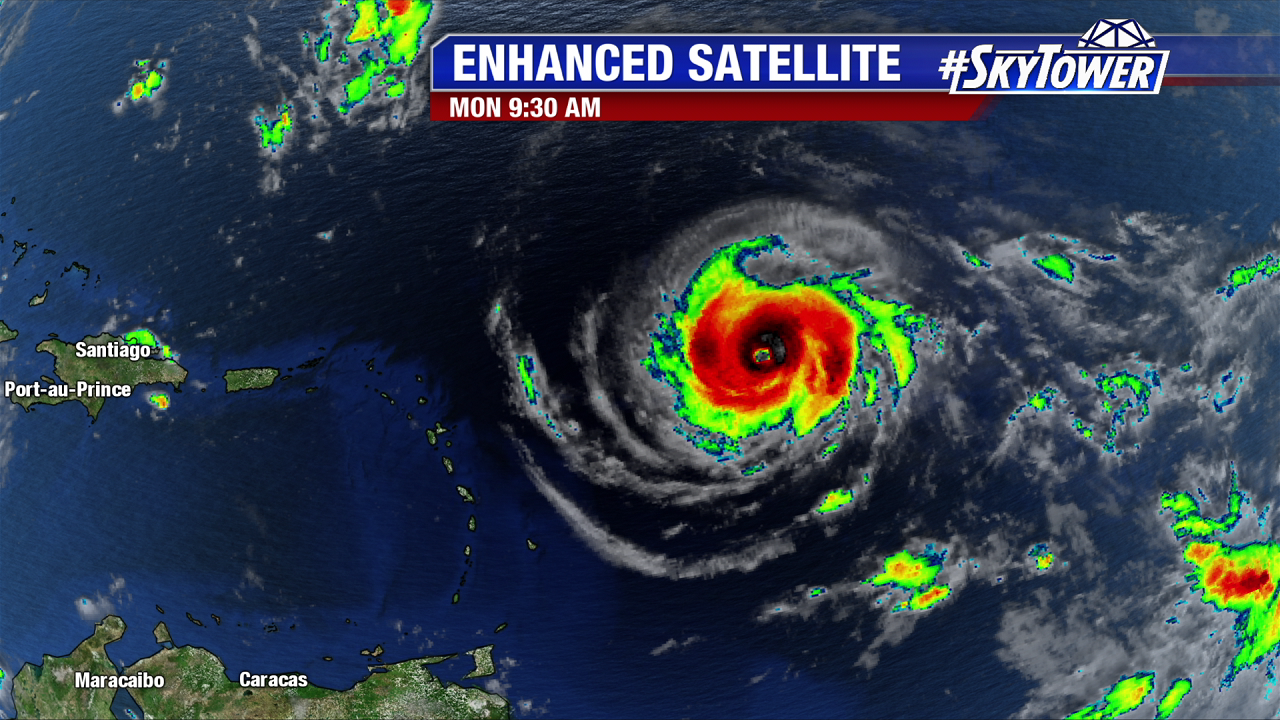
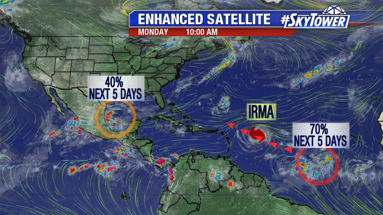
Hurricane Hunter information is essential to fine tuning the future intensity of Irma later this week/this weekend. In Monday morning’s P3 mission the data shows Irma gains strength as it moves west-southwest at 14 mph. At this pace it will move over, or just north of portions of the northern Leeward Islands early Wednesday. A Hurricane Warning is in effect for Antigua, Barbuda, Anguilla, Montserrat, St. Kitts, and Nevis, Saba, St. Eustatius, and Sint Maarten, Saint Martin and Saint Barthelemy . Pressure steadily drops Monday morning as the major hurricane intensifies. As of 11 AM pressure is down to 944 mb and winds are at 120 mph. As Irma continues to strengthen over a favorable environment its wind field expands in size too. The core of major hurricane force winds extend of 35 miles from its center. The tropical storm wind field now expands 140 miles from the center.
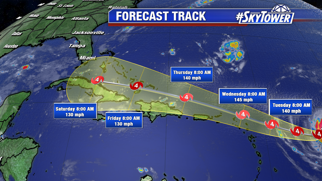
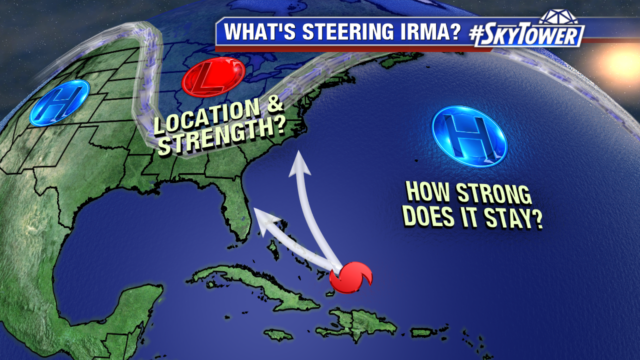
The strong Bermuda high guides Irma west late Monday and Tuesday. If Irma doesn’t gain latitude soon it will track further south and west down the road. The NHC and computer models have trended significantly further south and west since this weekend. Time has slowed a little too. That puts portions of Hispaniola. Cuba, The Bahamas, and eventually Florida in the cone of error. The worst of the storm could pass just north of Puerto, but close by Wednesday and Thursday. A Hurricane Watch is in effect for Guadeloupe, the British Virgin Islands, U.S. Virgin Islands, Puerto Rico, Vieques, and Culebra. A Tropical Storm Watch is in effect for Dominica. Land interaction, especially with mountainous Cuba and Hispaniola, could disrupt the growing, major hurricane. Keep in mind there a large track error on Day 4 and 5. This is 175 miles on day 4 and 225 miles in day 5. Things can and will change in the coming days. Now is the time be not panic, but stay informed and be prepared.
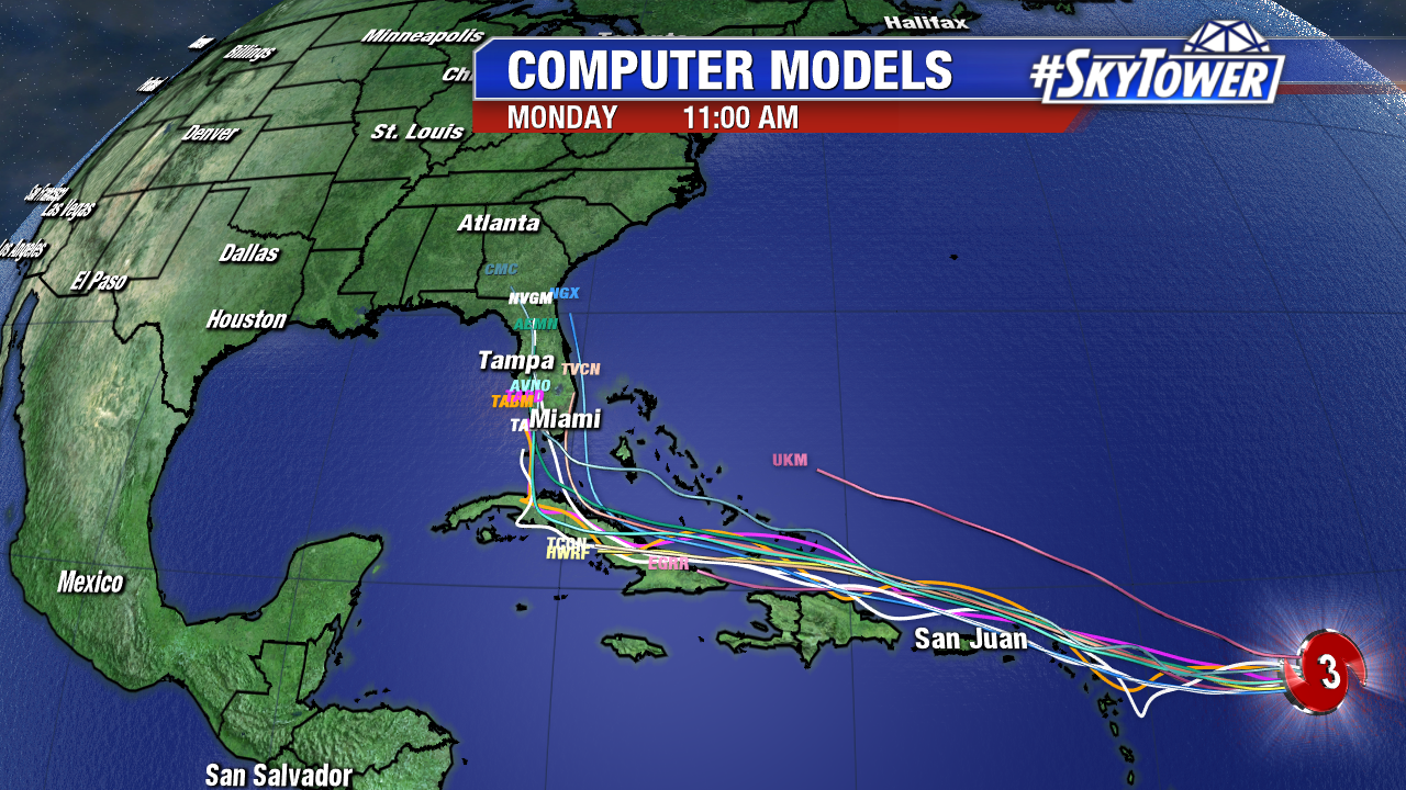
Here’s a look at a significant shift west in early Monday computer models. If this trend continues, South Florida needs to prepare for possible major hurricane conditions Sunday and Monday. Notice the sharp track northward near and eventually over the Sunshine State. While there will be a sharp trough over the East coast, it now appears it may lift out and possibly miss Irma. Instead of the storm heading up possibly out the sea, high pressure may build back in and guide Irma into Florida or somewhere on the Southeast coast. This is a complex upper level setup and small changes will make a big difference in the track. The GFS has jumped on the furthest westward shift. The 06Z has the large major hurricane riding the spine of the Sunshine State. The Euro is west too with a path near southeast Florida and then up into the Carolinas. Stay tuned.
Also of note is a tropical wave on the heels of Irma. It now has a 70% chance of developing over the next 5 days. An area of low pressure is worth watching in the southern Gulf of Mexico. While there is a 40% chance of development the next 5 days, it looks to stay south of flooded coastal Texas.
hgk
