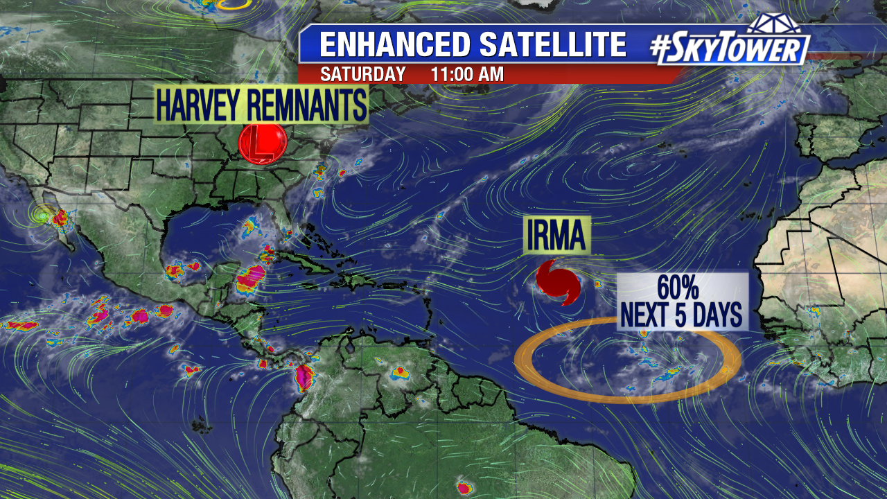
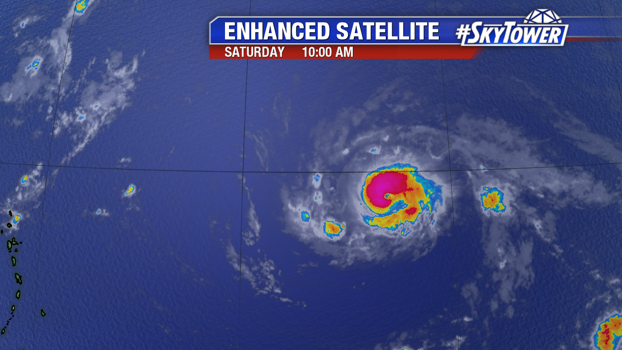
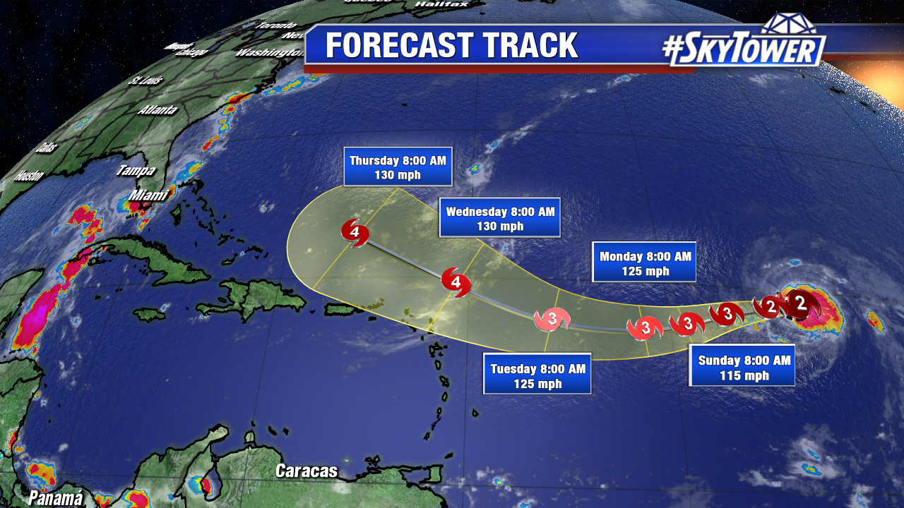
Hurricane Irma maintains intensity as a strong category 2 hurricane early Saturday. As of 11 AM max sustained winds are at 110 mph. Irma starts its slight wobble west-southwest at 15 mph. Irma has fluctuated between a category 2 and category 3 hurricane over the past 24 hours. These changes are due to eye wall replacement cycles. The tiny hurricane sits over marginally favorable water temperatures and there is some dry air nearby too. Irma should bounce back from these features and become a major hurricane again by Sunday or Monday. Under the influence of a strong Bermuda high it will move west-northwest starting Tuesday. It will pass uncomfortably close to the Leeward Islands early Wednesday. While most models are trending north of the Leeward Islands and Puerto Rico, Irma may be larger during this time as it strengthens. As of 11 AM Saturday hurricane force winds only extend out 25 miles for its center, while tropical storm force winds extend out up to 70 miles. Interest in these locations need to prepare for possible major hurricane conditions late Tuesday, Wednesday, and Thursday.
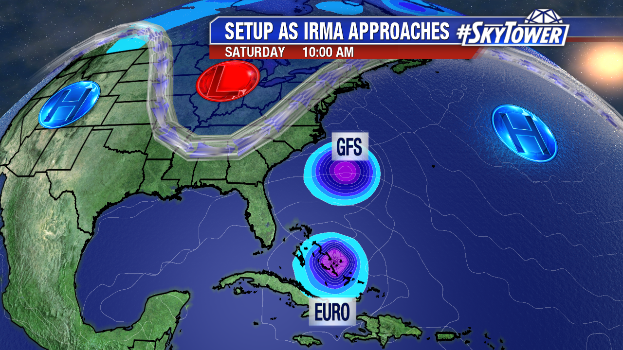
Here’s the suite of computer models early Saturday. The forecast is highly subject to change, especially beyond 5 days (after Wednesday). The Bahamas and the entire East coast of the U.S. need to keep a close eye. As of early Saturday many models and their ensembles show a major hurricane landfall somewhere on the East coast in 8 or 9 days. A track out to sea is also a possibility. The less likely solution at this time is a track into the Gulf of Mexico. That of course is good news for those impacted by Harvey. Multiple hurricane reconnaissance missions are scheduled for Sunday and Monday. This includes a G-IV mission, which will assess the surrounding environment. These missions will help long-range models get a better grasp on the future track/intensity of powerful Irma.
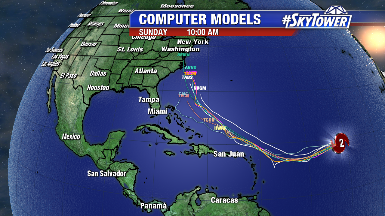
We will likely gain some clarity on any Bahamas/U.S. impacts early this work week. The forecast is highly dependent on the timing and strength of the Bermuda high and an East coast trough late in the week. If the Bermuda high maintains intensity, a path closer to/or into the U.S. is most likely. If the deepening trough stays strong during this time, Irma would track further east, possibly head out to sea. The bottom line is it is about a week from the climatological peak of the Atlantic season. Now is the time to tweak any hurricane plans/preparations just in case. Prior to catastrophic Harvey last week, there was no major hurricane landfall in the U.S. since Wilma in October 2005.
Elsewhere, a tropical wave southwest of the Cabo Verde Islands bears watching. It is fairly close to the equator. There is a medium chance of tropical depression development by early next week as it moves westward. Our next named storms is Jose.