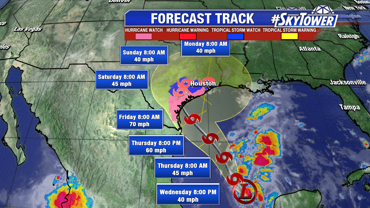
It’s official. Hurricane reconnaissance aircraft finds a closed area of low pressure and Harvey regains tropical cyclone status Wednesday. It is a tropical depression at 11 AM with max sustained winds of 35 mph. Harvey moves northwest at 9 mph. The disorganized tropical depression will strengthen in the days ahead with a landfall late Friday in southeast Texas. Harvey will approach hurricane strength during this time. Regardless of tropical storm strength/hurricane strength, ingredients are in play for tremendous rainfall/flooding and a significant storm surge event. Harvey interacts with a slow moving upper level trough/front through at least the weekend. It will be slow to exit the Lone Star State and may even stall over the weekend. Parts of Louisiana, southern Louisiana and Mississippi will also see heavy rain early next week.
A Hurricane Watch is in effect for the coast of Texas from north of Port Mansfield to San Luis Pass. A Tropical Storm Watch has been issued for the coast of Texas from the Mouth of the Rio Grande to Port Mansfield and from north of San Luis Pass to High Island. In 2017 the National Hurricane Center issues Storm Surge Watches and Watches to stress the danger of coastal flooding. A Storm Surge Watch is in effect for the coast of Texas from Port Mansfield to High Island. A storm surge of 4-6 feet is possible in coastal Texas.
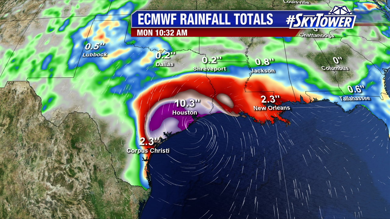
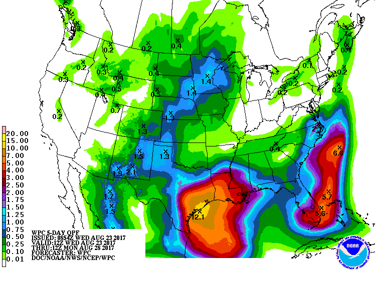
Of greatest concern is the potential for very heavy rainfall late work week through early next week. The ECMWF has been very aggressive the past several runs and prints out 10-15″+ in the Houston area through next Monday morning. Also of note is the possibility for 20″ of rainfall over the course of several days along the immediate coast near Galveston. The other issue will be storm surge. There will be multiple tide cycles with coastal flooding, especially if Harvey is slow to exit. This is a very dangerous setup and residents need to keep a close eye on the forecast and head any warnings.
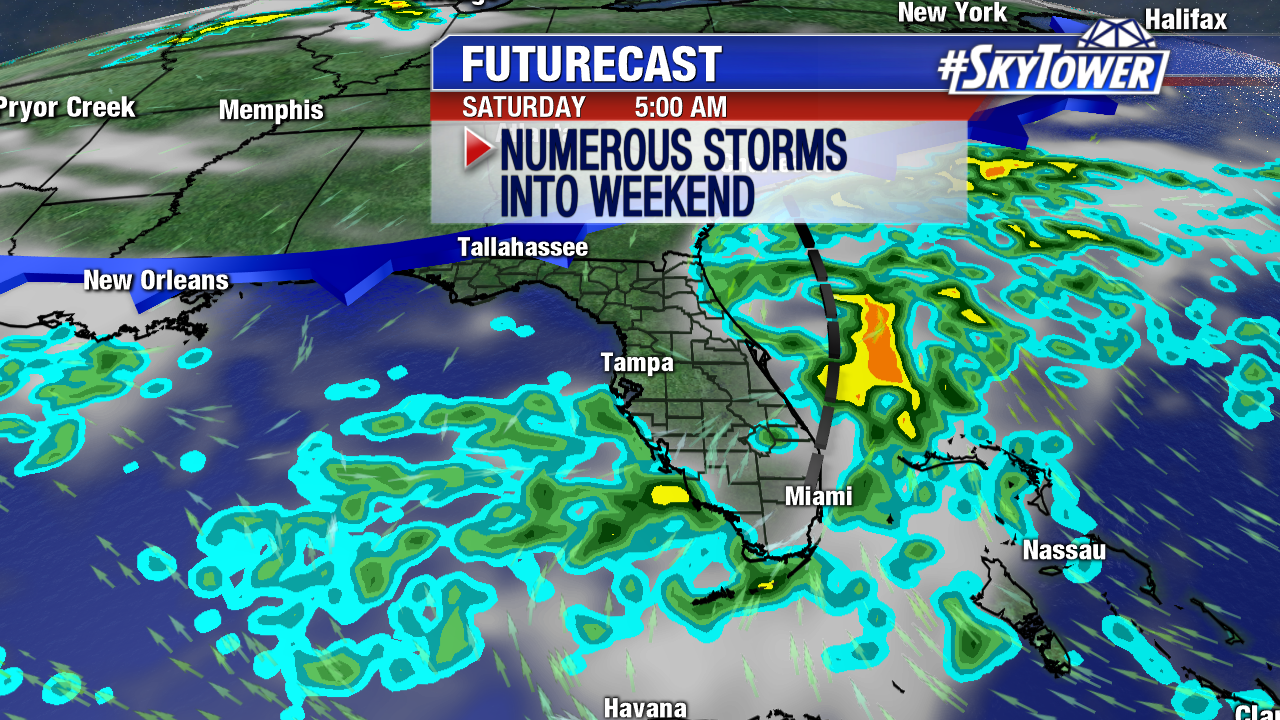
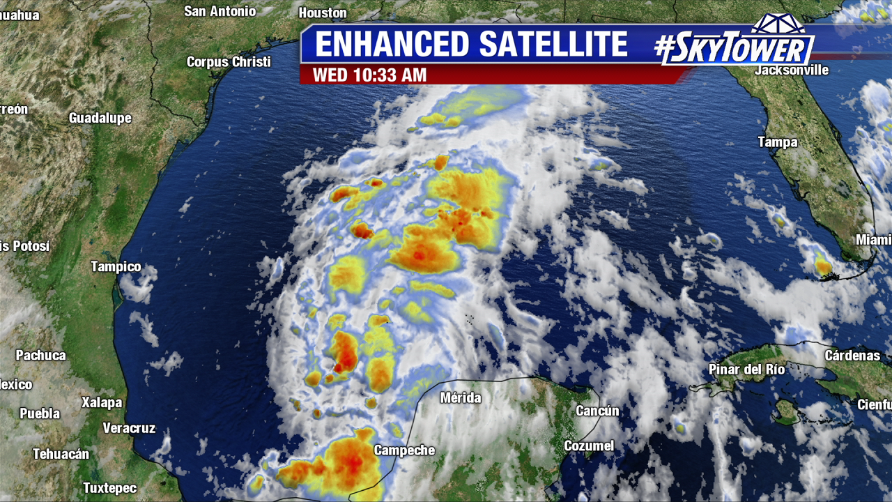
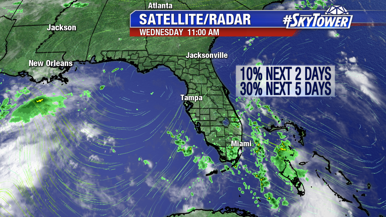
We’re also watching Invest 92L over south Florida. The broad area of low pressure/tropical wave will linger over the state for a few days. This enhances rainfall, especially in central and south Florida. As of Wednesday afternoon there is no sign of tropical depression development in the short-term. There is a low chance of tropical/subtropical development mainly east of Florida over the next 5 days.
The GFS and Euro close off a weak area of low pressure east of Florida late in the weekend. This feature would head northeast over the open Atlantic under the influence of a slow moving front.